Browse Listings in Europe > Portugal > Portugal General Maps
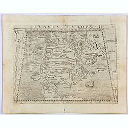
Tabula Europae II. (Spain and Portugal)
Gastaldi's map showing Spain and Portugal, based upon Ptolemy.It is one of the earliest obtainable maps of the region.From Giacomo Gastaldi's Atlas of 1548 which has been...
- $375 / ≈ €351
Place & Date: Venice, 1548
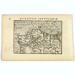
Portugallia.
A nice miniature map of Portugal, published by Petrus Bertius, in Amsterdam, at the beginning of the seventeenth century. North is orientated to the right. Strap-work tit...
Place & Date: Amsterdam, 1606

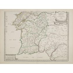
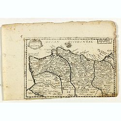
Portugalliae que olim Lusitania..
The best-known map of Portugal, after Alvares Secco (1560), orientated west to the top of the sheet. Secco's map was copied by many mapmakers and publishers for upwards o...
Place & Date: Amsterdam, 1628
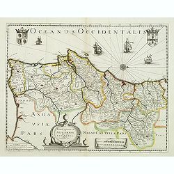
Portugallia et Algarbia quae olim Lusitania. . .
Rare map of Portugal with decorative title cartouche. Oriented to the west. Prepared by Fernando Alvares Seco.
Place & Date: Paris, c.1630
Parte meridional do Reyno de Portugal. . .
Map of southern part of Portugal, with original or early outline hand-color. Numerous place-names of counties, cities, towns, physical features. Prepared by N.Sanson.
- $150 / ≈ €140
Place & Date: Paris, 1654
Portugal et Algarve.
Rare map of Portugal, published by Jollain in 1667. Published in "Trésor Des Cartes Geographiques Des Principaux Estats de Lunivers".This atlas is based upon B...
- $150 / ≈ €140
Place & Date: Paris, 1667
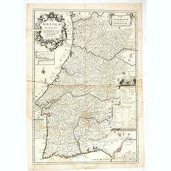
Le Portugal dedié au Roy.
Detailed over-sized map of Portugal prepared by P. Placide Augustin, with fine title cartouche. Engraved by Inselin.Le Père Placide de Sainte-Hélène was the brother-in...
- $400 / ≈ €374
Place & Date: Paris, ca. 1700
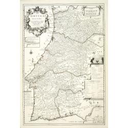
Le Portugal dedié au Roy.
Detailed oversized map of Portugal prepared by P. Placide Augustin, with fine title cartouche. Engraved by Inselin.Le Père Placide de Sainte-Hélène was the brother-in-...
- $300 / ≈ €281
Place & Date: Paris, ca. 1700
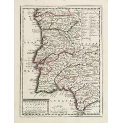
Les Royaumes de Portugal et d'Algarve..
Lovely small map of Portugal showing a panel in the upper right corner with a list of local rulers.From Le Nouveau et Curieux Atlas Geographique et Historique.. by Jacque...
Place & Date: Paris, 1719
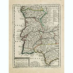
Les Royaumes de Portugal et d'Algarve. . .
Lovely small map of Portugal showing a panel in the upper right corner with a list of local rulers.From Le Nouveau et Curieux Atlas Geographique et Historique.. by Jacque...
- $100 / ≈ €94
Place & Date: Paris, 1719