Search Listings matching "dare" in Europe > Germany > German Provinces
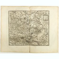
Mansfeldiae Comitatus.
A very fine map centered on the city of Mansfelt . A very nice title cartouche in the upper right corner. Signed by the engraver Franz Hogenberg lower left. Abraham Ortel...
- $75 / ≈ €64
Place & Date: Antwerp, 1598
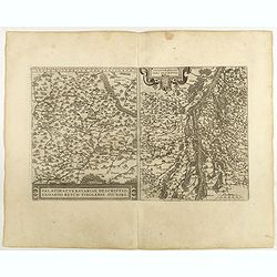
Palatinatvs Bavariae . . . / Argentoratensis agri . . .
From 'Theatrum Orbis Terrarum [Atlas of the Whole World]. The left-hand map of Bavaria is after Erhart Reych's 4-sheet map of 1540. Including the towns of Regensburg, Nü...
- $100 / ≈ €85
Place & Date: Antwerp, 1598
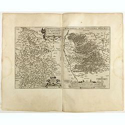
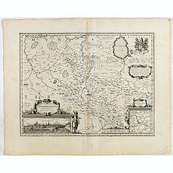
Braunsvicensis et Luneburgensis . . . (together with) Norimberg Agri,..
Two maps on one sheet, showing the regions of Braunschweig and Nuremberg from 'Theatrum Orbis Terrarum [Atlas of the Whole World]': published in Antwerp.Dare to go in Bla...
- $125 / ≈ €107
Place & Date: Antwerp, 1598
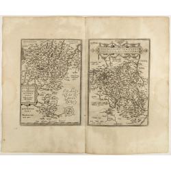
Buchaviae / Waldeccensis Comitatus.
Two maps on one sheet. The map on the left is based on Wolfgang Regerwyl's 1574 single fulda map. The map of Waldeck is based on Joist Moers map of 1572. Abraham Ortelius...
- $100 / ≈ €85
Place & Date: Antwerp, 1598
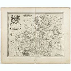
Hassia Landgraviatus.
FIRST EDITION, FIRST ISSUE OF THIS MAP. From the 1634 edition of Blaeu's Atlas Novus, the first edition of this work.Important map of Hesse in Germany, centered on the to...
- $100 / ≈ €85
Place & Date: Amsterdam, 1634
Osnabrugensis Episcopatus.
Originally engraved for Jodocus Hondius II, at his death in August 1629 this map was, among 39 other copper plates, purchased by Willem Blaeu who deleted Hondius' name an...
- $150 / ≈ €128
Place & Date: Amsterdam, 1634