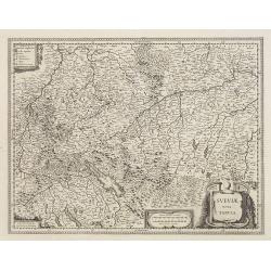
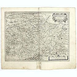
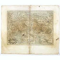
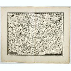
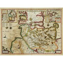
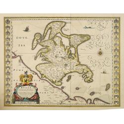
Sueviae Nova Tabula.
Extremely rare first edition of this beautiful map of Swaben, including Ulm, Augsburg, Stuttgart, Zurich, Lucerne and Lake Constance.Jodocus Hondius Jr. planned to produc...
Place & Date: Amsterdam, 1629
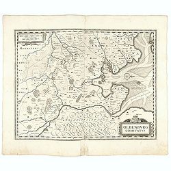
Oldenburg Comitatus
A map of the northern part of Germany centered on Oldenburg. Also showing Bremen. North to the right. The decoration consists with a windrose and a title cartouche surmou...
Place & Date: Amsterdam, 1629-1630
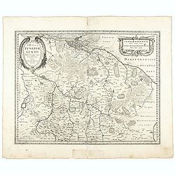
Ducatus Luneburgensis
Very detailed map centered on Albis river and the cities of Hamburg and Lunburg to the north. Also showing Bremen.
Place & Date: Amsterdam, 1629-1630
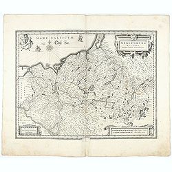
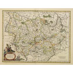
Meklenburg Ducatus.
Very detailed map of the northern part of Germany decorated with a coat of arms, a windrose and two saling ships.From the rare atlas Appendix, published in a very small n...
Place & Date: Amsterdam, 1629-1630
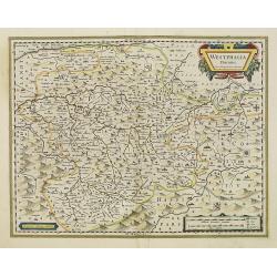
Westphalia Ducatus.
Elegantly engraved map of Westphalia including Hamm and Lippstadt. The mountainous topography is graphically depicted and several small coats of arms dot the map. Strapwo...
- $100 / ≈ €94
Place & Date: Amsterdam, 1629-1630
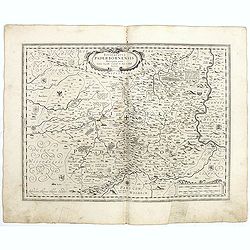
Episcopatus Paderbornensis
Detailed map centered on Paderborn. Prepared by Joannes Michael Gigas (1580-1650+), a doctor, mathematician and geographer who made also maps of Osnabrug, Westphalia, Mun...
- $100 / ≈ €94
Place & Date: Amsterdam, 1629-1630
Osnabrugensis episcopatus. . .
A beautiful map of Munster centered on the city of Osnabruck. Prepared by Joannes Michael Gigas (1580-1650+), a doctor, mathematician and geographer. Showing an inset wit...
- $200 / ≈ €187
Place & Date: Amsterdam, 1629-1630
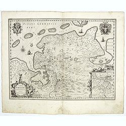
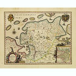
Typus Frisiae Orientalis.
Decorative map of east Frisia in Germany with the Watten islands. With inset map of the area south of Emden. Prepared by Ubbo Emmius (1547-1625). Two very decorative coat...
- $350 / ≈ €328
Place & Date: Amsterdam, 1629-1630
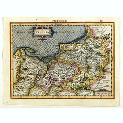
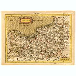
Prussia.
An attractive, detailed and early map of present-day Poland and Lithuania from the rare Cloppenburg edition slightly larger format and more scarce edition of the Mercator...
Place & Date: Amsterdam, 1630
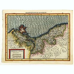
Pomeraniae Ducatus.
Pomerania map from the rare Cloppenburg edition slightly larger format and more scarce edition of the Mercator/Hondius "Atlas Minor". Small and detailed map of ...
Place & Date: Amsterdam, 1630
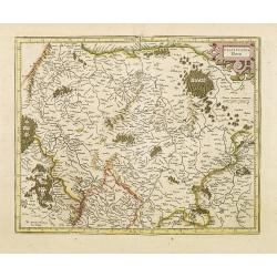
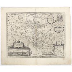
Palatinatus Rheni.
Map depicting part of Germany provinces.
Place & Date: Amsterdam, 1630
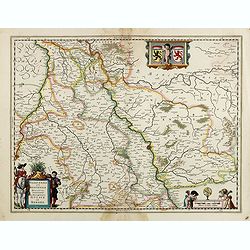
![Tabula electoratus Brandenburgici, Meckelenburgi, et maximae partis Pomeraniae, ex variis, famosissimisq[ue] auctoribus summo studio concinnata. . .](/uploads/cache/29543-250x250.jpg)
Tabula electoratus Brandenburgici, Meckelenburgi, et maximae partis Pomeraniae, ex variis, famosissimisq[ue] auctoribus summo studio concinnata. . .
Uncommon "carte à figures"- map engraved by the master engraver Abraham Goos and published by Claes Jansz. Visscher (1587-1652). Showing the area of Brandenbur...
Place & Date: Amsterdam, 1630

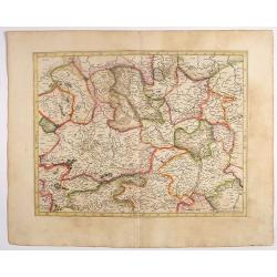
Palatinatus Rheni Nova et Accurata Descriptio.
Early state (1630) of Visscher's "carte à figures"- map of the German Rhine River Valley. Inset views of Frankfurt am Main, Mainz, Speyer, Worms and Heidelberg...
Place & Date: Amsterdam, 1630
Westfaliae.
A nice map showing the province of Westphalia.Mercator was born in Rupelmonde in Flanders and studied in Louvain under Gemma Frisius, Dutch writer, astronomer and mathema...
- $100 / ≈ €94
Place & Date: Amsterdam, 1630
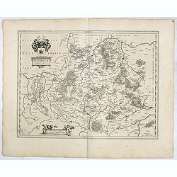
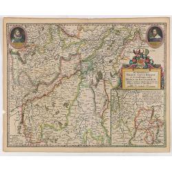
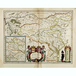
Marca Brandeburgensis & Pomerania.
Centered on the towns of Brandenburg and Berlin. Based on the map by Elias Cameriarus (abt.1530-1581).RARE second state, with both the signatures of Gerard Mercator and H...
- $75 / ≈ €70
Place & Date: Amsterdam, 1630
Prussia.
An attractive, detailed and early map of present-day Poland and Lithuania. From the Cloppenburg edition slightly larger format and more scarce edition of the Mercator/Hon...
- $450 / ≈ €421
Place & Date: Amsterdam, 1630

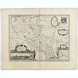
Nova Germaniae Descriptio..
A finely engraved carte à figures, with the side borders depicting emperors, while the upper and lower panels contain finely engraved miniature town prospects, among the...
Place & Date: Amsterdam, 1632
Ducatus Iuliacensis, Cliviensis, Montensis. et Comitatus Marciae et Rapens-Bergae finitimaeque eis Regiones de novo accurate in lucem editae. per Nicolaum I. Piscatorem. t'Amsterdam Gedruckt bij Claes Ianß. Visscher. Anno 1633.': .
Claes Visscher map of the German Duchies Jülich, Cleves, Berg with the County of Mark. - Bottom right is an inset map the country around Ravensberg. Top left is a pretty...
- $250 / ≈ €234
Place & Date: Amsterdam, 1632
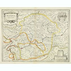
Nassovia comitatus.
Elegantly engraved map of the region including Koblenz Sigen and Dillenburg. The mountainous topography is graphically depicted and there is a coats of arms in the corner...
- $75 / ≈ €70
Place & Date: Amsterdam, after 1633
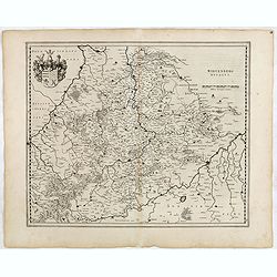
Wirtenberg Ducatus.
FIRST EDITION, FIRST ISSUE OF THIS MAP. From the 1634 edition of Blaeu's Atlas Novus, the first edition of this work. PROOF STATE with blank upper right corner, only incl...
- $100 / ≈ €94
Place & Date: Amsterdam, 1634
Osnabrugensis Episcopatus.
Originally engraved for Jodocus Hondius II, at his death in August 1629 this map was, among 39 other copper plates, purchased by Willem Blaeu who deleted Hondius' name an...
- $150 / ≈ €140
Place & Date: Amsterdam, 1634
Westphalia Ducatus.
Originally engraved for Jodocus Hondius II, at his death in August 1629 this map was, among 39 other copper plates,purchased by Willem Blaeu who deleted Hondius' name and...
- $100 / ≈ €94
Place & Date: Amsterdam, 1634
Waldeck Comitatus.
FIRST EDITION, FIRST ISSUE OF THIS MAP. From the 1634 edition of Blaeu's Atlas Novus, the first edition of this work.Important early map of Waldeck. Attractive coat of ar...
- $100 / ≈ €94
Place & Date: Amsterdam, 1634
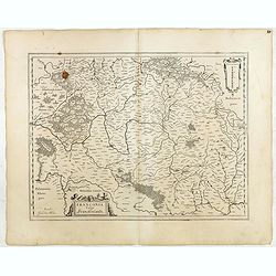
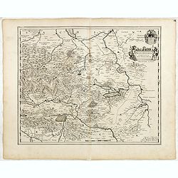
Franconia vulgo Franckenlandt.
FIRST EDITION, FIRST ISSUE OF THIS MAP. From the 1634 edition of Blaeu's Atlas Novus, the first edition of this work.Map highlights all the major cities of this region li...
- $100 / ≈ €94
Place & Date: Amsterdam, 1634
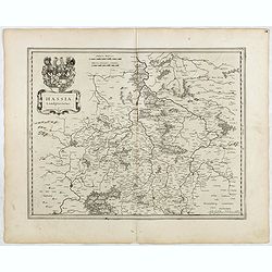
Hassia Landgraviatus.
FIRST EDITION, FIRST ISSUE OF THIS MAP. From the 1634 edition of Blaeu's Atlas Novus, the first edition of this work.Important map of Hesse in Germany, centered on the to...
- $100 / ≈ €94
Place & Date: Amsterdam, 1634
Mansfeldia Comitatus. . .
FIRST EDITION, FIRST ISSUE OF THIS MAP. From the 1634 edition of Blaeu's Atlas Novus, the first edition of this work.Centered on Mansfeld and its surrounding region, this...
- $100 / ≈ €94
Place & Date: Amsterdam,1634
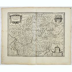
Nassovia comitatus.
Elegantly engraved map of the region including Koblenz, Sigen and Dillenburg. The mountainous topography is graphically depicted and there is a coats of arms in the corne...
- $100 / ≈ €94
Place & Date: Amsterdam, 1634
Ducatus Holsatiae nova tabula.
Finely engraved map centered on the area north of Hamburg and Lubeck with two insets. This is a second state of a map initially made by Jodocus Hondius.
- $250 / ≈ €234
Place & Date: Amsterdam, 1635
Franconia vulgo Franckenlandt.
Fine copy centered on Bamberg, Nuremberg, Würzburg, and Nuremberg. French text on verso. Würzburg is the main city in Franconian wine country. Grapevines cover the stee...
Place & Date: Amsterdam, 1635
Typus Frisiae Orientalis.
Finely engraved map of east Frisia in Germany with the Watten islands. With inset map of the area south of Emden. Prepared by Ubbo Emmius (1547-1625). A very decorative t...
Place & Date: Amsterdam, 1635
De Hertochdommen Gulick Cleve Berghe en de Graefschappen...
It is one of Blaeu's early maps: It was only published between 1630 and 1635 in three editions of the "Appendix" and one of the "Theatrum". In the lef...
Place & Date: Amsterdam, 1635
Rugia Insula ac ducatus. . .
Willem Blaeu's highly decorative map of the island of Rugen in the Baltic Sea from a map by Eihard Lubin. Embellished with a title-cartouches, and 30 coats-of-arms in the...
- $300 / ≈ €281
Place & Date: Amsterdam, 1638
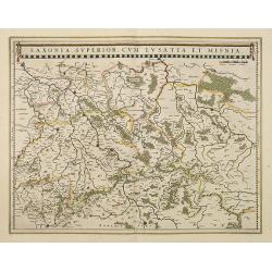
Saxonia Superior, cum Lusatia et Misnia.
Finely engraved and detailed map of Saxony including Halle, Leipzig, Meissen, and Dresden. Filled with forests and tiny villages. It presents Prague close to the centre o...
Place & Date: Amsterdam, 1638
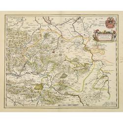
Mansfeldia Comitatus. . .
Centered on Mansfield and prepared by Telemann Stella (1527-1589) a German cartographer who made maps of Germany and the Holy Land.As Willem Blaeu died in 1638 most of hi...
Place & Date: Amsterdam, 1638
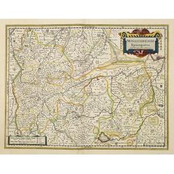
Monasteriensis Episcopatus.
A very detailed map of Germany centered on Munster and Linge. Also showing Wessel to the top of the map and Oldenburg to the right. North to the right. The map is adorned...
Place & Date: Amsterdam, 1638
Bravnswyck et Meydburg. . .
As Willem Blaeu died in 1638 most of his maps are actually published by his son Joan. This maps carries his (engraved) signature and was actually published in volume II o...
Place & Date: Amsterdam, 1638
Westphalia Ducatus.
Elegantly engraved map of Westphalia including Hamm and Lippstadt. The mountainous topography is graphically depicted and several small coats of arms dot the map. Strapwo...
Place & Date: Amsterdam, 1638
Osnabrugensis episcopatus.
A beautiful map of Munster centered on the city of Osnabruck. Prepared by Joannes Michael Gigas (1580-1650+), a doctor, mathematician and geographer. Showing an inset wit...
Place & Date: Amsterdam, 1638
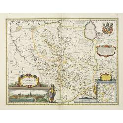
Comitatus Marchia et Ravensberg.
With an inset of Ravensberg comitatus. Decorative title cartouche with coats of arms. Scale cartouche with a surveyor.As Willem Blaeu died in 1638 most of his maps are ac...
- $80 / ≈ €75
Place & Date: Amsterdam, 1638
Juliacensis et Montensis Ducatus/ De Hertoghdomen Gulick. . .
Map of the area to both sides of the Rhine between Bonn and Wesel, centered on Düsseldorf and reaching to Maastricht in the west and Altena/Westfalen in the east.Decorat...
- $100 / ≈ €94
Place & Date: Amsterdam, 1638