Search Listings matching "silk" in Asia > Central Asia
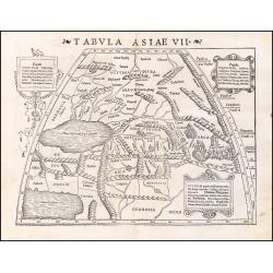
Tabula Asiae VII.
Attractive woodblock map, depicting the Caspian Sea, Black Sea and the Persian Gulf, extending to the Imaus Mountains. according to Ptolemy. In the center of the map is...
Place & Date: Basle, 1542
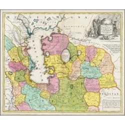
Carte la plus nouvelle et plus exacte du royaume de Perse . . .
This is a decorative map of Persia and Central Asia. It has very good details of the region east of the Caspian Sea, showing modern-day Uzbekistan. The region is labeled ...
- $400 / ≈ €342
Place & Date: Leiden, 1719
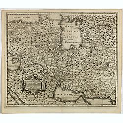
Nova Maris Caspii et Regionis Usbeck cum Provincijs adjacentibus vera Delineatio
This is the first printed map specifically of the Uzbek region. It shows the area around the Caspian Sea and northern Iran. The area eastward from the Caspian is marked '...
Place & Date: Nuremberg, 1735
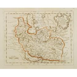
Perse.
Scarce small map of Persia based on cartography of Guillaume Delisle (. Published in "Nouveau traité de geographie par M ", published by La veuve Lottin & ...
Place & Date: Paris, P.G. Le Mercier, 1752
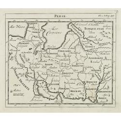
Le Royaume de Perse suivant les nouvelles observations Par J.B.Nolin.
This is a rare map of Persia with modern-day Uzbekistan to the north. The region is labeled as "Grande Tartarie" and "Pays des Usbeks." Bocara (Bukhar...
- $300 / ≈ €256
Place & Date: Paris, 1783