Browse Listings in Africa > Central Africa

.Tabu nova partis Aphri.
Based on Waldseemüller's map. The maps show Northern Africa as it was known to Europeans at the first part of the 16th century. There is great details across north Afric...
Place & Date: Lyons, M. Servetus, 1535
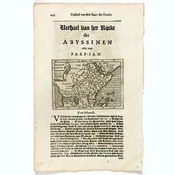
Abissinorum Imperium. / Acomath .I. Turcarum Imperator .XIIX. Ex Stirp. Ottomannica.
Map of central Africa. Copperplate engraving on text leaf with letterpress on verso. The engraving depicts a half length oval portrait of "Acomath I".Nicolaes d...
Place & Date: Amsterdam, Cloppenburch, 1621
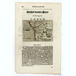
Congo Regnum Christian. In Africa.
Small map illustrating the western seashores of Central Africa, surrounded by text in Dutch.Nicolaes de Clerck (de Klerc) was active as engraver and publisher in Delft fr...
Place & Date: Amsterdam, Cloppenburch, 1621
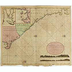
Nieuwe Paskaert van de Custen Zee Loango en Angoy van C. de Lopo Gonzalves tot R. de Zaire os Congo vertoonende alle desselfs gelegenteden.
Sea-chart of the coast of Gabon, Loango, Angoy and Angola to Zaire (Congo) River. In lower right side title and two coastal profiles. In upper left corner inset charts of...
- $300 / ≈ €281
Place & Date: Amsterdam, ca. 1715 -1751
![Loandas St.Paulo [Luanda]](/uploads/cache/48500-250x250.jpg)
Loandas St.Paulo [Luanda]
Engraved by Thomas Doesburgh (active between 1683 and 1714) for Carolus Allard's for his Orbis habitabilis oppida et vestitus the print shows a distance view of the Angol...
- $150 / ≈ €140
Place & Date: Amsterdam, c.1685-1690
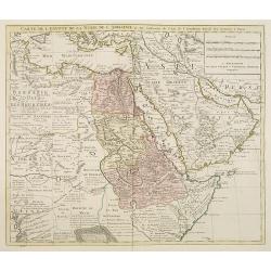
Carte de l'Egypte de la Nubie de l'Abissinie. . .
Detailed copper-engraved map of North-East Africa showing Guinea in the southwest through Ethiopia , the Red Sea to the Persian Gulf.In the northwest, Tunis through Egypt...
- $250 / ≈ €234
Place & Date: Amsterdam, 1745
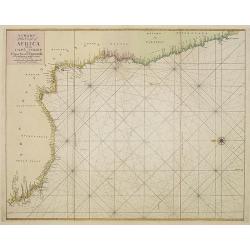
A chart of the coast of Africa from Cape Virde to Cape Bona Esperansa.
Rare and attractive chart of the western part of Africa.
- $800 / ≈ €749
Place & Date: London, 1748

Paskaart van Guinea van C.Verde tot R. deGalion.
Rare edition of Doncker's sea chart of Guinea coast. From an atlas printed in 1668, "l'Atlas de MER ou MONDE AQUATIQUE, Remontrant toutes lescôtes de la Mer…"...
- $1000 / ≈ €936
Place & Date: Amsterdam, 1660-1668
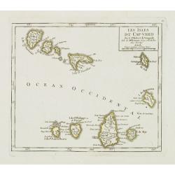
Les Isles du Cap-Verd. . .
Charming small map of the archipelago of Cape Verde. From Atlas Portatif Universel, by Robert de Vaugondy.From Atlas Portatif Universel, by Robert de Vaugondy.Page 87 out...
Place & Date: Paris, later than 1748
Selling price: $120
Sold in 2011
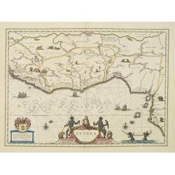
Guinea.
An attractive map covered with intersecting rhumb lines and decorated with monkeys, lions, elephants and native figures. With a dedication to Dr. Nicolas Tulp.As Willem B...
- $750 / ≈ €702
Place & Date: Amsterdam, 1638