Subscribe to be notified if similar examples become available.

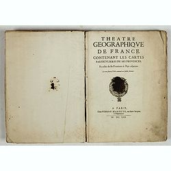
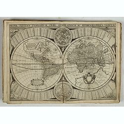
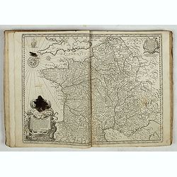
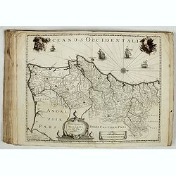
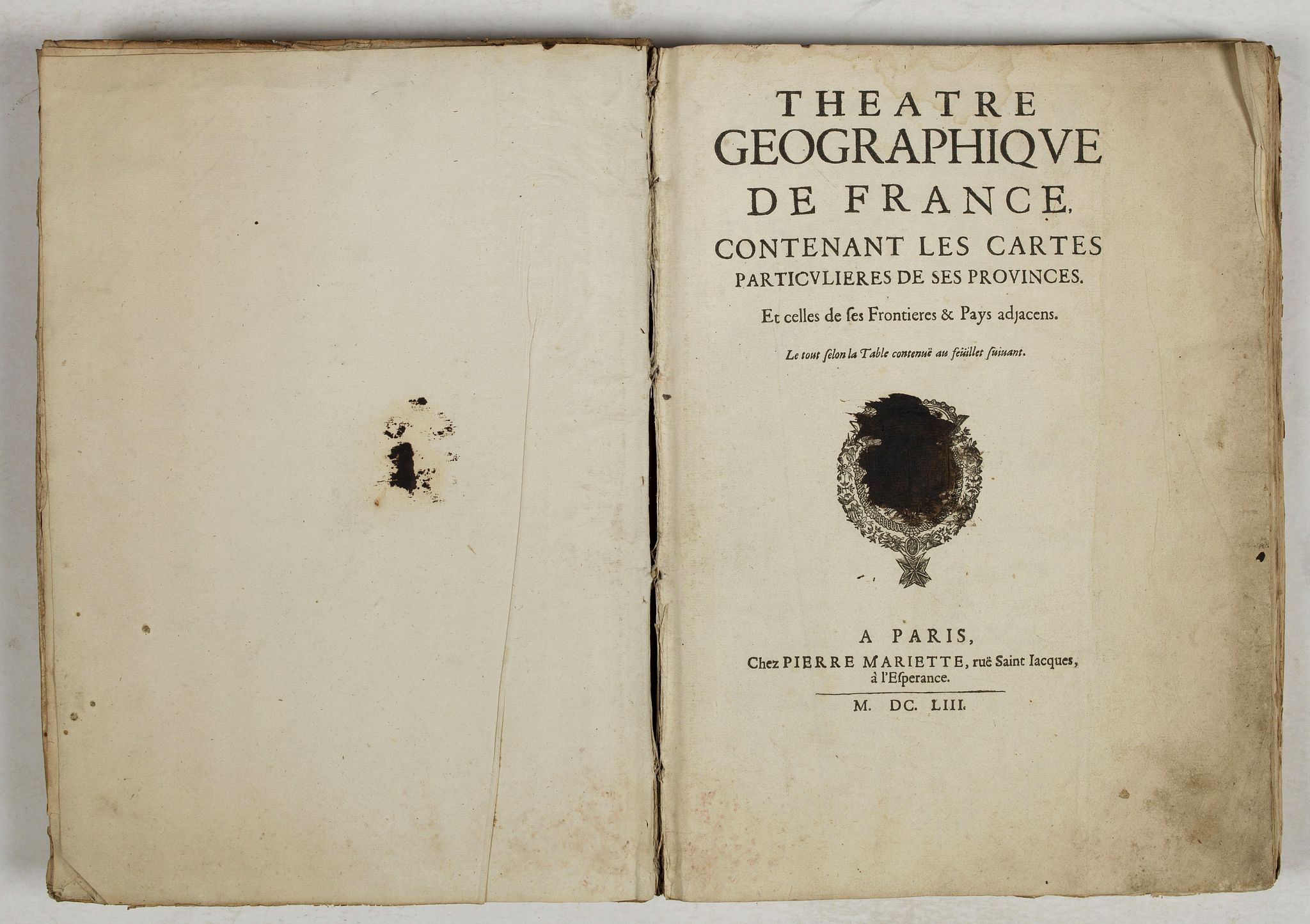
Theatre Geographiqiue de L'Europe. . . |
||||||||||||||||||||
|
||||||||||||||||||||
|
|
||||||||||||||||||||
|
Selling price: $10500
Sold in 2019 Missed this item! Be the first to get notified about our newly added listings. Feel free to contact us if you have a question about this item. Add your name to our mailing list. |
||||||||||||||||||||
Description
For this atlas, as for that of Tavernier, there are variations from one copy to another, a given region may be represented by different maps, depending on the stock available at the sale of the atlas.
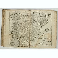
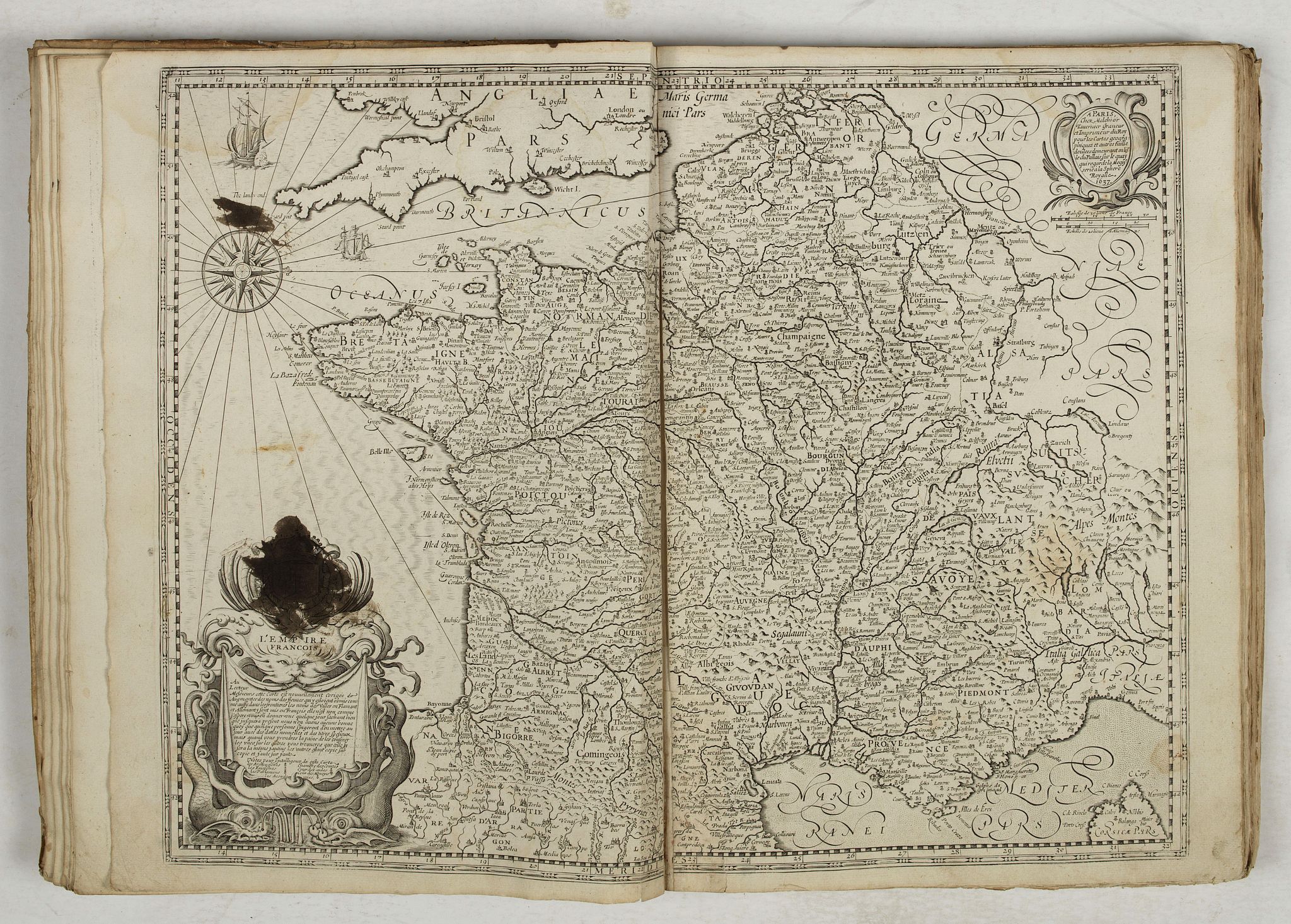
The world map is that of edition A of 1650 by Tavernier; the map of France Nova Gallia is replaced by L'Empire Francois, 1637 by Tavernier; the maps of Maine, Nivernais, Auvergne and Spain are those of edition A.
The map of the islands St Honorat and Ste Marguerite is that of Tassin (replacing that of Tavernier).
"On February 12, 1644, Pierre Mariette acquired the major part of Melchior Tavernier's stock. Mariette's "Théâtre géographique" succeeds that of Tavernier but bears little resemblance to him.
Indeed, it provides only 60 maps (whereas Tavernier gave 106) and, among these, only 3 Dutch maps and 7 maps published by Tavernier. The core of the atlas is composed of 26 maps of Tassin, from the "Cartes générales de toutes les provinces de France". This suggests that Antoine de Fer and Nicolas Berey, who had bought the copperplates of Tassin in 1644, had then sold them to Pierre Mariette.
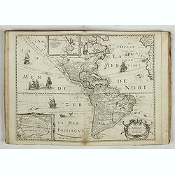
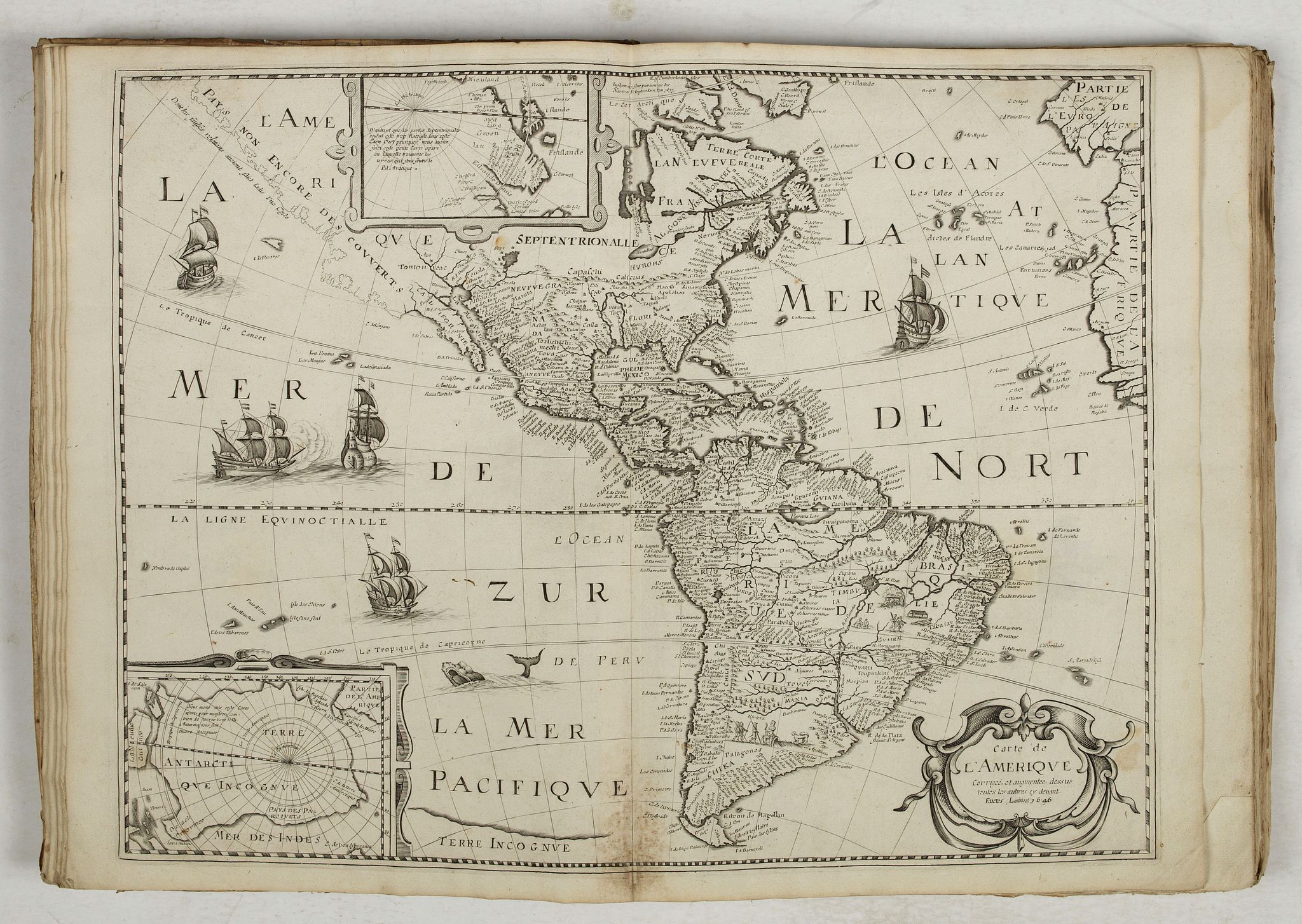
Quantitatively, a second group of maps is constituted by Mariette's own printings, about 17. In addition to the maps of Peyrounin and Duval, there is a world map, copied from that of Hondius-Tavernier, and anonymous maps: France, Italy, Germany and the British Isles.
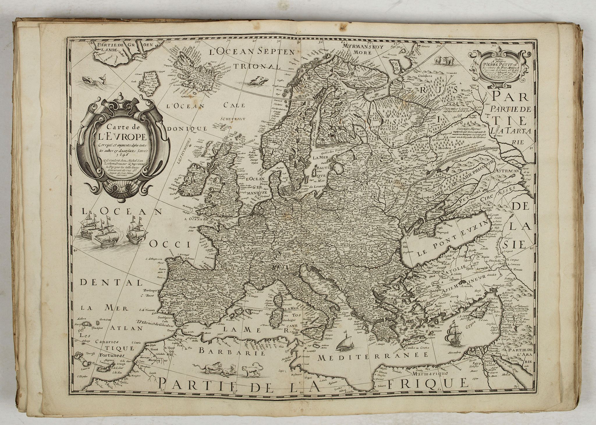
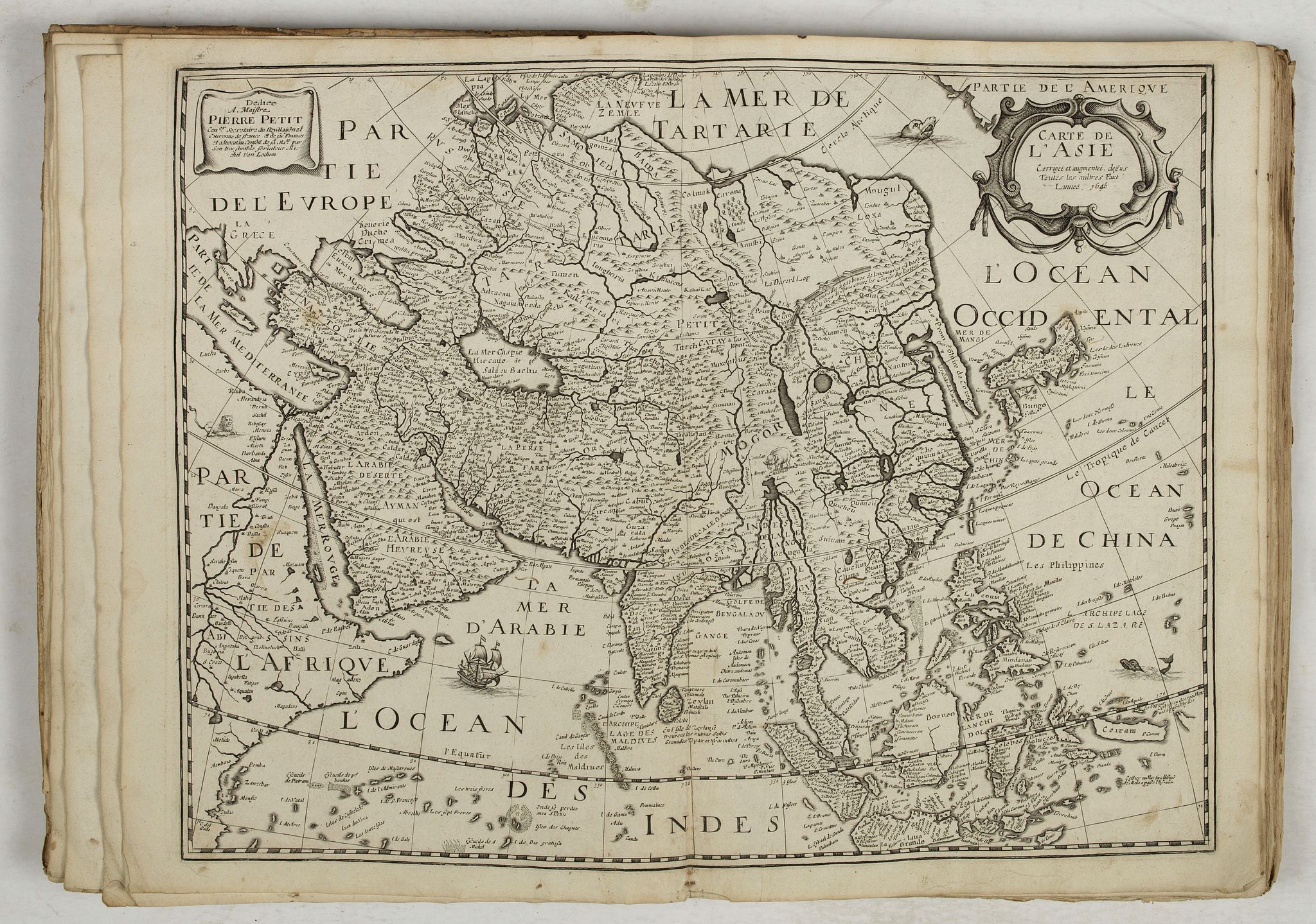
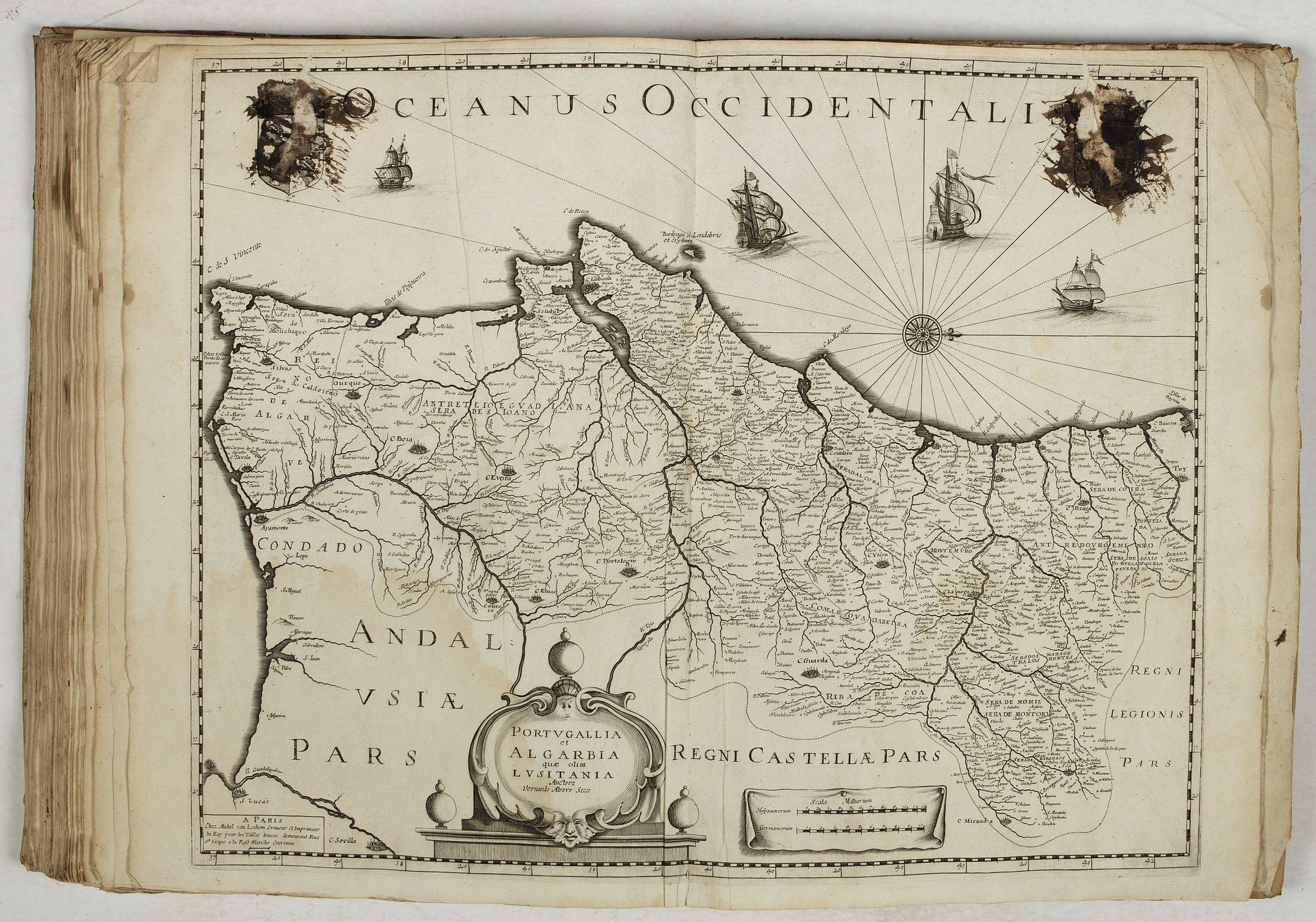
Then comes a series of 10 maps published by Michel van Lochom: the four continents, copied from those of Bertius-Tavernier, Picardy by Pierre van Lochom, Auvergne, the Viscounty of Turenne, Spain, Portugal and, in association with Mariette, Maine.
The atlas also contains 7 maps by Tavernier, 3 Dutch maps, 2 maps of Boisseau, 2 of Leclerc and 8 anonymous maps. The second edition of 1653 makes three Dutch maps disappear: the government of La Capelle (map 18), the Boulonais (map 19) and the diocese of Reims (map 14), in favor of 3 new French maps : the viscounty of Turenne (map 67), the Périgord (map 68) and Portugal (map 70).
For this atlas, as for that of Tavernier, there are variations from one copy to another, a given region can be represented by different maps, depending on the stock available at the time of the sale of the atlas.
The "Théâtre géographique de France" was no longer republished after 1653 ".
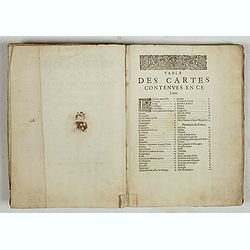
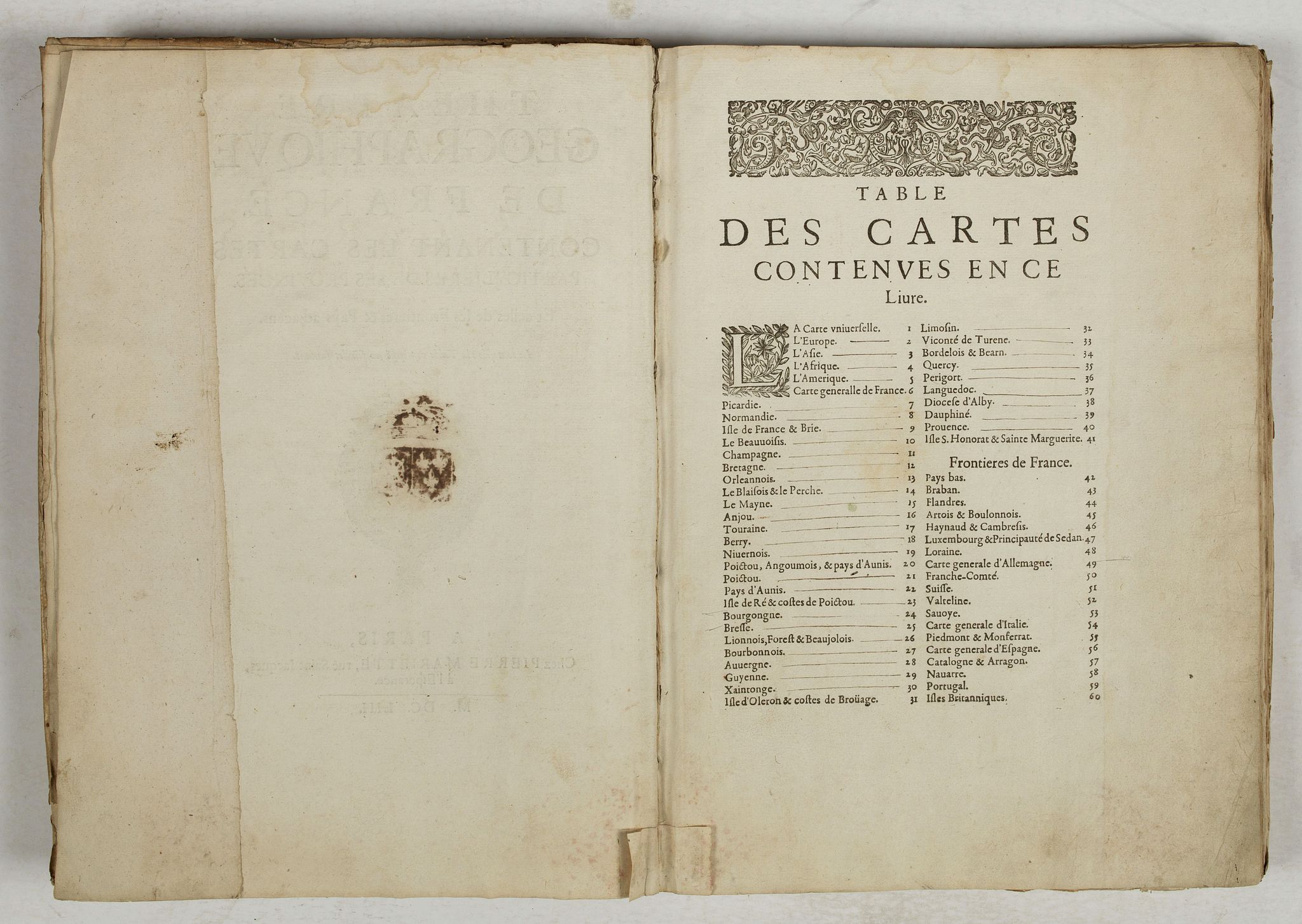
LIST OF MAPS :
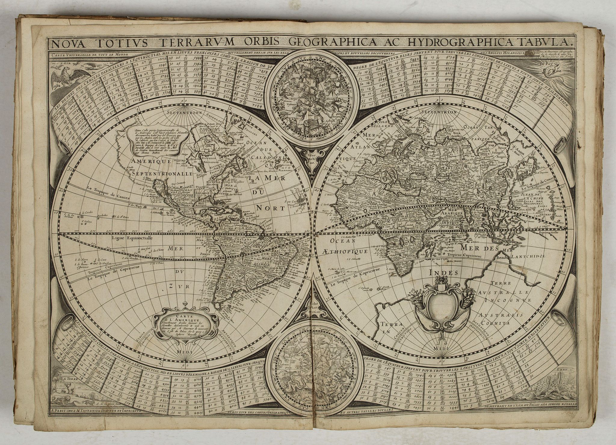
1./ Tavernier. - Nova totius terrarum orbis geographica ac hydrographica tabula. Carte universelle de tout le monde nouvellement dressé [sic] sur les relations et nouvelles decouvertes des Anglois, Holandois et autres / par M. Tavernier idrographe de sa Majesté & avec son privilege pour 20 ans ; A. de la plaes fecit. A Paris chez M. Tavernier graveur et imprimeur du roy pour les cartes geographique [sic] et autres tailles doulces demeurant en l'isle du Palais a la Sphere Royalle, 1643 (split along center fold on one third of the map). Shirley, R.W. (World) 360.
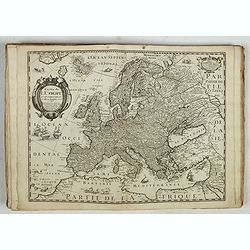
2./ Van Lochom. - Carte de l'Europe corrigée et augmentée dessus toutes les aultres cy devant faictes l'année 1646.
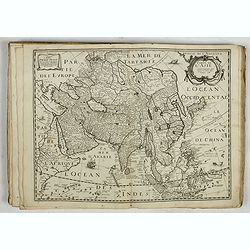
3./ Van Lochom. Carte de l'Asie corrigée et augmentée dessus toutes les aultres Faict l'année 1646.
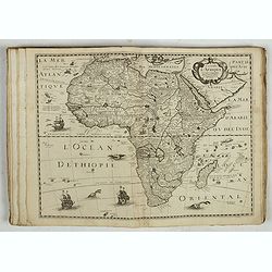
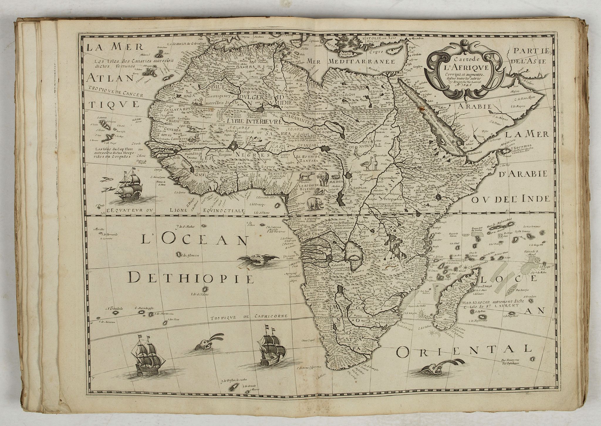
4./ Van Lochom. Carte de l'Afrique corrigée et augmentée dessus toutes les aultres cy devant faictes Lannée: A[nn]o 1646.
5. Van Lochom. Carte de l'Amerique corrigée et augmentée dessus toutes les aultres cy devant faictes Lannée: A[nn]o 1646
6./ Tavernier. - L’Empire Francois / 1637.
7./ Van Lochom. Picardie (paper creased, two large vertical splits on 16 and 12 cm)
8./ Tassin. - Carte de Normandie (split along center fold on two-thirds of the map)
9./ Tassin. Carte de l'Isle de France et Brie (split along center fold on two-thirds of the map)
10./ Mariette.- Carte du Beauvaisis
11./ Tassin. - Carte generale de Champagne
12./ Tassin. Carte de Bretagne
13./ Tassin. - Carte du duché d'Orleans
14./ Mariette. - Carte du Perche / Carte du Blaisois / A. Peyrounin fecit
15./ Tassin. - Carte du Maine
16./ Tassin. - Carte du duché d'Aniou
17./ Tassin. - Carte de Touraine
18./ Tassin. - Carte de Berry
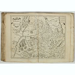
19./ Tassin. - Carte de Nivernois
20./ Tassin. - Carte generale de Poictou Xaintonge Angoulmois et pays d'Aulnix (split along center fold on 10 cm)
Mariette. - Pictavia ducatus descriptio. Carte du duché de Poictou / A. Peyrounin fecit (split along center fold on 10 cm)
22./ Tavernier. - Carte du pais d'Aunis ville & gouvernement de la Rochelle 1627 / Designée par le Sr Bachot
23./ Tavernier. - Carte particuliere des costes de Poittou Aunis, et de la Rochelle et du fort St Louys comme aussy de l'Isle de Ré avec ses forts / 1627
26./ Tassin. - Carte du Lionnois Forest et Beauielois
27./ Duché de Bourbonnois
28./ Carte d’Auvergne /1643
29./ Tassin. - Carte generale de Guyenne.
30./ Mariette. - Xaintonge et Angoumois / A. Peyrounin fecit.
31./ Tavernier. - Carte de la coste de la Rochelle a Brouaige et de l'Isle d'Oleron / observée par le Sr de Chatillon ingenieur du roy / 1627.
32./ Tassin. - Carte de Limosin.
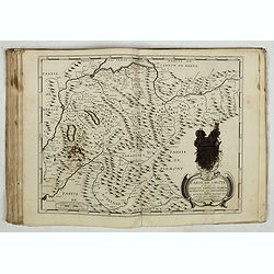
33./ Van Lochom. - Description generalle du pais et Viconté de Turenne, avec les confins des provinces qui l'avoisinent / Par le Sr du Bac.
34./ Mariette. - Carte du Bourdelois du pais de Medoc et de la Prevosté de Born / Carte de la principauté de Bearn / A. Peyrounin fecit.
35./ Mariette. - Carte du Querci / A. Peyrounin fecit.
36./ Ph. de la Rue / Mariette. - Comté de Perigort / Par Ph. de la Rue Paris[ien] ; J. Somer sculp.
37./ Tassin. - Carte du Languedoc.
38./ Tavernier. - Carte du diosese d'Alby / par Tavernier (ink-stained coats of arms with paper loss)
39./ Tassin. - Carte de Dauphiné.
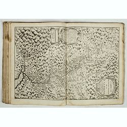
40./ Tassin. - Carte de Provence
41./ Tassin. - Description du Cap de la Croix isles Ste Margueritte et St Honorat.
43./ Dankerts. - Nouvelle et exacte carte du Duché de Brabant l'anné [sic] / 1635 (ink-stained coats of arms with paper loss)
44./ Dankerts. - Comitatus Flandriae Nova Tabula.
45./ Du Val / Mariette. - Carte des comtés d'Artois et Boulenois / Par du Val Geographe ; A. Peyrounin fecit.
46./ Du Val / Mariette. - Carte de Hainault et Cambresis / Par du Val Geographe ; A. Peyrounin fecit.
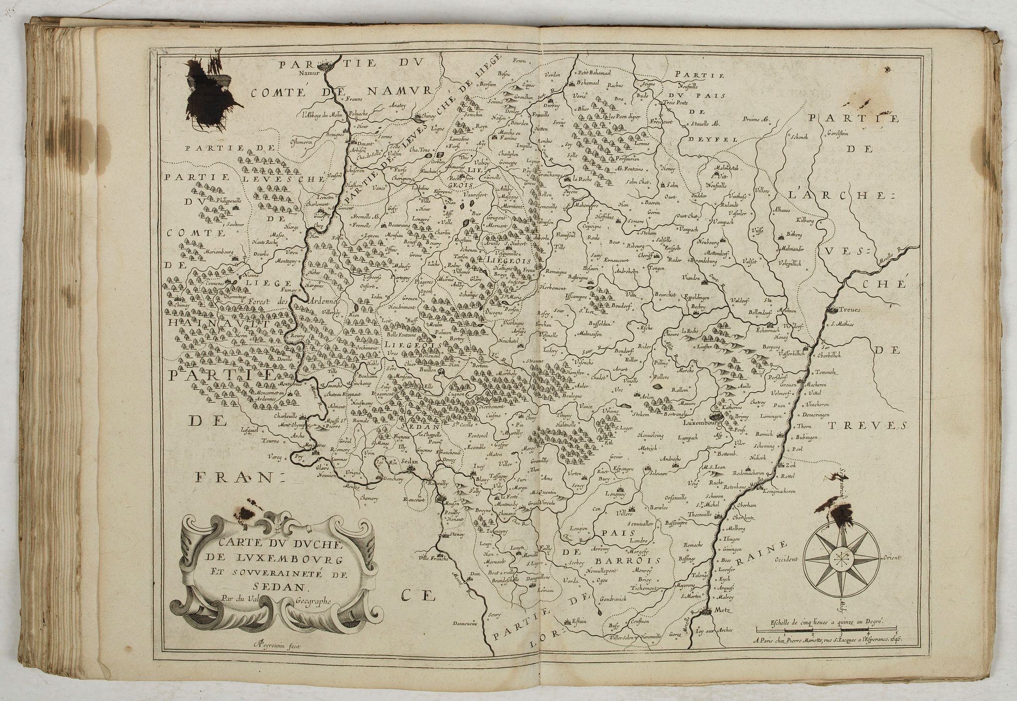
47./ Du Val / Mariette. -Carte du duché de Luxemhourg et souveraineté de Sedan / Par du Val Geographe ; A. Peyrounin fecit.
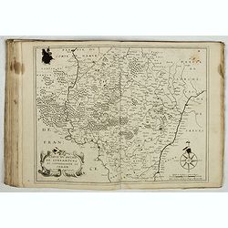
48./ Carte des duchez de Lorraine et Bar.
50./ Tassin. - Carte de la Franche Comté et du duché de Montbeliart.
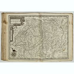
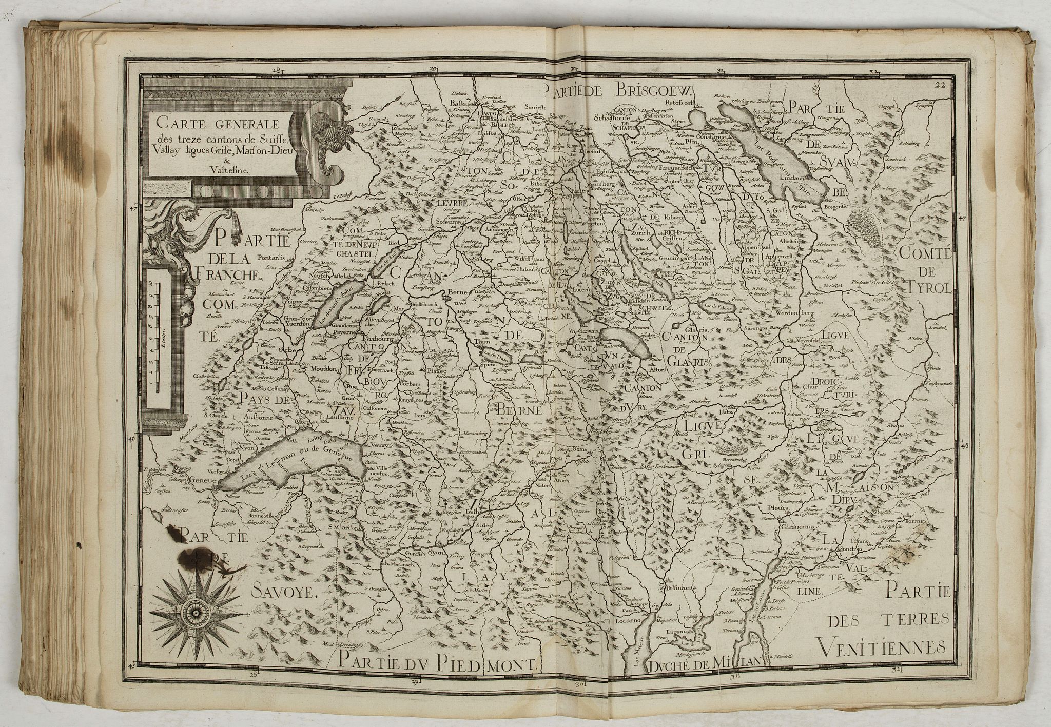
51./ Tassin. - Carte generale des treze [sic] cantons de Suisse, Vallay, ligues grises Maison-Dieu & Valteline.
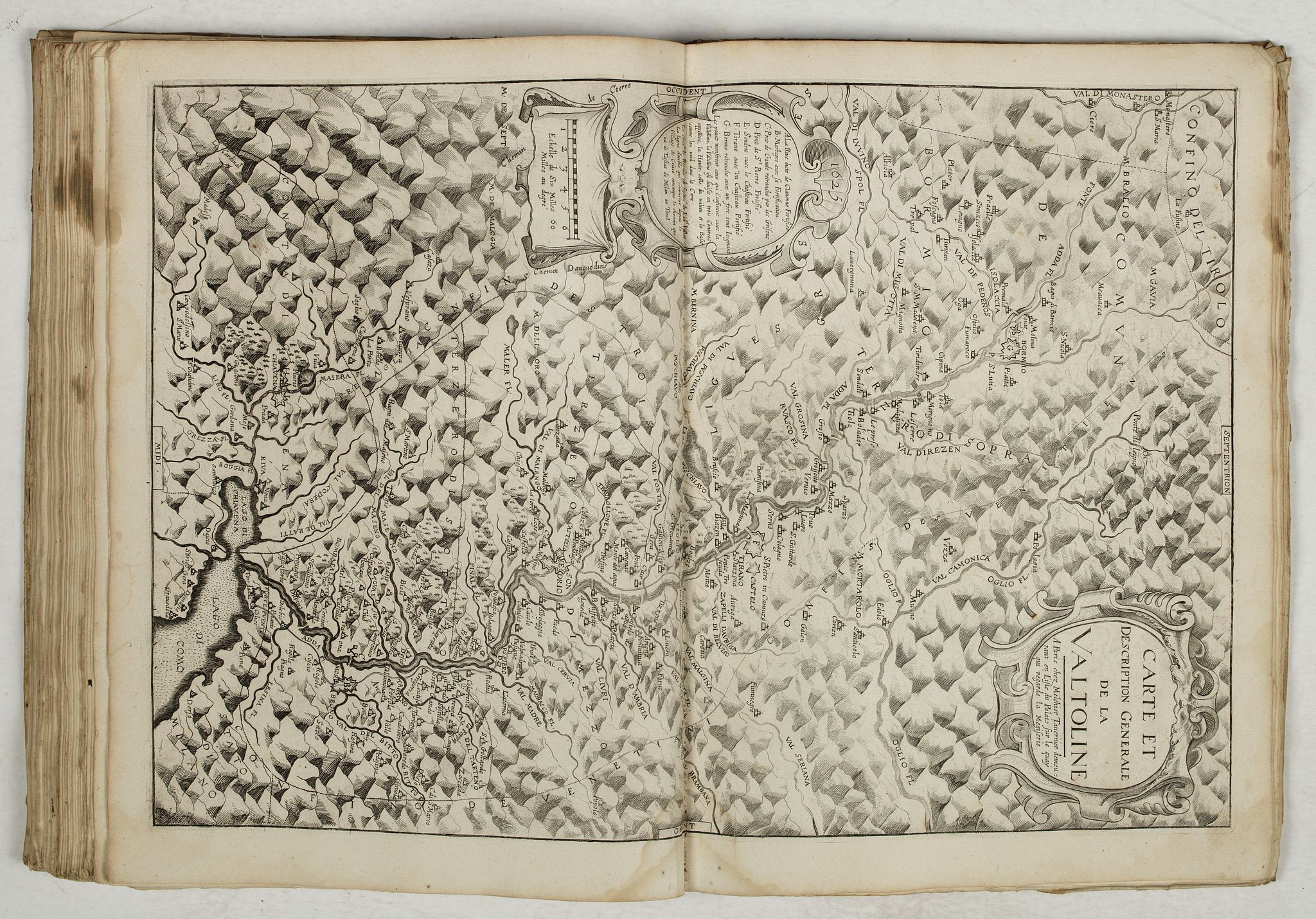
52./ Tavernier. - Carte et description generale de la Valtoline.
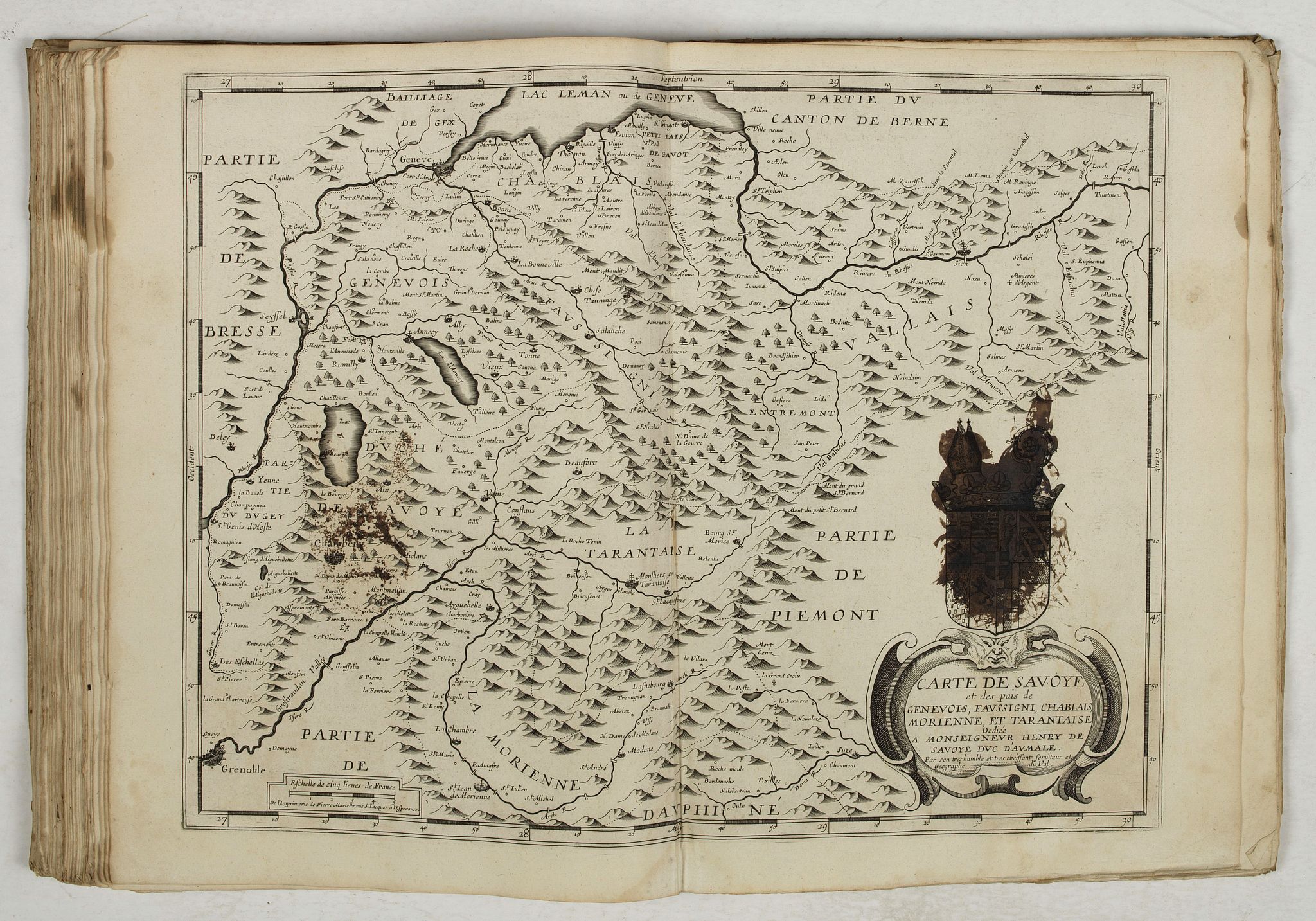
53./ Du Val / Mariette. - Carte de Savoye et des païs de Genevois Faussigni, Chablais, Morienne, et Tarantaise / Dediée a Monseigneur Henry de Savoye duc d'Aumale ; Par son tres humble et tres obeissant serviteur et Geographe du Val.
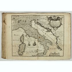
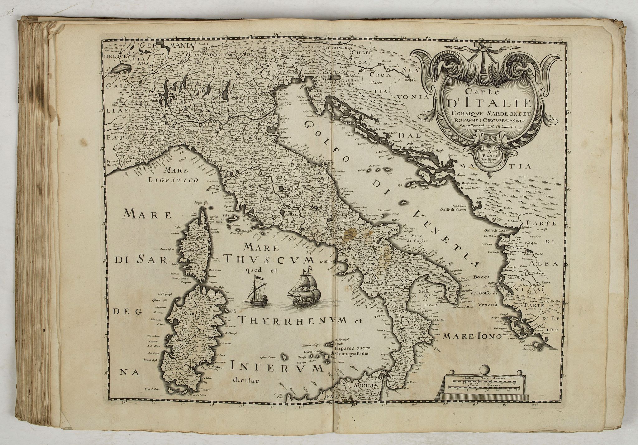
54./ Mariette. - Carte d'Italie Corsique Sardegne et royaumes circumvoysines [sic] Nouvellement mise en lumiere.
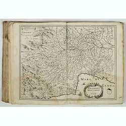
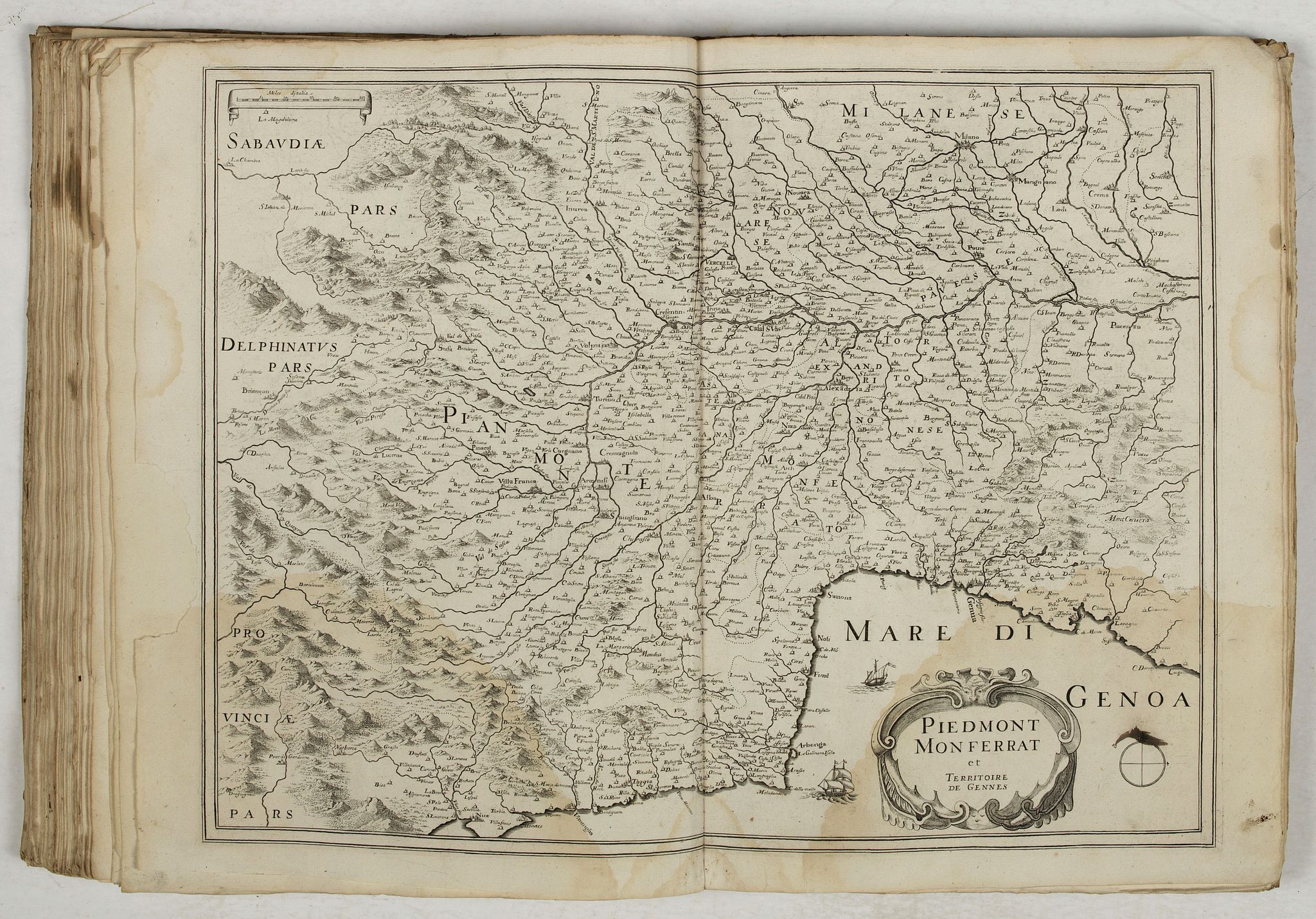
55./ Piedmont Monferrat et Territoire de Gennes (lack of paper in the left-hand margin)
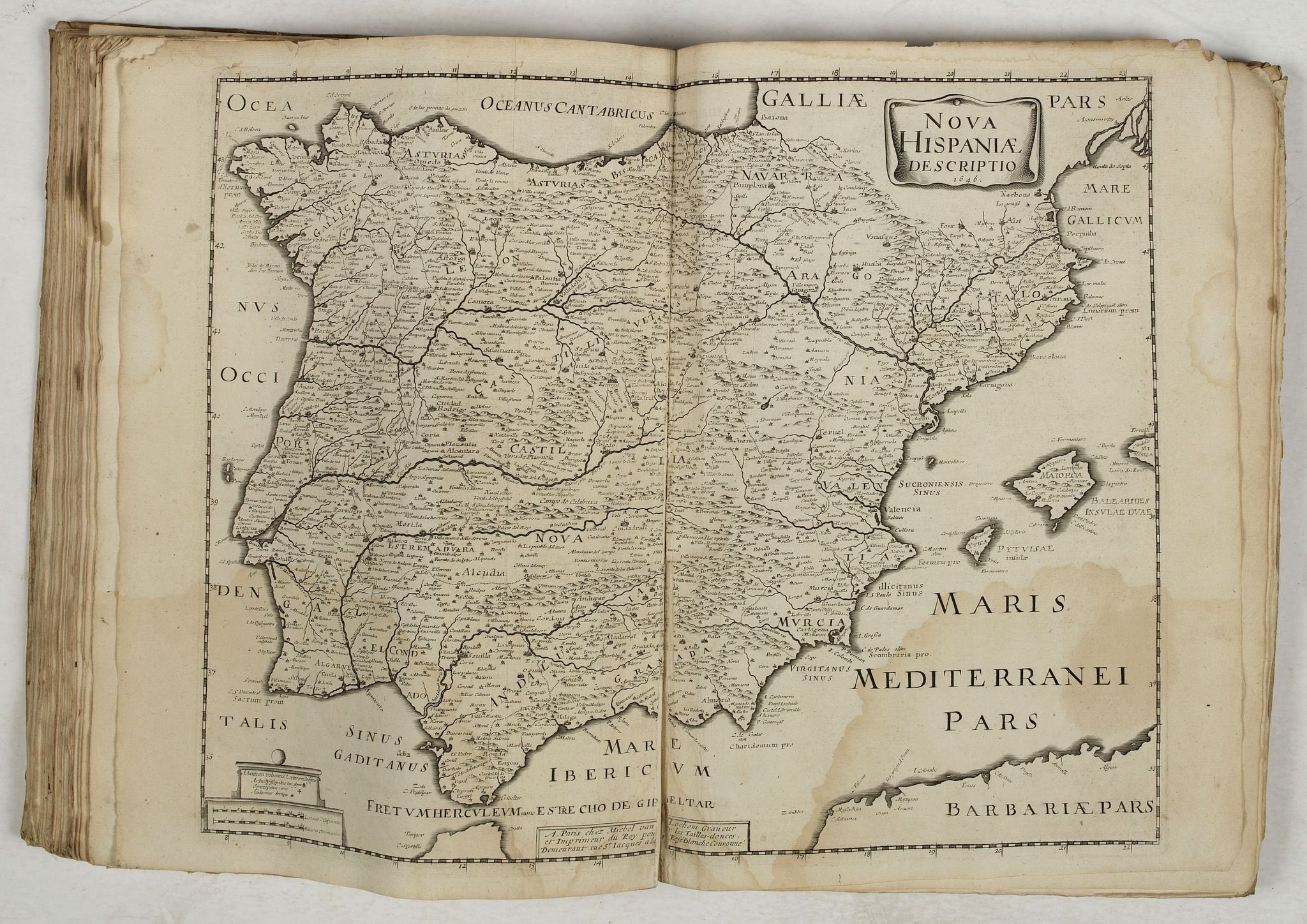
56./ Van Lochom. - Nova Hispania description / 1646.
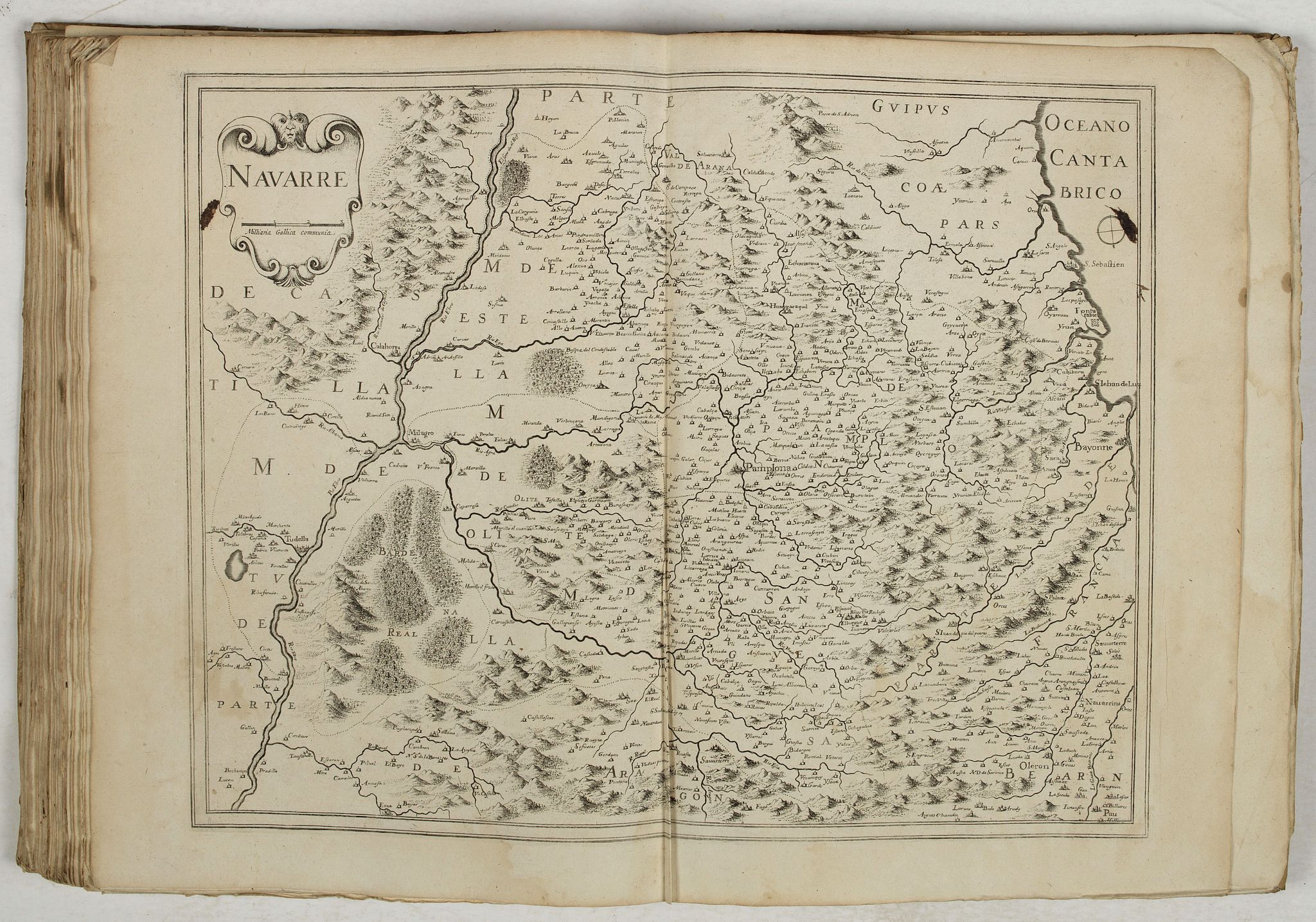
57./ Navarre
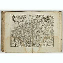
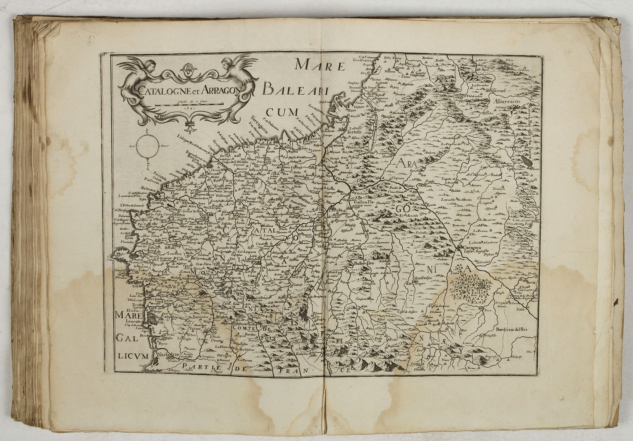
58./ Catalogne et Arragon /1641
59./ Van Lochom. - Portugallia et Algarbia quae olim Lusitania / Auctore Vernando Alvero Secco (ink-stained coats of arms with paper loss)
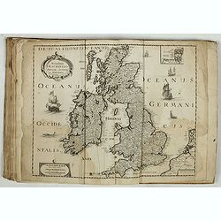
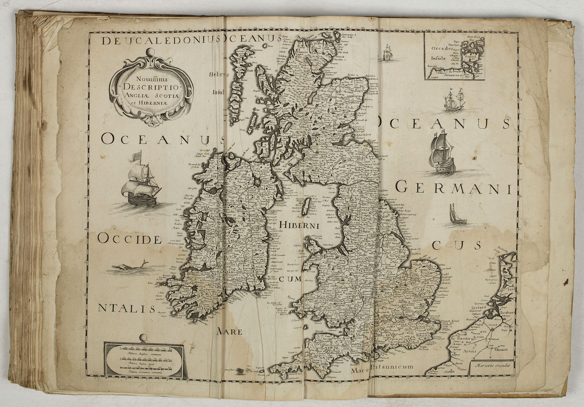
60./ Mariette. - Novissima descriptio Angliae Scotiae et Hiberniae (water stains, paper creased, margin partly redone on the right-hand side).
Reference: Pastoureau, Les atlas français XVIe – XVIIe siècles, Mariette B.
FAQ - Guarantee - Shipping
Buying in the BuyNow Gallery
This item is available for immediate purchase when a "Add to Cart" or "Inquire Now" button is shown.
Items are sold in the EU margin scheme
Payments are accepted in Euros or US Dollars.
Authenticity Guarantee
 We provide professional descriptions, condition report and HiBCoR rating (based on 45 years experience in the map business)
We fully guarantee the authenticity of items we sell. We provide a certificate of authenticity for each purchased item.
Condition / Coloring
We indicate the condition of each item and use our unnique HiBCoR grading system in which four key items determine a map's value: Historical Importance, Beauty, Condition/Coloring and Rarity.
We offer many maps in their original black and white condition. We do not systematically color-up maps to make them more sellable to the general public or buyer.
Copper engraved or wood block maps are always hand colored. Maps were initially colored for aesthetic reasons and to improve readability. Nowadays, it is becoming a challenge to find maps in their original colors and are therefor more valuable.
We use the following color keys in our catalog:
Original colors; mean that the colors have been applied around the time the map was issued.
Colored; If the colors are applied recently or at the end of the 20th century, then "colored", or "attractive colors" will be used.
Original o/l colors; means the map has only the borders colored at the time of publication.
Read more about coloring of maps [+]
FAQ
Please have a look for more information about buying in the BuyNow gallery.
Many answers are likely to find in the general help section.
Virtual Collection
![]()
With Virtual Collection you can collect all your favorite items in one place. It is free, and anyone can create his or her Virtual map collection.
Unless you are logged in, the item is only saved for this session. You have to be registed and logged-in if you want to save this item permanently to your Virtual Collection.
Read More [+]
Registering Here, it is and you do not need a credit card.
Add this item to
Virtual Collection
or click the following link to see my Virtual Collection.
Invoice
The invoice and certificates of authenticity are available in the client center >Invoices
| High-Resolution Digital Image Download | |
|
Paulus Swaen maintains an archive of most of our high-resolution rare maps, prints, posters and medieval manuscript scans. We make them freely available for download and study. Read more about free image download |
Click this image for a free HR-image download. |

In accordance with the EU Consumer Rights Directive and habitually reside in the European Union you have the right to cancel the contract for the purchase of a lot, without giving any reason.
The cancellation period will expire 14 calendar days from the day after the date on which you or a third party (other than the carrier and indicated by you) acquires, physical possession of the lot. To exercise the right to cancel you must inform Paulus Swaen Europe bv, which is offering to sell the lot either as an agent for the seller or as the owner of the lot, of your decision to cancel this contract by a clear statement (e.g. a letter sent by post, or e-mail (amsterdam@swaen.com).
To meet the cancellation deadline, it is sufficient for you to send your communication concerning your exercise of the right to cancel before the cancellation period has expired.