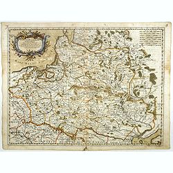
![Magni Ducatus Lithuaniae. . . (together with] Campus Inter Bohum et Borystenem. . .](/uploads/cache/49232-250x250.jpg)
Magni Ducatus Lithuaniae. . . (together with] Campus Inter Bohum et Borystenem. . .
Six sheet wall map of Lithuania and parts of Poland, Russia, Ukraine, Latvia, etc., extending to Cracow, Kyiv, Warsaw, Riga, Konigsberg, Danzig, Leopolis, etc.This is the...
Place & Date: Amsterdam, 1658
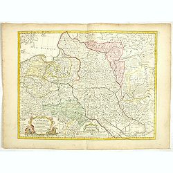
Stati della Corona di Polonia Divisa nella sue Principali Provincie e Palatinati da Guglielmo Sansone. . .
Rare map of Poland, Lithuania and the Ukraine. Copies of his first edition of 'Mercurio Geografico', published in 1674, do not contain a map of Poland. Only added in late...
- $1250 / ≈ €1069
Place & Date: Rome, 1678
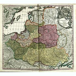
Poloniae Regnum ut et Magni Ducatus Lithuaniae . . .
Detailed map of Poland and the Baltic regions, extending in the south to Ukraine and northern Hungary.Here in its second state, now with added letters to the border scale...
- $750 / ≈ €641
Place & Date: Augsburg, 1735

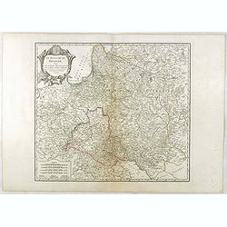
La Pologne Dressée sur ce qu'en ot donné Starovolsk, Beauplan, Hartnoch. . .
Large map of Poland, Lithuania, Belarus and part of Ukraine. The map is filled with detail and decorated with a title cartouche flanked by mythological figures.According ...
Place & Date: Paris, 1773 - 1780
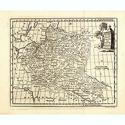
Poland Lithuania and Prussia.
Uncommon miniature map of Poland, Lithuania and the Ukraine, engraved by Thomas Kitchin - with his signature in lower right bottom.
- $300 / ≈ €256
Place & Date: London, 1782
Le Royaume De Pologne, divise selon les Partages faits en 1772, 1793 et 1795, etnre la Russie, la Prusse et l'Autriche . . .
The uncommon later edition of this detailed map of Poland, showing the lands lost to Russia, Prussia and Austria in 1772, 1793 and 1795. with a color key added underneath...
- $600 / ≈ €513
Place & Date: Paris, ca. 1796
La Pologne Dressée sur ce qu'en ont donné Starovolsk, Beauplan, Hartnoch. . .
This is a late edition of the De L'Isle copper plate with a date of 1806. The copper plate was used many times and has several erased addresses. This one with address &qu...
- $750 / ≈ €641
Place & Date: Paris, 1806

Mapa Polski i Krajów Osciennych - Wydanie trzecie. Opracowal Stanislaw Max. Wydani M. Arcta.
‘The Birth of Modern Poland on a map’ - an excellent wall map of Poland and surrounding regions, published in Warsaw near the end of World War I, when Poland’s fate...
Place & Date: Warsaw, [H. Sklodowski], 1918