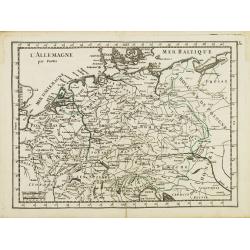
L' Allemagne par Postes.
Fine map of Germany. George Louis Le Rouge was active from 1740 to 1780 as a publisher and was appointed engineer for the King of France. From his "Atlas Nouveau Por...
- $60 / ≈ €51
Place & Date: Paris 1756
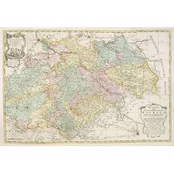
Neue Karte des Kuhrfürstenthums Sachsen. . .
Scarce road map, first published by Peter Schenk II (1698-1775) in his "Neuen Sächsischen Atlas". It is based on a map already created and 1732 and improved in...
- $750 / ≈ €641
Place & Date: Amsterdam, 1758
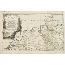
Nouvelle carte géographique des postes et autres routes d'Allemagne. . .
Map showing the northern provinces in Germany and part of the Netherlands. Decorative title cartouche in the upper left corner. A so-called post road maps.
- $80 / ≈ €68
Place & Date: Paris, 1766
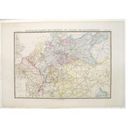
Nouvelle carte des routes de poste de l'Allemagne.
Large post road maps map of Germany, Poland, Austria, Franc, Switzerland, Austria and the Low Countries published by A. Logerot and engraved by C.Dyonnet.The mapsmakes di...
- $350 / ≈ €299
Place & Date: Paris, A. Logerot, c.1867