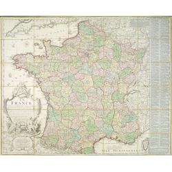
La France divisée en 83 départemens suivant les décréts de l'Assemblée Nationale, sanctionnés per le Roi. . .
An interesting folding map of France divided in 83 departments, to the right the 83 departments added on past-on slips. Another past-on is advertising Desnos' atlas in la...
Place & Date: Paris, 1790
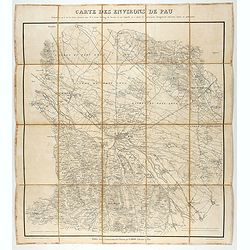
Carte des environs de Pau. . .
Folding map of Pau and its surroundings, being a reduced version of the map by Comte Dulong de Rosnay and engraved by Nicolas Delamare and published by Lafon.More about f...
- $75 / ≈ €64
Place & Date: Pau, Lafon, 1840-1850
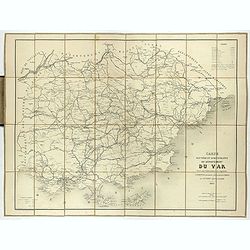
Carte routière et administrative du département du Var dressée sous l'administration et l'approbation de M. Montois, officier de la légion d'honneur, préfet , par J.B CHABET.
Folding-map of the Maritime Alps, and the Mediterranean coastline of Fréjus, Ramatuelle, St Tropez, Toulon. Engraved by Erhard, geographer and engraver (1821-1880) at th...
- $125 / ≈ €107
Place & Date: Paris, 1865
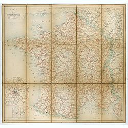
Carte nationale des routes de la France.
Map of the national roads in France, engraved and published by Regnier et Dourdet. Four inset maps of which three shows the three largest cities in France and one shows C...
- $75 / ≈ €64
Place & Date: Paris, ca. 1900