Search Listings matching "philippines" in Australia & Oceania > Oceania

Mar del Zur, Hispanis Mare Pacificum.
Janssonius' fine chart of the Pacific including the west coast of America with California shown as an island, Japan and a small Australian coastline. This is the earliest...
$2500 / ≈ €2137
Place & Date: Amsterdam, 1650
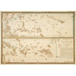
Carte particuliere de la Polynesie. . .
Prepared by A.Brué in 1826 and published by Charles Piquet. Two maps on one sheet, showing the Polynesian islands. In upper left an inset map of Formosa and the coast o...
- $150 / ≈ €128
Place & Date: Paris, 1834
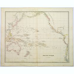
Pacific Ocean.
A wonderfully laid out map of the region, displaying the many island groups that make up this fascinating part of the world. The region is separated into parts, the South...
$350 / ≈ €299
Place & Date: London, 1839