Search Listings matching "Geological"
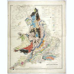
The Inland Navigation, Rail Roads, Geology and Minerals of England & Wales.
A beautifully color-coded and robustly labelled map describes the geology of England and Wales. The colors indicate particular rock materials in accordance with a key at ...
Place & Date: London, 1834

Kiepert's Physikalische Wandkarten. VI. Nord-America.
Large folding school wall map of North and Central America printed in chromo-lithography. Published by Dieter Reimer and printed by Leopold Kraatz in Berlin. Three inset...
Place & Date: Berlin, Dieter Reimer, 1864
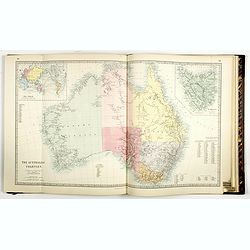
The Family Atlas Containing Eighty maps Constructed by Eminent Geographers. . .
Un unrecorded later edition of the S.D.U.K. Family atlas, with 80 plus one extra map. Most maps are single sheet but several are double page maps. Printed on heavy paper ...
Place & Date: London Edward Stanford, 1874

Dutton Map of the Grand Canyon, Arizona (in 4 joined sheets)
An important 1882 map of the Grand Canyon, Arizona, published in "Atlas To Accompany The Monograph On The Tertiary History Of The Grand Canon District By Capt. Clare...
- $1000 / ≈ €936
Place & Date: Julius Bien & Co., 1882
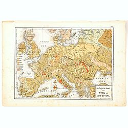
Geologische Kaart van Middel- en Zuid-Europa.
One of the earliest thematic maps published in the Netherlands from "Atlas der natuurkundige aardrijkskunde. . .". prepared by Nicolaas Wilhelmus Posthumus. Wit...
- $35 / ≈ €33
Place & Date: Amsterdam, C.L. Brinkman, 1883
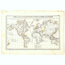
Kaart, voorstellende de Seculaire Rijzingen en Dalingen van den Bodem, alsmede de Vulkamen.
One of the earliest thematic world maps published in the Netherlands from "Atlas der natuurkundige aardrijkskunde. . .". prepared by Nicolaas Wilhelmus Posthumu...
- $35 / ≈ €33
Place & Date: Amsterdam, C.L. Brinkman, 1883
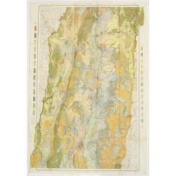
Soil map - Connecticut. - Massachusetts, (Hartford) Springfield sheet.
Early color lithographed soil map by Julius Bien & Co. in New York for Department of Agriculture. Legends at side give detail on soil type, etc. They also include int...
Place & Date: New York, 1903
Selling price: $85
Sold in 2008
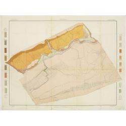
Soil map - Pennsylvania, Lockhaven sheet.
Early color lithographed soil map by Julius Bien & Co. in New York for Department of Agriculture. Legends at side give detail on soil type, etc. They also include int...
- $50 / ≈ €47
Place & Date: New York, 1903
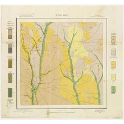
Soil map - Texas, Nacogdoches sheet.
Early color lithographed soil map by Julius Bien & Co. in New York for Department of Agriculture. Legends at side give detail on soil type, etc. They also include int...
- $75 / ≈ €70
Place & Date: New York, 1903
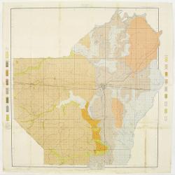
Soil map - Louisiana, Ouachita sheet.
Early color lithographed soil map by Julius Bien & Co. in New York for Department of Agriculture. Legends at side give detail on soil type, etc. They also include int...
- $40 / ≈ €37
Place & Date: New York, 1903