Browse Listings

CANTON Kong-Teheou.
Very detailed (1:1.000.000) map centered on Macao and Victoria Island, showing soundings, English, Australian, Danish telegraph lines reaching Hong Kong and extended to M...
Place & Date: Paris, 1898 updated for june 1904
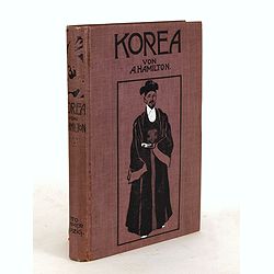
Korea. Das Land des Morgenrots. Nach seinen Reisen geschildert von Angus Hamilton. Autorisierte Übersetzung aus dem Englischen.
With 114 illustrations after photographes and one map.
Place & Date: Leipzig: Spamer, 1904

Excelsiori (Rana N. 28 - Cent. 20).
"After so many wars and so many troubles, young Russia, in a more serene glaze all the beautiful sun of freedom you will enjoy ... ". Fascinating allegorical sa...
Place & Date: Bologna, 1905

Parliamentary Papers - Foreign Office - Annual Series - Diplomatic and Consular Reports on Trade and Finance.
Very scarce - Only for the British Parliament and the British Crown printed - and not for the trade! Accounts about the Korean country during the time span of the last th...
Place & Date: London, Harrison and Sons, 1882-1906
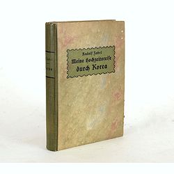
Meine Hochzeitsreise durch Korea während des Russisch-japanischen Krieges.
Illustrated with ca. 200 illustrations. All photographs are taken by the author.
Place & Date: Altenburg, S.-A., Stephan Geibel Verlag, 1906
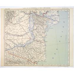
Carte de la Roumanie et Pays limitrophes. Odessa. GALATZ.
Very detailed (1:750.000) map centered on Constanta, with the river Danube in Romania. Made after an Austrian map. The French Service géographique des armées was founde...
Place & Date: Paris, 1908

L'illustration, journal officiel hebdomadaire.
L'Illustration, the first French illustrated newspaper from 1843, became the first magazine in the world in 1906 and is distributed in more than 150 countries.The mythica...
Place & Date: Paris, 1908

Atlas Geographique. (Puzzle).
Three map puzzles, each measuring 25 x 33 cm., housed in the original color printed card case. Geographical jigsaw puzzle set comprising three maps (world, Europe and Fra...
Place & Date: Paris, ca. 1910
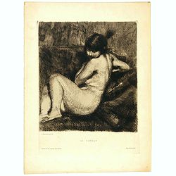
Le Turban.
Etching in brown ink on cream laid paper by Albert Besnard (1849–1934) of a young naked woman with feathered turban. Inscribed below the borderline: (left) “A. Besnar...
Place & Date: Paris, 1910

Standford's map of the empires of China and Japan with the adjacent parts of the Russian Empire, India, Burma &c.
Charming, folding map of China and Japan with the adjacent parts of the Russian Empire, India, and Burma. A key identifies railway lines in red, projected railway lines i...
Place & Date: London, ca. 1911