Browse Listings
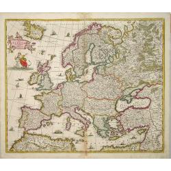
Nova et Accurata totius EUROPAE Descriptio Authore Frederico de Wit Amstelodami.
General map of Europe richly ornamented with small compass rose and Europa shown riding Zeus in the form of a bull, and several putti holding the title banner aloft.
$800 / ≈ €749
Place & Date: Amsterdam, 1680
Partie de L'Amerique Septentrionale, qui comprend Le Cours De L'Ohio, La N[ouve]lle Angleterre, La N[ouve]lle York, Le New Jersey, La Pensylvanie, Le Maryland, La Virginie, La Caroline.
Double page map of the East coast of America, showing the area from Maine to South Carolina. Inset map titled ""Supplement Pour La Caroline"" showing ...
$980 / ≈ €917
Place & Date: Paris. 1755

![Partie de L'Amerique Septentrionale, qui comprend Le Cours De L'Ohio, La N[ouve]lle Angleterre, La N[ouve]lle York, Le New Jersey, La Pensylvanie, Le Maryland, La Virginie, La Caroline.](/uploads/cache/1129917-250x250.jpg)