Browse Listings in America > North America > Western America / Texas
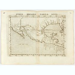
Nueva Hispania tabula nova.
Uncommon first edition of this early map of New Spain, Florida and Gulf of Mexico. The map is an enlarged version of Giacomo Gastaldi's map published in 1548. Nomenclatur...
Date: Venice, 1561
Selling price: ????
Please login to see price!
Sold in 2024
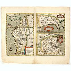
La Florida/ Peruviae Auriferae regionis Typus/ Guastecan.
The Chaves map of Florida is a prime example of an explorer's map since it records the recent discoveries of Cabeza de Vaca, De Soto, and Moscoso. The map revealed little...
Date: Antwerp, 1592
Selling price: ????
Please login to see price!
Sold in 2016
![[Gulf of Mexico showing entire Texas coast, and extending east to Florida]](/uploads/cache/37159-250x250.jpg)
[Gulf of Mexico showing entire Texas coast, and extending east to Florida]
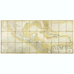
Untitled sheets from Ottens’ important 6-sheet wall map: "Grand Théâtre de la Guerre en Amérique suivant les plus nouvelles observations des Espagnols, Anglois,...
Date: Amsterdam, 1741
Selling price: ????
Please login to see price!
Sold in 2016
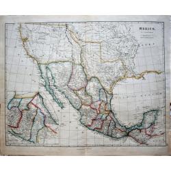
Mexico of Nieuw Spanje.
A map of Mexico and Texas ( called Tecas) from the Dutch edition of Robertson's ' History of America'.
Date: Amsterdam, 1778
Selling price: ????
Please login to see price!
Sold in 2018
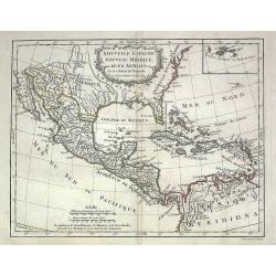
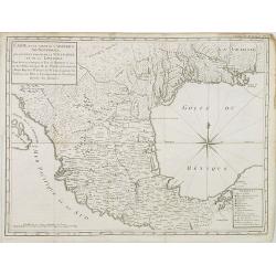
Nouvelle Espagne, Nouveau Mexique, Isles Antilles
Map of the 18th century Spanish territories of New Spain and New Mexico together with islands of the Caribbean. Accurate coastlines and good delineation of the rivers alo...
Date: Paris, 1778
Selling price: ????
Please login to see price!
Sold in 2009
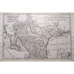
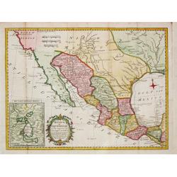
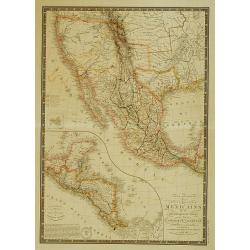
Le Nouveau Mexique, Avec La Partie Septentrionale De L'Ancien, ou De La Nouvelle Espagne.
Highly detailed map of the Southwest USA, from Baja California to West Florida, including parts of Mexico and a tip of Yucatan. With very interesting features: In Texas,...
Date: Paris, 1780
Selling price: ????
Please login to see price!
Sold in 2015
Carte des Isles Antilles et du Golfe du Mexique, avec la Majeure partie de la Nouvelle Espagne. Par M. Bonne, Inge´nieur Hydrographe de la Marine. Aoust 1780. . .
The first edition of this scarce large format map of Florida, the Gulf Coast, Texas (almost to Corpus Christi), Mexico, Baja California and Central America, northern Sout...
Date: Paris, 1780
Selling price: ????
Please login to see price!
Sold in 2022
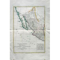
L'Ancien et le Nouveau Mexique avec la Floride et la Basse Louisiane. Partie Occidentale.
Excellent early map of California, Texas, Arizona, New Mexico, and Mexico. Very detailed with many towns, jesuit missions, forts, Indian areas, etc. Early geography of in...
Date: Paris, c 1780
Selling price: ????
Please login to see price!
Sold in 2010
Carte d\'une partie de l\'Amerique.. et de la Louisiane..
A handsome and seldom-seen map of the Spanish colonial period. Included in Voyages de Mr. de Pagés.De Pages, a French nobleman and Navy captain, crossed the \"Provi...
Date: Paris, 1782
Selling price: ????
Please login to see price!
Sold in 2008
Carte des cotes du Golfe du Mexique..
Detailed and important early chart of the Gulf Coast and Florida and dated 1800. From Neptune des cotes occidentales d'Amerique sur le Grand Ocean, an extensive atlas of ...
Date: Paris 1800
Selling price: ????
Please login to see price!
Sold
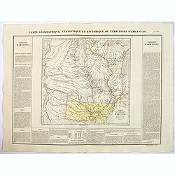
Carte Geographique, Statistique et Historique du Territoire d'Arkansas.
A nice detailed map of the Territory of Arkansas, from Buchon's Atlas Gégraphique Statistique, historique et chronologique des deux Ameriques et des isles adjacentes tra...
Date: Paris, 1825
Selling price: ????
Please login to see price!
Sold in 2019
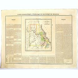
Carte Geographique, Statistique et Historique du Territoire Missouri.
A nice detailed map of the state of Missouri, from Buchon's Atlas Gégraphique Statistique, historique et chronologique des deux Ameriques et des isles adjacentes traduit...
Date: Paris, 1825
Selling price: ????
Please login to see price!
Sold in 2019
![[TEXAS] Set of 5 maps in plano format, on an uniform scale, covering Texas.](/uploads/cache/35573-250x250.jpg)
[TEXAS] Set of 5 maps in plano format, on an uniform scale, covering Texas.
A set of 5 plano sheet maps covering Texas, from Vandermaelen's famous Atlas Universel.It is to be noted that only a handful of these were made in plano format (they were...
Date: Brussels, 1825-1827
Selling price: ????
Please login to see price!
Sold in 2021
Set of 5 maps covering Texas.
A set of 5 plano sheet maps covering Texas, from Vandermaelen's famous Atlas Universel.
Date: Brussels, 1825-1827
Selling price: ????
Please login to see price!
Sold in 2014
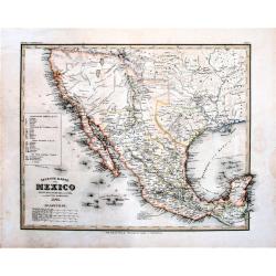
Carte générale des États-Unis Mexicains, de la République du Texas..
Map of Texas, Mexico and the South-West. Rare mention of the Republic of Texas in the title.Excellent pre-Fremont cartography in Upper or New California, although the 3 r...
Date: Paris 1840
Selling price: ????
Please login to see price!
Sold
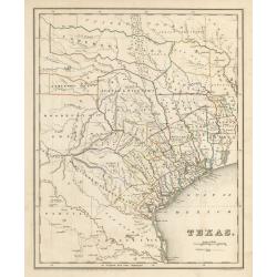
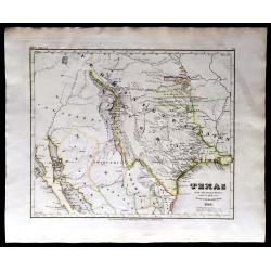
Texas
This is an important map of Texas during its time as a republic, showing the region as divided into land grants based on empresarios established by the Mexican government...
Date: Boston, 1841
Selling price: ????
Please login to see price!
Sold in 2023
Mexico. By J. Arrowsmith. Mexico, Shewing the connection with the Ports of Acapulco, Vera Cruz, & Tampico; on double the scale of the Map.
This map of Mexico, published by J. Arrowsmith in 1842, brings, below the lower neat line at center: "London, Pubd. 15 Feby. 1842, by J. Arrowsmith, 10 Soho Square&q...
Date: London, 1842
Selling price: ????
Please login to see price!
Sold in 2018
Neueste Karte von Mexico Nach den Besten Quellen . . . (shows Republic of Texas)
The Republic of Texas was a sovereign state from 1836 to 1845. It claimed a region including all of the present state of Texas, together with parts of present-day New Mex...
Date: Hildburghausen, 1845
Selling price: ????
Please login to see price!
Sold in 2018
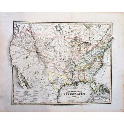
Nord-Americanische Freistaaten (shows Republic of Texas).
An attractive map of the United States just prior to the Mexican-American War. It shows a small Republic of Texas with its southwestern border on the Nueces River. The na...
Date: Hildburghausen, 1845
Selling price: ????
Please login to see price!
Sold in 2018
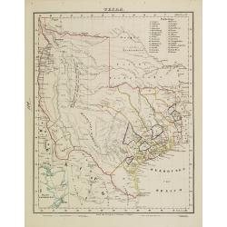
Texas.
Rare map of Texas by Flemming. With counties outlined in color and an inset map of Galveston Bay.
Date: Glogau 1841 - 1845
Selling price: ????
Please login to see price!
Sold
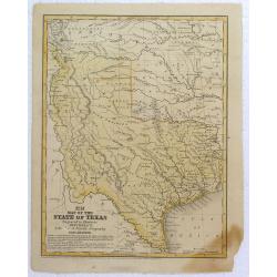
Map of the State of Texas.
Early map of Texas, a year after annexation, from Mitchell's school & Family Geog. Dated in plate.
Date: Pennsylvania, 1846
Selling price: ????
Please login to see price!
Sold in 2016
Sketch of the Battle Ground at Palo Alto, (Texas) (One of three maps)
The other two maps are “Sketch of the Battle Ground at Palo Alto, Texas” and "Sketch of the Main Road from fort Brown to Point Isabel Island”.These three maps ...
Date: Wahsington, 1846
Selling price: ????
Please login to see price!
Sold in 2017
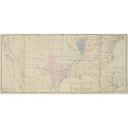
Texas, 1846.
RARE! The first year Texas as a state. A large lithographic map showing the state of Texas, with county boundaries, in original hand coloring. It shows the brand new stat...
Date: Leipzig, 1846
Selling price: ????
Please login to see price!
Sold in 2020
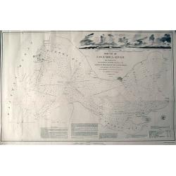
Mouth of Columbia River...
Large and very detailed chart of the Columbia River entering the Pacific Ocean near Astoria, Oregon. With numerous depth soundings and observations on the approach. I...
Date: United States, 1851
Selling price: ????
Please login to see price!
Sold in 2011

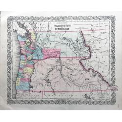
Map of the States of California, Washington, Utah, New Mexico, & Oregon Territories
This map by one of the leading U.S. cartographic firms of the period, is an excellent example of American mapping at an important time in the development of the western U...
Date: Philadelphia, 1854
Selling price: ????
Please login to see price!
Sold in 2023
The Territories of Washington and Oregon.
Rare and early map of this region, in nice conditions.
Date: New York, 1855
Selling price: ????
Please login to see price!
Sold in 2022
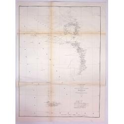
Sketch K Showing the Progress of the Survey in Section No. XI (Upper Sheet) from Tillamook Bay to the Boundary.
A fine 1857 US Costal Survey map, or triangulation chart, of Washington State, from Tillamook Head to Vancouver Island, including Juan De Fuca Strait, the Puget Sound, Ol...
Date: Washington, 1857
Selling price: ????
Please login to see price!
Sold in 2017
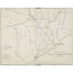
Carte du Chemin de Fer de Galveston Houston & Henderson. Texas Etats Unis D'Amerique.
Hand colored map of the United States showing the "Galveston, Houston & Henderson" railroad system. The state of Texas is colored in pink and Illinois in bl...
Date: Paris, Imp. Kaeppelin, 17 Quai Voltaire, ca 1857
Selling price: ????
Please login to see price!
Sold in 2010
Tracé d'une partie du Chemin de Fer de Galveston à Houston et Henderson. Texas Etats Unis D'Amerique.
Hand colored map of the area between Galveston, Harrisburg, Richmond and Houston, showing "Galveston, Houston & Henderson railroad", also "Buffalo Bayo...
Date: Paris, ca. 1857
Selling price: ????
Please login to see price!
Sold in 2010
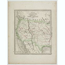
Stati e territorii Occidentali della Unione Americana.
Rare map of the Transmississippi West, with an oversized California, Oregon, Nebraska, Kansas, New Mexico and Utah and a totally eclipsing Washington, Idaho, North & ...
Date: Genova, Paolo Rivara fu Giacomo, 1858
Selling price: ????
Please login to see price!
Sold in 2020
![North America [Sheet XV] Utah, New Mexico, Texas, California &c. . .](/uploads/cache/42397-250x250.jpg)
North America [Sheet XV] Utah, New Mexico, Texas, California &c. . .
A detailed steel engraved map of the American S.W. showing the states of California, New Mexico, Texas, Indian Territory (Oklahoma), Utah, Kansas and parts of Missouri, N...
Date: London, 1859
Selling price: ????
Please login to see price!
Sold in 2018
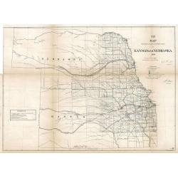
Map Showing the progress of the Public surveys in Kansas and Nebraska
An impressive and important early land survey of Kansas and the Nebraska Territory immediately following the Civil War when America set its sight back on the western fron...
Date: Philadelphia, 1866
Selling price: ????
Please login to see price!
Sold in 2023
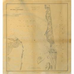
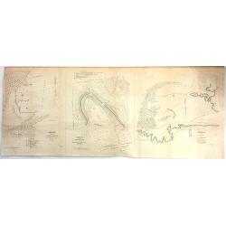
Brazos Santiago, Texas
Completed chart. Area of Padro Island.Brazos Island has a hospital and barracks shown.Quite interesting for this area and time. Dated in plate. Needs bottom re-margining.
Date: 1867
Selling price: ????
Please login to see price!
Sold in 2016
![Untited [Texas, Indian Territory, Kansas, Missouri, Arkansas, Louisiana]](/uploads/cache/23331-250x250.jpg)
Untited [Texas, Indian Territory, Kansas, Missouri, Arkansas, Louisiana]
Very detailed map prepared by A.Petermann, illustrating the South Central United States: Texas, Indian Territory, Kansas, Missouri, Arkansas, Louisiana. Great detail in T...
Date: Gotha 1875
Selling price: ????
Please login to see price!
Sold
Carte générale du Golfe du Mexique d'après les traveaux Américans, Anglais et Français les plus récents. Publiée par ordre de L'Empereur..
Important chart of Texas, Florida and the Gulf Coast, heavenly leaning on the landmark map Carta Esferica. The original map was commissioned by the governor of Spanish Lo...
Date: Paris (1865) corrected for 1878
Selling price: ????
Please login to see price!
Sold
Parts of Western Wyoming, Southeastern Idaho and Northeastern Utah.
A fine, detailed economic map of portions of the mid-western states of Wyoming, Idaho and Utah, published in 1883 in Hayden's 12th Annual Report. It is a spectacular, ear...
Date: Washington, 1883
Selling price: ????
Please login to see price!
Sold in 2018
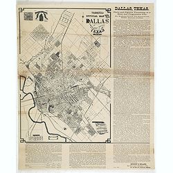
Murphy Bolanz. Official Map of the City of Dallas and East Dallas, Texas, 1887.
Engraved map with to the right and lower margin. Very small inset map of northeast Texas at top, along with an illustration of the firm's offices. Size of the map 375x252...
Date: Dallas, June, 1888
Selling price: ????
Please login to see price!
Sold in 2014
![[Untitled Turkish map of Central America, from California until Honduras]](/uploads/cache/81325-250x250.jpg)
[Untitled Turkish map of Central America, from California until Honduras]
An unusual Turkish map of Central America, from California until Honduras, including parts of today's Arizona, New Mexico, Texas and Louisiana. A highly collectible Ottom...
Date: Turkey, ca. 1890
Selling price: ????
Please login to see price!
Sold in 2018
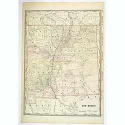
New Mexico.
A large, detailed map of New Mexico, possibly published at the turn of the last century. Each county is color coded, parcels of land and property are recorded, together w...
Date: Unknown, ca 1900
Selling price: ????
Please login to see price!
Sold in 2019
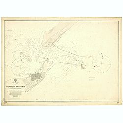
East Coast, Gulf of Mexico, Texas - Galveston Entrance from the latest United States Government Chart.
A fine Hydrographic Office chart no. 192 (1714) showing Galveston entrance. Engraved by Davies & Company. London : Published at the Admiralty, 6th Nov.r 1897 under th...
Date: London, 1897/ 1900
Selling price: ????
Please login to see price!
Sold in 2019
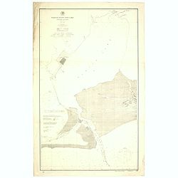
Sabine Pass and Lake / Louisiana and Texas (Polyconic proJection) / Scale 1/40 000.
A fine Hydrographic Office chart no. 517 showing Sabine Pass and Lake with Port Arthur in Louisiana and Texas.Published at Washington D.C. April, 1901, by the U. S. Coast...
Date: Washington D.C, 1901-1902
Selling price: ????
Please login to see price!
Sold in 2019
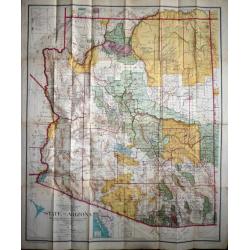
State of Arizona compiled chiefly from the official records of the General Land Office with supplemental data from other map making agencies, under the direction of I.P. Berthrong, chief of drafting division, G.L.O.
The map was compiled by Daniel P.O'Hare under the supervision of I. P. Berthrong, Drafting Division Chief of the General Land Office. It was printed by the Columbia Plano...
Date: Washington D.C., 1921
Selling price: ????
Please login to see price!
Sold in 2015
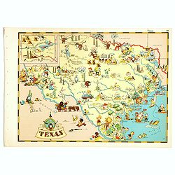
Texas.
Pictorial map of Texas, from the famous illustrator, Ruth Taylor White and published in "Our USA: A Gay Geography".Ruth Taylor White was among the most prolific...
Date: Boston, Little, Brown and Company, 1935
Selling price: ????
Please login to see price!
Sold in 2018
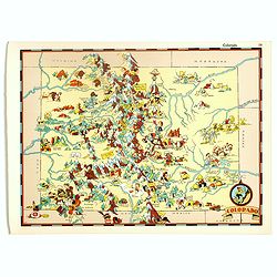
Colorado.
Pictorial map of Colorado, from the famous illustrator, Ruth Taylor White and published in "Our USA: A Gay Geography".Ruth Taylor White was among the most proli...
Date: Boston, Little, Brown and Company, 1935
Selling price: ????
Please login to see price!
Sold in 2017
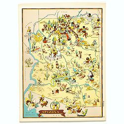
Arizona.
Pictorial map of Arizona, from the famous illustrator, Ruth Taylor White and published in "Our USA: A Gay Geography".Ruth Taylor White was among the most prolif...
Date: Boston, Little, Brown and Company, 1935
Selling price: ????
Please login to see price!
Sold in 2017
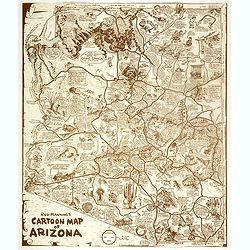
Reg Manning's Cartoon Map of Arizona.
Original edition of this lively map of Arizona by Reginald W. Manning (1905 – 1986), who was a Pulitzer Prize winning American artist and illustrator, best known for hi...
Date: J.J. Augustin., New York, 1938
Selling price: ????
Please login to see price!
Sold in 2017
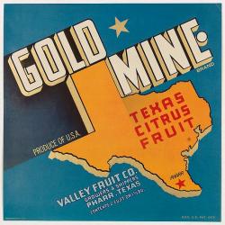
Gold Mine brand.
colorful Texas crate label from the Gold Mine brand and shipped by the Valley Fruit Company of Pharr, Texas. The company’s 111,000 sq. ft. packing facility was pivotal ...
Date: Texas, ca. 1940
Selling price: ????
Please login to see price!
Sold in 2020
![[Post card] The United states as seen through the eyes of Texas.](/uploads/cache/40291-250x250.jpg)
[Post card] The United states as seen through the eyes of Texas.
Pictorial post card map of North America with the state of Texas taking up the entire middle portion of the map, and a large red heart in the middle reads "Biggest a...
Date: Chicago, 1948
Selling price: ????
Please login to see price!
Sold in 2017
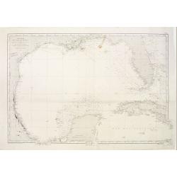
Gulf of Mexico. Ship Shoal to Brazos Santiago.
A large sea chart of the Gulf of Mexico, Ship Shoal to Brazos Santiago, 'from Admiralty Charts and US Government charts, corrected to 1943'. (In fact there are correction...
Date: London, 1951
Selling price: ????
Please login to see price!
Sold in 2017
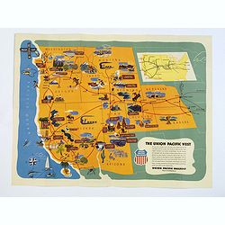
The Union Pacific West / Western Wonderlands.
A striking folded pictorial map of The western states of America, from Nebraska and Kansas to the Pacific coast. Inset of the region covered in context of general map of ...
Date: United States, 1951
Selling price: ????
Please login to see price!
Sold in 2018
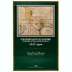
Crossroads of Empire. Early Maps of Texas and the Southwest 1513 - 1900
Poster made for the exhibit 'Crossroads of Empire: Printed Maps of Texas and the Southwest, 1513-1900' at the Amon Carter Museum, Fort Worth" June 11–July 26, 1981...
Date: Fort Worth, 1981
Selling price: ????
Please login to see price!
Sold in 2021
