Gallery Highlights
In the highlights section of the BuyNow catalog, we present some personal favorites from our large stock of authentic maps, atlases, prints, globes, posters and Medieval manuscripts.
The items are immediately available, and no commission is charged.
Feel free to contact us if you have a question or if you are looking for a specific item.
-256x256.jpg)
Algemene kaart van Suriname Algemeene kaart van de Colonie of Provintie van Suriname. This map is of particular interest as a record of one of the most important early Jewish communities in the Americas.
-256x256.jpg)
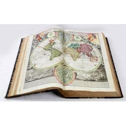
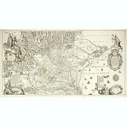
A unique, made-to-order atlas comprising 18 double-page engraved maps by or after Hessel Gerritsz, Theodoor Galle, Jacob van Deventer, Gerard Mercator, Peter Verbiest, Jean Surhon, Claes Janszoon Visscher, Jan Baptist Vrients, David Fabritius, Christiaan 's Grooten, Gerard de Jode and Abraham Ortelius, several dated between 1603 and 1633.
Scenographie, oder, Geometrisch perspect. Abbildung der kaÿl. königl. Haupt u. Residenz Stadt Wien in Oesterreich, auf allerhöchsten Befehl aufgenommen und gezeichnet vom Jahr 1769 May Monats bis letzten October 17724 unter der glorreichen Regirung beider kaÿl. königl. apost. Maÿest Iosephi II F Mariæ Theresiæ.
![Insulae Philippinae [Philippines]](/uploads/cache/49446-(1)-256x256.jpg)
A miniature map of the Philippines, centered on Mindanao and Luzon. First published in 1598 in his Caert-Thresoor. An essential map for Philippine Collectors, here in stunning original colors.
-256x256.jpg)
VALK, G. / L. - Amsterdam, after 1750- A very rare 15-inch (39cm.) diameter celestial globe made up of two sets of twelve finely engraved and hand-colored gores and two polar calottes (70°) laid to the ecliptic poles of a papier-maché and plaster sphere, the axis through the celestial poles.
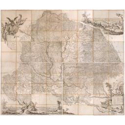
Mappa Geographica novissima Regni Hungariae divisi in suos Comitatus cum Districtibus Jazygum et Cumanorum, Banatus Temesiensis ejusque Districtuum nec non Regnorum Croatiae, Slavoniae, Dalmatiae, Magni Principatus Transsylvaniae, partis Bosniae, Serviae.
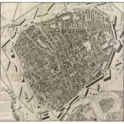
![Londres 1678. [Panoramic view of London in 1678]](/uploads/cache/49352-256x256.jpg)
Extremely rare panoramic broadsheet town view of London from Whitehall to the Tower
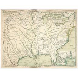
Composite atlas by Guillaume Delisle comprising 91 maps published between 1700 and 1726. Including the first edition of the Map of Louisiana and the Course of the Mississippi, the first printed map to locate “Texas”.
Diocesi Padovana Con Tutta La Sua Estensione Ne Vicini Territori. CLARICI, Paolo Bartolomeo. (Padova, 1720) 710 x 137 mm / 28 x 5.4 inches. A large map on three joined sheets (approx. 71 x 139 cm at the neat line.
