Search Listings matching "valentijn"
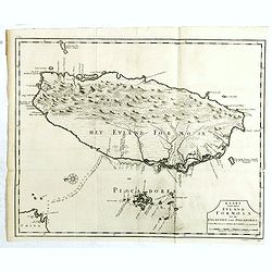
Kaart van het Eyland Formosa en de Eylanden van Piscadores.
The earliest printed map of Taiwan or Formosa. Oriented to the east, with north at the left, covering the entire island and the nearby Pescadores, now known as the Penghu...
- $4000 / ≈ €3743
Place & Date: Amsterdam, 1724
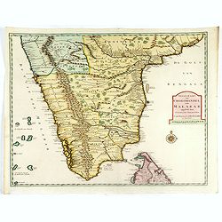
Nieuwe Kaart van Choromandel ende Malabar. . .
Fine map depicting the southern part of India and the northern tip of Ceylon. Much detail is given along the coastlines, settlements and principal coastal features are id...
- $650 / ≈ €608
Place & Date: Amsterdam, 1726
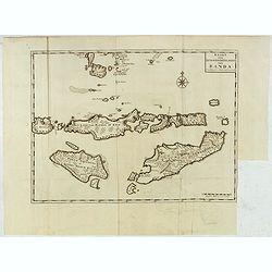
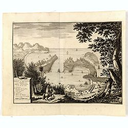
Kaart van de Zuyd-Wester Eylanden van Banda.
Map of the Banda islands.François Valentijn (1666-1727), a missionary, worked at Amboina from 1684 to 1694 and 1705 to 1713 and travelled extensively in the VOC's lands....
- $400 / ≈ €374
Place & Date: Amsterdam, 1726
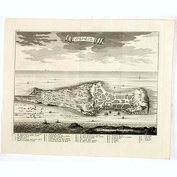
Platte Grond vande Stadt Macao.
A fine view of the city of Macao from Lappa Island showing in schematic blocks the structure of the town. With European vessels and junks in the surrounding water. With n...
- $750 / ≈ €702
Place & Date: Amsterdam, 1724
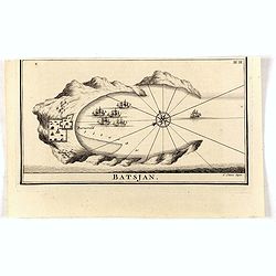
Batsjan. (Bacan)
Decorative panoramic view of Bay with the Dutch fortress Barneveld at the island of Bacan in today's Indonesia. Dutch (V.O.C.) sailing ships are illustrated.François Val...
- $45 / ≈ €42
Place & Date: Amsterdam, 1726
Haven van Aquapulco in ' Coninkryk van Nova Spagnien in de Zuyd Zee.
A finely engraved plan of the harbor, fort and village of Acapulco drawn from a hilltop vantage point looking out to sea. Several galleons are pictured approaching or anc...
- $650 / ≈ €608
Place & Date: Amsterdam, 1726
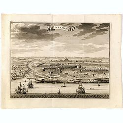
Astjien.
Nice bird's eye-view of the Town of Atjien on the northernmost point of Sumatra by François Valentijn (1666-1727), a missionary, who worked at Amboina from 1684 to 1694 ...
- $225 / ≈ €211
Place & Date: Amsterdam, 1726
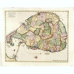
Nieuwe kaart van het Eyland Ceylon. . .
Fine map depicting the Island of Ceylon/Sri Lanka, oriented with north to the left.. Good interior detail is given with settlements, roads, etc. An attractive early map, ...
- $850 / ≈ €795
Place & Date: Amsterdam, 1726
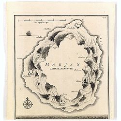
Makjan Geheel Bergagtig.
The island of Makian in Indonesia (formerly the Dutch East Indies) is represented on this map as a mountainous Möbius strip around a giant donut hole. François Valentij...
- $150 / ≈ €140
Place & Date: Amsterdam, 1726
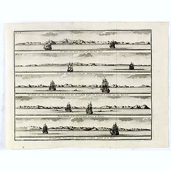
De Kust van Nova Guinea tot aan deze bogt . . .
Five views of the coast of New Ireland in New Guinea. Abel Tasman, but also Willem Schouten and Isaac le Maire, thought that this was the coast of New Guinea. In reality ...
- $150 / ≈ €140
Place & Date: Amsterdam, 1726