Browse Listings in Europe > Luxembourg
![[Lot of 25 leaves of France, Brabant, Netherlands, Luxemburg]](/uploads/cache/48264-250x250.jpg)
[Lot of 25 leaves of France, Brabant, Netherlands, Luxemburg]
Twenty-five text leaves with wood block illustrations relating to France, Brabant, the Netherlands, Luxemburg. From the 1552 Latin text edition of Münster's Cosmographia...
- $100 / ≈ €94
Place & Date: Basel, 1552
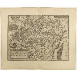
Lutzenburgen sis Ducatus Veriss. Descript.
An attractive map of Luxembourg: title cartouche on the lower left corner. From 'Theatrum Orbis Terrarum [Atlas of the Whole World]'.Iacobo Surhonio Montano auctore. D...
Place & Date: Antwerp, 1598
Lutzenburg.
A lovely miniature map of the small, landlocked European country of Luxembourg, published by Petrus Bertius, in Amsterdam at the beginning of the seventeenth century. The...
Place & Date: Amsterdam, 1606

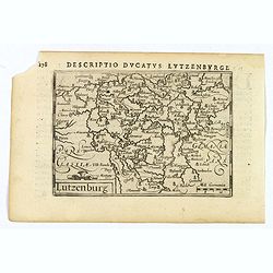
Lutzenburgensis Ducatus veriss descript.
Prepared by Jacob Surhon who made a manuscript map of Luxembourg for which he received 500 Livres from Charles V in 1551. For security reasons the map was not published. ...
Place & Date: Antwerp, 1609
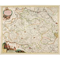
Ducatus Lutzenburgi Novissima et Accuratissima Delineatio.
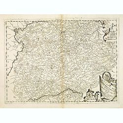
West to the top. Very detailed and fine map of Luxembourg, including the towns of Namur, Liege, Trier and Metz.
Place & Date: Amsterdam, 1680
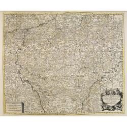
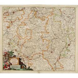
Le Duché du Luxembourg . . .
Fine map of the Duchy of Luxemburg with a figurative title cartouche and two small scales.The map notes Nicolas Sanson as the mapmaker and claims that the map was publish...
- $220 / ≈ €206
Place & Date: Amsterdam, 1692
Ducato di Luxembourgo . . .
A beautiful and flamboyantly engraved map of Luxembourg. The map is the product of the late 17th century Venetian cartographer, Vincenzo Coronelli. A decorative title car...
- $200 / ≈ €187
Place & Date: Venice, 1698
Ducatus Lutzenburgi Nova et Accurataa Tabula. . .
Rare issue of Justus Danckert's attractive map of Luxembourg. Decorative title cartouche lower left hand corner.
- $450 / ≈ €421
Place & Date: Amsterdam, 1700
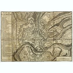
Plan de Luxembourg.
Beautiful engraved plan of the city of Luxembourg, accompanied by a table of references.
- $500 / ≈ €468
Place & Date: Paris, 1741
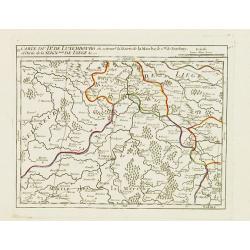
II. Carte du D.é de Luxembourg.. Seign.rie de Lyege &c.
Charming small map representing part of the Walloon Region, south to Liège. From Atlas Portatif Universel, by Robert de Vaugondy.Edited by : "Au dépôt de Géograp...
Place & Date: Paris, later than 1749