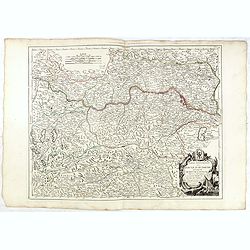
Partie Septentrionnale du Cercle d'Autriche.. Duché de Stirje.
Finely and crisply engraved map of Austria, centered on Vienna.Venetian edition of Giles Didier Robert De Vaugondy's map from Atlas Universel printed in 1776-84.With orna...
- $100 / ≈ €94
Place & Date: Venice, 1776 - 1784
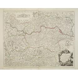
Partie Septentrionnale du Cercle d'Autriche.. Duché de Stirje.
Finely and crisply engraved map of Austria, centered on Vienna.Venetian edition of Giles Didier Robert De Vaugondy's map from Atlas Universel printed in 1776-84.Ornamenta...
- $90 / ≈ €84
Place & Date: Venice, 1776 - 1784
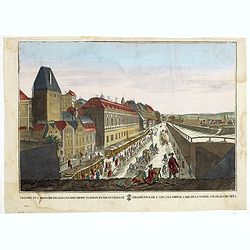
Prospectus primarii telonii caesarei prope turrim rubram Viennae. . .
So-called optical print, showing Red tower in Vienna.In the eighteenth and nineteenth centuries there were many popular specialty establishments in Paris, Augsburg and Lo...
- $80 / ≈ €75
Place & Date: Italy c.1790

Prospectus primarii.. turrim rubram Viennae.
So-called optical print, showing Red tower in Vienna.In the eighteenth and nineteenth centuries there were many popular speciality establishments in Paris, Augsburg and L...
- $175 / ≈ €164
Place & Date: Italy c.1790
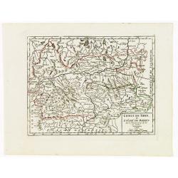
Comté de Tirol, et Evêché de Brixen.
Small detailed map of Tirol and the Italian Alto-Adige region, centered on Innsbruck. From Atlas Portatif Universel, by Robert de Vaugondy.Edited by : "Au dépôt de...
- $30 / ≈ €28
Place & Date: Paris, 1799
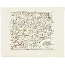
L'Archiduché d' Autriche et les Duchés de Stirie, Carinthie et Carniole.
Small detailed map of the eastern part of Austria, including Slovenia and part of Italy.From Atlas Portatif Universel, by Robert de Vaugondy. Edited by : "Au dépôt...
- $30 / ≈ €28
Place & Date: Paris, 1799
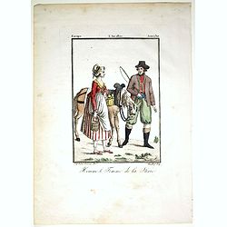
Homme & et Femme de la Sirie.
Originally hand-colored mezzotint from 'Costumes civils actuels de tous les peuples connus'. Engraved by Félix Mixelle after Jacques Grasset de Saint-Sauveur.As an etche...
- $50 / ≈ €47
Place & Date: Paris,1805
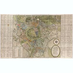
Plan de la ville de Vienne et de ses faubourgs divisés en quartiers.
Fine plan of Vienna, engraved by Franz T. Müller and published by Jean Crappi. On both side an extensive key and a color key to the different sectors in town.
- $900 / ≈ €842
Place & Date: Vienna, 1805
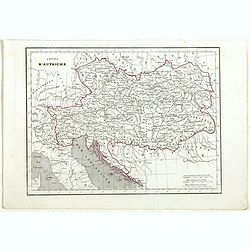
Empire d'Autriche.
Detailed map of Austria, prepared by Charles V. Monin (fl.1830-1880) a French cartographer of Caen and Paris. Published in Atlas Universel de Géographie Ancienne &c ...
- $25 / ≈ €23
Place & Date: Paris, 1845
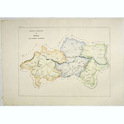
Provincia ecclesiastica di Vienna nell' Impero Austriaco (Tav LXV)
A large-format map of Vienna / Austria with it's different dioceses. The map is finely engraved and beautifully colored and was prepared by Girolamo Petri, a lawyer who s...
- $350 / ≈ €328
Place & Date: Rome, 1858