Browse Listings in Asia > Tartary / Siberia

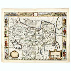
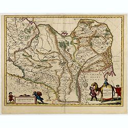
A newe mape of Tartary.
Early edition of one of the most decorative "carte à figures"- map of Tartary, known for its figured borders with costume figures, while above are vignettes of...
Place & Date: London, 1627

The narta, or Sledge for burdens in Kamtschatka.
The narta, or Sledge for burdens in Kamtschatka, taken from "Views in the South Seas" being a very important and early views depicting scenes encountered while ...
Place & Date: London, Boydell and Co., 1808

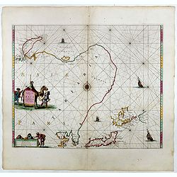
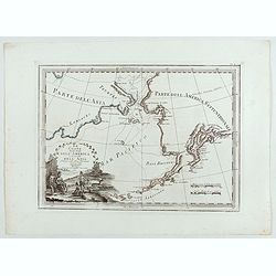
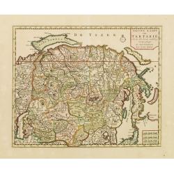
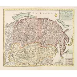
Noordoost Cust van Asia van Japan tot Nova Zembla.
Important for its early depiction of Hokkaido and the Islands to the North of Japan. Ships navigate the seas around the Siberian, Chinese and Japanese coast extending as ...
- $3000 / ≈ €2807
Place & Date: Amsterdam, 1666
Noordoost Cust van Asia van Japan tot Nova Zemla.
An eye-catching chart of Hokkaido and the Islands to the North of Japan. Ships navigate the seas around the Siberian, Chinese and Japanese coasts extending as far west as...
- $2500 / ≈ €2339
Place & Date: Amsterdam, 1666

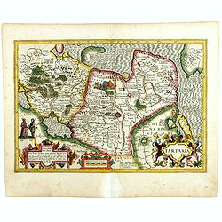
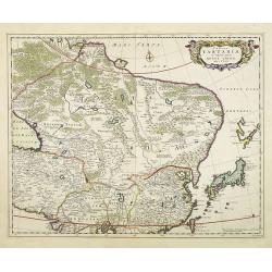
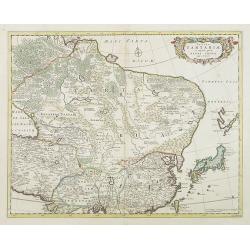
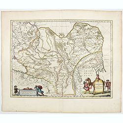
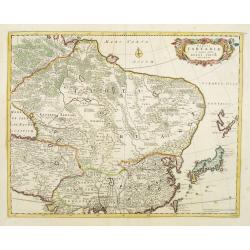
Tartariae sive Magni Chami Imperium.
This is a very early depiction of the northern Pacific, with the first mapping of Northwest Coast of America and probably the first map to name California 'C. Califormio...
- $2500 / ≈ €2339
Place & Date: Antwerp, c. 1608-1612
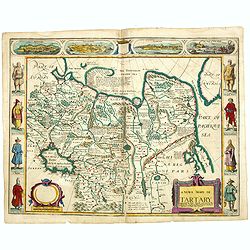
A newe mape of Tartary.
One of the most decorative maps of Tartary, known for its figured borders with costume figures, while above are vignettes of the cities of Astrakhan, Samarkand and Cambal...
- $2000 / ≈ €1871
Place & Date: London, Bassett & Chiswell, 1627-1676

Noordoost Cust van Asia van Japan tot Nova Zemla.
An eye-catching chart of Japan, Hokkaido and the Islands to the North of Japan. In the lower left Korea and part of northern China. Korea has three names mentioned: "...
- $2000 / ≈ €1871
Place & Date: Amsterdam, 1666
A newe mape of Tartary.
Early edition of one of the most decorative maps of Tartary, known for its figured borders with costume figures, while above are vignettes of the cities of Astrakhan, Sam...
- $2500 / ≈ €2339
Place & Date: London, 1627
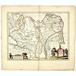
Tartaria.
Published in Hondius' editions of the Mercator Atlas from 1606 onwards, showing China, Korea as an island, and the northern Pacific coast of America showing the two conti...
Place & Date: Amsterdam, 1633
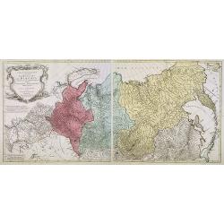
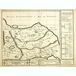
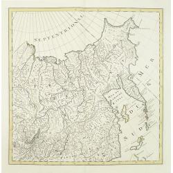
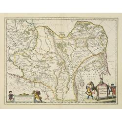
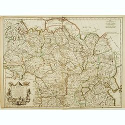
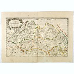
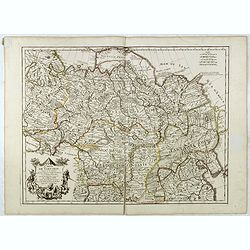
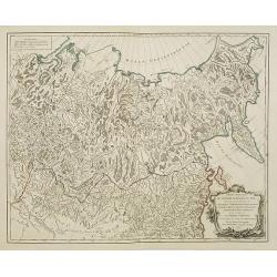
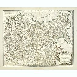
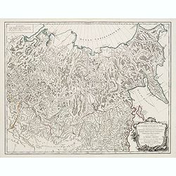
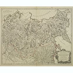
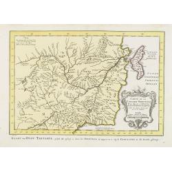
Carte géographique contenant le royaume de Sibérie . . .
Scarce and highly detailed map of Siberia subdivided into three provinces, namely Tobolsk, Jenissejesk, Irkutsk, and outer parts of the Tartary.In upper right corner inse...
Place & Date: Augsburg, c. 1770-1780
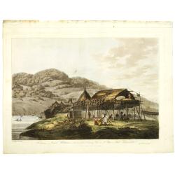
Balagans or summer habitations, with the method of drying fish at St. Peter and Paul, Kamtschatka.
Balagans or summer habitations, with the method of drying fish at St. Peter and Paul, Kamtschatka, taken from "Views in the South Seas" being a very important a...
Place & Date: London, Boydell and Co., 1808
Selling price: $1200
Sold in 2017
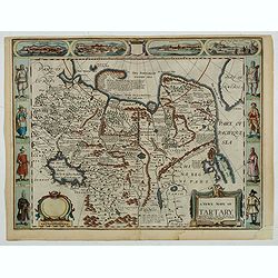
A newe mape of Tartary.
An early edition of one of the most decorative maps of Tartary, known for its figured borders with costume figures, while above are vignettes of the cities of Astrakhan, ...
- $2000 / ≈ €1871
Place & Date: London, 1676
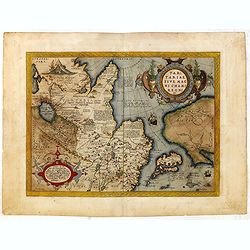
Tartariae sive Magni Chami Imperium.
This is a very early depiction of the northern Pacific, with the first mapping of Northwest Coast of America and probably the first map to name California 'C. Califormio'...
- $1750 / ≈ €1638
Place & Date: Antwerp, c. 1590
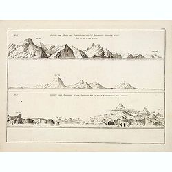
Ansicht der Küste von Kamtschatka vom Cap Poworotnoy Nordlich hinauf - Ansicht der Einfahrt in die Awatscha Bay, in einer entfernung von 4 meilen.
An original view in imperial folio size, originating from the original first edition (Russian & German) of Krusenstern's atlas to his voyage around the world: Atlas k...
- $1500 / ≈ €1404
Place & Date: St.Petersburg, 1824
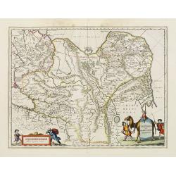
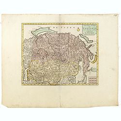
Die Grosse Tartari.
Rare map showing Siberia, Korea with part of the Caspian Sea to the West, as well as India and North Russia. The title in an oval cartouche in upper right cornerThe map r...
- $1000 / ≈ €936
Place & Date: Augsburg, 1689

La Tartaria Chinese.
With decorative title cartouche. Covering north eastern part of China, with good detail in Korea and a curious shape for Hokkaido (here called Jeso-Gasima ).Engraved by G...
Place & Date: Venice, 1784
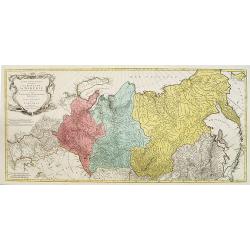
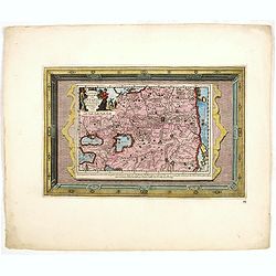
Carte géographique contenant le Royaume de Siberie . . .
Very rare and highly detailed map of Siberia subdivided in three provinces, namely Tobolsk, Jenissejesk, Irkutsk, and outer parts of the Tartary. In upper right corner in...
- $800 / ≈ €749
Place & Date: Augsburg, 1770- 1780
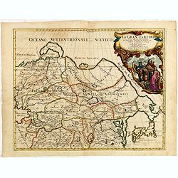
La Gran Tartaria divisa nelle sue parti pricipali da Giacomo Cantelli. . .
In upper right hand corner a large title cartouche with dedication to Tavernier and Thévenot. The cartographer was Giacomo Cantelli (1643-1695) who was active in Modena ...
Place & Date: Rome, 1683
Tabula Tartariae et majoris partis regni Chinae.
Stretching from the Caspian Sea in the west to Formosa in the south-east. Including the peninsula of Korea, Japan, Taiwan and the east coast of Yedso. Decorated with fine...
- $900 / ≈ €842
Place & Date: Amsterdam, 1680

La Tartaria Chinese.
With decorative title cartouche. Covering north eastern part of China, Korea and Hokkaido (here called Jeso-Gasima, Tartary including the Gobi Desert; also Peking and the...
Place & Date: Venice, 1784
Imperii Russici et Tartariae Universae tam majoris Afiaticæ quam minoris et EuropæTabula.
The map is of interest for the use of Mere Orientale Minus Corea for the sea between Korea and Japan.Decorative map covering Russia, Tibet, China, Tartary, Korea, Taiwan ...
Place & Date: Nuremberg, 1739
![КАРТА ТАТАРИ КИТАЙСКОЙ [Map of Tartary in Cyrillic ].](/uploads/cache/44336-250x250.jpg)
КАРТА ТАТАРИ КИТАЙСКОЙ [Map of Tartary in Cyrillic ].
A rare map of Tartary, including Korea, China and Tibet.This Cyrillic version of the map appeared in one of the first world atlases published in Russia "Novy Atlas, ...
- $750 / ≈ €702
Place & Date: Paris / St.Petersburg, ca. 1790

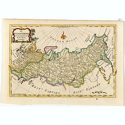
The Russian Empire in Europe and Asia . . .
Detailed map of the whole of Russia, extending from Poland to the Pacific and from Nova Zembla to Tartaria.The map is of interest for the use of Corea Gulf for the sea be...
Place & Date: London, 1790

Siberie ou Russie Asiatique, Tartarie Chinoise, Pays des Eluts et Isles du Japon.
Map of the Kamchatka peninsula, Russian Far East., Korea, Japan, with Hokkaido labeled "Terre del Jeso".By C. F. Delamarche, successor of Robert de Vaugondy, Ge...
Place & Date: Paris, 1794 - 1806
Grande Tartarie vers l'orient où sont le Turquestan, la Tartarie septentrionale, et la Tartarie du Kin. . .
Early edition of this rare map of Tartary which incorporates Turkestan (including East Turkestan), Greater Mongolia, Giacathai.The Great Wall is shown in the lower center...
- $750 / ≈ €702
Place & Date: Paris, 1677
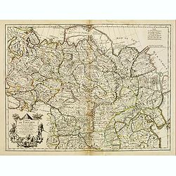
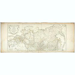
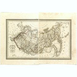
Troisième partie de la carte d'Asie, contenant la Sibérie, et quelques autres parties de la Tartarie. . .
Engraved map of Tartary on two sheets, with country boundaries in out line color. Includes geographic notes and ornamental cartouche by "H. Gravelot, invenit., DeLaf...
- $750 / ≈ €702
Place & Date: Paris, 1754
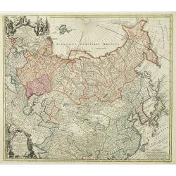
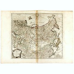
No title (Carte générale de l'empire de Russie).
The right hand sheet of a map of the Empire of Peter the Great.This important map is based on maps from the Bering expedition and on De L'Isle's Akademiia nauk Atlas of 1...
- $800 / ≈ €749
Place & Date: Amsterdam, ca.1748
Tartaria sive Magni Chami imperium.
Detailed and decorative map of Tartary and Northern part of China, and the Chinese Great Wall is depicted. Including the Caspian Sea and the Volga River east as far as th...
- $575 / ≈ €538
Place & Date: Amsterdam, 1658
Tabula Tartariae et majoris partis regni Chinae.
Stretching from the Caspian Sea in the west to Formosa in the south-east. Including the peninsula of Korea, Japan and the east coast of Yedso. Decorated with finely engra...
- $800 / ≈ €749
Place & Date: Amsterdam, 1680
Tartaria sive Magni Chami Imperium.
Detailed and decorative map of Tartary and Northern part of China. Northern tip of Korea included. The Chinese Great Wall is depicted, with Central Asia, extending from M...
- $550 / ≈ €515
Place & Date: Amsterdam, 1645
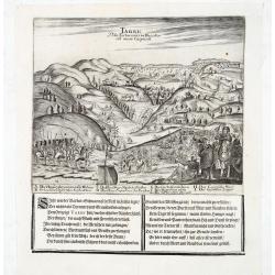
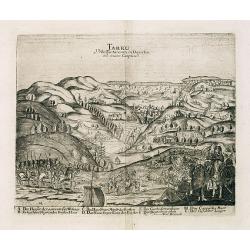
Tarku Urbs Tartaroum in Dagestan ad mare Caspium.
An early of Tarku, in the Republic of Dagestan. From the scarce Hamburg edition "Viel Vermehrte Moscowitische und Persianische Reisebeschreibung" by Adam Olear...
- $500 / ≈ €468
Place & Date: Hamburg, 1696
Tartaria sive Magni Chami imperium.
Detailed and decorative map of Tartary and Northern part of China. Northern tip of Korea included. The Chinese Great Wall is depicted, with Central Asia, extending from M...
- $500 / ≈ €468
Place & Date: Amsterdam, 1638
Carte de Tartarie.
Rare first edition "Chez l'Auteur Rue des Canettes préz de St. Sulpice". The "Rue des Canettes" address appears on the original versions of maps date...
- $600 / ≈ €561
Place & Date: Paris, 1706

Carte des parties Nord et est de l'Asie..
Five maps on one sheet show the Northern Russian territories in Europe and Asia, including the western coastline from Siberia, Japan, and Korea with the island of "Q...
Place & Date: Paris, 1779
ETATS DE MOSCOVIE.
A detailed map of the Russian Empire West to East from Poland, Finland to the Baring Strait and North to South from China to Spitzbergen. The Siberian coastline is based ...
Place & Date: Paris, 1744
Tartaria sive Magni Chami Imperium.
A detailed and decorative map of Tartary and the northern part of China. The very northern tip of Korea included. The Chinese Great Wall is depicted, with Central Asia, e...
- $500 / ≈ €468
Place & Date: Amsterdam, 1644
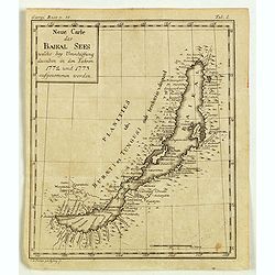
Neue Carte des Baikal Sees welche bey Umschiffung desselben in den Iahren 1773 und 1773 aufgenommen worden.
Rare engraved map by Johanna Dorothea Sysang, showing Lake Baikal. Johanna Dorothea Sysang (1729 - 1791) was a copper engraver from and was a daughter of Johann Christoph...
- $500 / ≈ €468
Place & Date: 1777
Tartariae sive Magni Chami Imperium.
Fine map of Tartary, including northern part of China, and tip of Korea.
- $500 / ≈ €468
Place & Date: Amsterdam, 1645
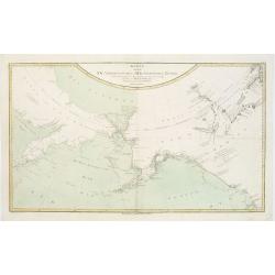
Le Coste Nord Ovest Dell'America e Nord Est dell'Asia Delineate sulle ultime Osservazioni del Cap. Cook
Cassini’s splendid early map of Cook's exploration of the Bering Strait, made on his Third and final voyage. The title is within a decorative title cartouche depicting ...
Place & Date: Rome, Calcography, 1798-before 1839
Karte von den N.W. Amerikanischen und N.OE. Asiatischen Kusten nach den Untersuchungen des Kapit. Cook...
A detailed large-scale map showing the Bering Strait, Kamchatka, Alaska and much of North America. While the Russian coastline is shown with reasonable accuracy. Showin...
- $450 / ≈ €421
Place & Date: Vienna, 1788
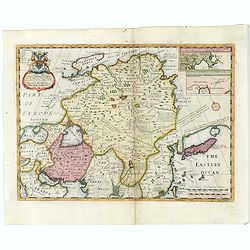
A New Map of Great Tartary and China with the adjoining parts of Asia...
Two insets showing the land to the north-east of China according to the Jesuits. Map stretches from northern Russia and Nova Zemlya in the north-west to Formosa in the so...
- $650 / ≈ €608
Place & Date: Oxford, 1700
Carte de Tartarie..
Uncommon Amsterdam edition covering north east Asia, Korea and part of "Terre d'Eso". Nova Zembla joined with the mainland.
- $500 / ≈ €468
Place & Date: Amsterdam, 1706
Nieuwe kaart van Tartarie.
A map of Tartary, Korea and part of Japan. The map is most notable for the confusion between Kamchatka and Iesso. Hokaido labelled Compagnie LandFrom: Nieuwe en Beknopte ...
- $450 / ≈ €421
Place & Date: Amsterdam 1750

Siberia & Central Asia.
This map covers the eastern section of Russia as well as China, Japan, Korea, India and Tibet. The map is of interest for the use of Sea of Corea, the sea between Korea a...
Place & Date: Boston, 1835
Description de la Tartarie. . .
Detailed map of Tartary, northern China and Korea as an island. The Caspian Sea in the utmost left. Numerous place-names of counties, cities, towns, physical features.Ala...
- $250 / ≈ €234
Place & Date: Paris, 1679
Tarku Urbs Tartaroum in Dagestan ad mare Caspium.
An early view of Tarku, in the Republic of Dagestan. From "Voyages en Moscovie, Tartarie et Perse, par Adam Olearius".Adam Olearius was a seventeenth-century G...
- $400 / ≈ €374
Place & Date: Paris, Abraham de Wicquefort , 1656
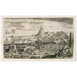
View of Derbendt an der Persischen Grentze.
An early view of Derbent, in the Republic of Dagestan. From "Voyages en Moscovie, Tartarie et Perse, par Adam Olearius".Adam Olearius was a seventeenth-century ...
- $400 / ≈ €374
Place & Date: Paris, Abraham de Wicquefort , 1656
Naaukeurige Kaart Van Tartaryen . . .
This attractive map of Tartary is formed of two separate engravings, first is the map itself (23 x 16 cm) and second is the engraved framework border. Map detail extends ...
- $500 / ≈ €468
Place & Date: Amsterdam, 1713
Tabula Tartariae et majoris partis regni Chinae.
Stretching from the Caspian Sea in the west to Formosa in the south-east. Including the peninsula of Korea, Japan and the east coast of Yedso. The Great Wall of China is ...
- $650 / ≈ €608
Place & Date: Amsterdam, 1680
Troisième partie de la carte d'Asie, contenant la Sibérie, et quelques autres parties de la Tartarie. . .
Engraved map of Tartary on two sheets, with country boundaries in out line color. Includes geographic notes and ornamental cartouche by "H. Gravelot, invenit., DeLaf...
- $450 / ≈ €421
Place & Date: Paris, 1753
Carte de Tartarie.
Covering north east Asia, Tibet, Korea and part of "Terre d'Eso". Nova Zembla joined with the mainland.With good detail in Korea, several cities a labeled: Ch...
- $300 / ≈ €281
Place & Date: Paris, 1706
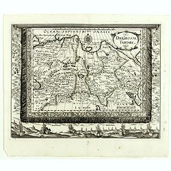
Tartaria.
A miniature map showing China, Korea and Russia. Title cartouche on the upper left corner.First published in 1598 in his Caert-Thresoor, the plates were executed by the m...
- $300 / ≈ €281
Place & Date: Amsterdam, 1609
Partie Orientale de l'Empire de Russie en Asie.
Detailed map of the north-eastern part of Russia, including Siberia.
- $400 / ≈ €374
Place & Date: Paris 1752

Kam Hi Fils de Chien chi Empereur des Tartares orientaux?.plusieurs titres d'honneur Ecrits de sa propre main.
Very rare and decorative costume plate. Underneath the plate a descriptive text in French. Bears the address AParis Chez Nolin rue St. Jacques à l'Enseigne de la Place d...
- $300 / ≈ €281
Place & Date: Paris ca. 1690
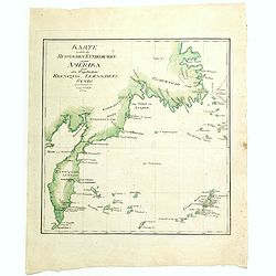
Karte welche die Russischen Entdeckungen gegen Amerika nach den Tagebüchern Krenizins, Lewaschefs, Synds und anderer vorstellt. 1781
Rare map of Siberia with Kamchatka. In outer right tip of America, published by the Weygandsche Buchhandlung in 1781.
- $300 / ≈ €281
Place & Date: Leipzig, 1781

Great or Asiatick Tartary, Agreable to Modern History.
Map of Tartary to Peking. The eastern coastline of Asia is almost flat, with no attempt to mark Kamchatka.
- $275 / ≈ €257
Place & Date: London, 1727

Impery sino Tartarici Supremus Monarcha.
Decorative costume plate showing Kam Hi son of the Shunzhi Emperor of China [1638 - 1661?], the second emperor of the Manchu Qing dynasty, who apparently supported the fo...
Place & Date: Amsterdam, 1668
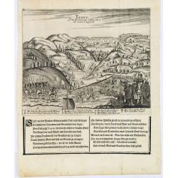
Tarku Urbs Tartaroum in Dagestan ad mare Caspium.
An early view of Tarku, in the Republic of Dagestan. From the scarce Hamburg edition "Viel Vermehrte Moscowitische und Persianische Reisebeschreibung" by Adam ...
- $300 / ≈ €281
Place & Date: Hamburg, 1696
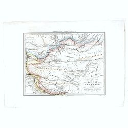
Asia Centrale, Tibet Thian - Scian - Nan - Lu, Mongolia Grand Deserto &.
From the "Geografia Commerciale". Steel engraving with attractive original outline color, printed on thick paper with wide margins. Engraved by C. Magrini.
- $300 / ≈ €281
Place & Date: Genova, 1860
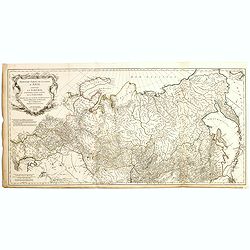
Carte Generale de la Russie d'Asie ou Siberie. Par L. Vivien, Geographe . . .
First edition, with a second edition in 1834 listed by Phillips. The map is well done, slightly smaller than the contemporary Brue and Lapie maps. Showing Asian part of R...
- $230 / ≈ €215
Place & Date: Paris, Ménard et Desenne, 1825
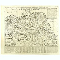
Nouvelle Carte de Moscovie où sont representés les differents etats de sa Maiesté Czarienne. . .
Map of Russia Tartary and part of China with key tables to the towns. Depicting the different states belonging to the Czar in Asia and Europe, showing the path of one of ...
- $250 / ≈ €234
Place & Date: Amsterdam, ca. 1732
Partie Orientale de l'Empire de Russie en Asie.
Detailed map of the north-eastern part of Russia, including Siberia, Kamchatka, the island of Sakhalin.
- $200 / ≈ €187
Place & Date: Paris, 1752
Partie Orientale de l'Empire de Russie en Asie.. et les Confins de la Tatarie Chinoise. . .
Large map with mostly topographical detail of mountains, deserts, rivers and forests. Covers the region from Tomsk eastward and includes Sakhalin. Uncolored, decorative t...
- $300 / ≈ €281
Place & Date: Paris, 1750
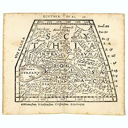
Scythia.
Woodblock engraved map covering the region between the Caspian and the Sea of China, much of which is Terra Incognita in the North and East. In 1546 Honter’s Cosmograph...
- $190 / ≈ €178
Place & Date: Zürich, 1546
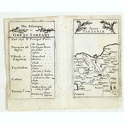
Lesser Tartaria.
A late seventeenth-century English map of Siberia / Tartary.A scarce little map with accompanying engraved text (94x55mm) from "Atlas Minimus, or, A book of geograph...
- $200 / ≈ €187
Place & Date: London, 1679
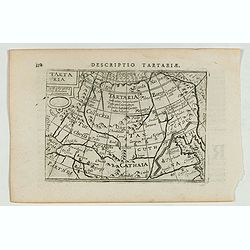
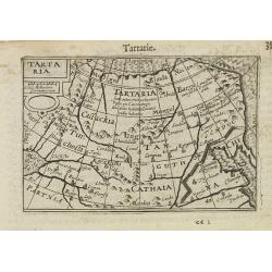
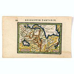
Descriptio Tartariae / Tartaria.
A rare miniature map of Tartary and China, showing the Great Wall. Title cartouche on the upper left corner.First published in 1598 in his Caert-Thresoor, the plates were...
- $300 / ≈ €281
Place & Date: Amsterdam, Cornelis Claes, 1606
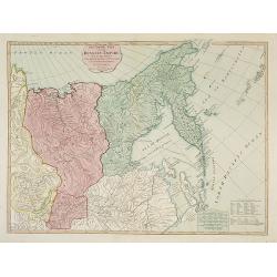
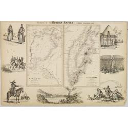
The Asiatic Part of the Russian Empire. . .
Large map of Asiatic Russia and some of the Aleutians recently discovered. Many details and speculations. Features the important discoveries of Vitus Behring (or Bering),...
- $500 / ≈ €468
Place & Date: London, 1794
Partie Orientale De L'Empire De Russie En Asie, ou trouvent les Provinces de Jakuckskoy, Kransnojarskoy, Selinginskoy, Ilimskoy, Krasnojarskoy, Narimskoy, Jenisseiskoy, Mangajeiskoy, & c. et les Confins de la Tatarie Chinoise. . . .1750
Map of the Northeastern portion of Asia, including Russia, China, the Gobi Desert, etc..
- $250 / ≈ €234
Place & Date: Paris, 1750
Nieuwe kaart van Tartarie.
A map of Tartary, Korea and part of Japan. The map is most notable for the confusion between Kamchatka and Iesso.Engraved by J.Keyser in 1731.
- $250 / ≈ €234
Place & Date: Amsterdam, 1731 / 1750
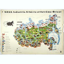
U.R.S.S. Industrie. Sibérie et Extreme-Orient. (4)
Map of Siberia. Propaganda poster for Russia's in and export of industrial goods from Siberia. Editions de l'Agence de presse Novosti".More about War Maps & Prop...
- $150 / ≈ €140
Place & Date: USSR, 1978
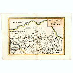
Scythia et Serica.
Covering the region between the Caspian and the Sea of China, much of which is Terra Incognita in the North and East. With title in upper right corner.Engraved by W.H.Tom...
Place & Date: London, 1755

Carte des parties Nord et est de l'Asie.. (5 maps on one sheet)
Five maps on one sheet, showing California, Alaska and Syberia, Korea and Japan. South to Korea the island "Quelpaerts".The map is from Diderot's "Encyclop...
- $200 / ≈ €187
Place & Date: Paris, 1772
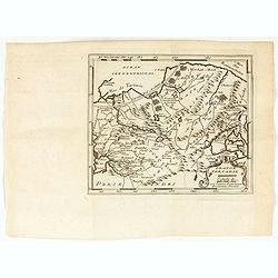
Grande Tartarie.
A very nice map of Tartaria extending from the Caspian Sea to the Pacific Ocean. From Francisco Giustiniani for El Atlas abreviado o el nuevo compendio de la Geografia un...
- $150 / ≈ €140
Place & Date: Leon de Francia (Lyon), Jaime Certa, 1739
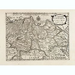
La grande Tartarie.
Map of Central Asia showing major cities, places and water bodies. Relief shown pictorially. Engraved by Anthony de Winter.
- $150 / ≈ €140
Place & Date: Amsterdam, Utrecht, ca. 1653
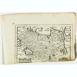
Tartarie.
Rare map of Tartary published by Jollain in 1667. In lower right corner Korea as a peninsular and part of America in upper right corner. Published in "Trésor Des Ca...
- $150 / ≈ €140
Place & Date: Paris, 1667
Nieuwe kaart van Tartarie.
A map of Tartary, Korea and part of Japan. The map is most notable for the confusion between Kamchatka and Iesso. Hokkaido labelled Compagnie LandReflecting the recent di...
- $250 / ≈ €234
Place & Date: Amsterdam, 1750
The Russian Empire, from the Best Authorities, by Thos. Kitchin, Geographer.
Showing the Asian part of Russia, with interesting note to a coast line north of Siberia "Land seen in 1723", likely referring to Vitus Bering (1681–1741), wh...
- $150 / ≈ €140
Place & Date: London, c. 1773
Tartaria.
An original early 17th century copper engraved miniature antique map of Tartary, China and part of America by Petrus Bertius.The title is displayed in a strap work cartou...
- $150 / ≈ €140
Place & Date: Amsterdam, J.Hondius, 1618
Carte de La Tartarie Orientale..
Uncommon edition of this fine map of Tartary with the Island of Sakhalin. In lower right engraved 21b.From Atlas Portatif pour servir a l'intelligence de l'Histoire Philo...
Place & Date: Amsterdam, 1773
Portions of the Russian Empire in eastern & western Asia.
Two maps on one sheet. Components: The Aral Sea according to Khanikoff -- Kamchatka according to A. Erman. Relief is shown by hachures and spot heights. No. 8 from Fullar...
- $200 / ≈ €187
Place & Date: London, 1860