Browse Listings in Asia

Paldobundo Province.
Woodblock printed map of Jeolla Province which was one of the historical Eight Provinces of Korea during the Kingdom of The map is drawn in "Paldo Bundo," styl...
Place & Date: 1710-1718

A newe mape of Tartary.
Early edition of one of the most decorative "carte à figures"- map of Tartary, known for its figured borders with costume figures, while above are vignettes of...
Place & Date: London, 1627
![Hongkong Piratenstrasse. [Pirate Street]](/uploads/cache/24363-250x250.jpg)
Hongkong Piratenstrasse. [Pirate Street]
Finely executed watercolor made by Henri Dieth of a charming street scene at "Pirate Street" in Hong Kong. The watercolor is made after Eduard Hildebrandt (1818...
Place & Date: Germany, 1882

Pascaerte van 't Westelyckste Deel van Oost Indien, van Cabo de Bona Esperanca tot C.Comorin..
An eye-catching chart of the western part of the Indian Ocean and its adjacent coasts of East Africa, Arabia with the Red Sea and the Arabian Gulf, Iran, Pakistan and we...
Place & Date: Amsterdam, 1666
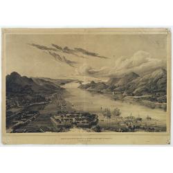
Gezigt op de haven en de baai van Nagasaki.
A very rare birds-eye view showing Deshima and Nagasaki bay. Von Siebold was born in Würtzburg, in Germany, and worked for the Dutch government as a doctor in Java. In J...
Place & Date: Leiden 1832-1852
![.[Bangladesh, Burma, India, Thailand]](/uploads/cache/33867-250x250.jpg)
.[Bangladesh, Burma, India, Thailand]
Wood block printed map and one of earliest printed representation of Bangladesh, Burma, India, Thailand prepared Martin Waldseemüller. Based on the slightly larger map f...
Place & Date: Vienna, Trechsel, G., 1525 -1541
![[India and China]](/uploads/cache/33875-250x250.jpg)
[India and China]
Wood block printed map and one of earliest printed representation of India and China prepared Martin Waldseemüller. Based on the slightly larger map from 1513 published ...
Place & Date: Vienna, 1525 -1541

Xantung, sinarum imperii provincia quatra.
A map of the northern province ‘Xantung’ of China after the Jesuit Martino Martini.Shows the Great Wall and is centered on the Bohai Sea, and the Shandong and Liaonin...
Place & Date: Amsterdam, ca 1660

Asiae Minoris nova descriptio. Geographische Beschryvinge aller Landen... ende sendbrieuen der Apostele...
Extremely rare map from a Dutch bible, published by Dancker Danckerts. This map was included in a Dutch bible including several maps signed by C.Danckerts and one dated 1...
Place & Date: Amsterdam, 1643

Kiepert's Physikalische Wandkarten IV. ASIEN. . .
Wall map of Asia printed in chromo lithography. Published by "Stich und Druck der lith. Anst. Von Leopold Kraatz in Berlin". Physical map showing the Asian cont...
Place & Date: Berlin, D. Reimer, 1873