Browse Listings
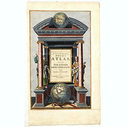
Joannis Janssonii Novus Atlas, sive Theatrum Orbis Terrarum: in quo Orbis Antiquus. . .
A glorious mid-seventeenth century engraved frontispieces to atlas by Janssonius. Finely decorated with a pair of terrestrial (bottom) and celestial (top) globes and the ...
Place & Date: Amsterdam, 1650

Provincia ecclesiastica di Malines nel Belgio (Tav LXII)
This large-format map of Belgium with its different dioceses. The map is finely engraved and beautifully colored and was prepared by Girolamo Petri, a lawyer who served a...
Place & Date: Rome, 1858
![[Map of Corfu. View of the city of Corfu on the foreground. ]](/uploads/cache/45221-250x250.jpg)
[Map of Corfu. View of the city of Corfu on the foreground. ]
Very rare map of Corfu with a view of the city of Corfu on the foreground. Published in the first edition of "Viaggio da Venetia, a Costantinopoli. Per Mare, e per T...
Place & Date: Venice, Giacomo Franco, 1598
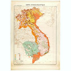
Carte de l'Indochine au 1 : 2.000.000. Carte ethnolinguistique.
Map showing Vietnam, Cambodia, and Laos, prepared under the direction of "l'Ecole Française d'Extrême-Orient". Relief shown by spot heights. With a colored ke...
Place & Date: Hanoï, 1949

The Empire of China and Island of Japan. . .
The map is of interest for the use of East Sea, the sea between Korea and Japan, here called "Sea of Corea". Some interesting notations are made. From his atlas...
Place & Date: London, 1736
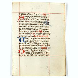
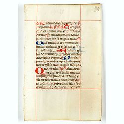
A leaf from a breviary.
Two large 2-line initials in red and or blue for the start of the new chapter.Nice clean leaves, with ample margins, from a breviary, end of the 15th. century.
Place & Date: Northern Netherlands ?, ca. 1480
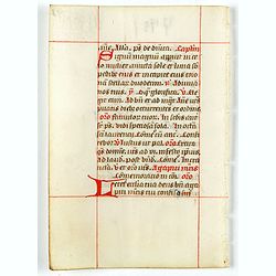
A leaf from a breviary.
Two large 2-line initials in red and or blue for the start of the new chapter.Nice clean leaves, with ample margins, from a breviary, end of the 15th. century.
Place & Date: Northern Netherlands ?, ca. 1480
A leaf from a breviary.
Two large 2-line initials in red and or blue for the start of the new chapter.Nice clean leaves, with ample margins, from a breviary, end of the 15th. century.
Place & Date: Northern Netherlands ?, ca. 1480
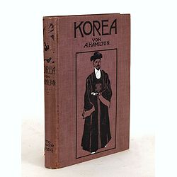
Korea. Das Land des Morgenrots. Nach seinen Reisen geschildert von Angus Hamilton. Autorisierte Übersetzung aus dem Englischen.
With 114 illustrations after photographes and one map.
Place & Date: Leipzig: Spamer, 1904
![Ch'onha chido.[Atlas of all under Heaven]](/uploads/cache/44639composition-world-250x250.jpg)
Ch'onha chido.[Atlas of all under Heaven]
A late 18th century Ch'onha chido atlas with 13 woodblock maps showing the World, China, Korea, Japan, Okinawa, and the 8 provinces. The seas are in black.
Place & Date: Korea, ca. 1760