Meta map gallery

What was born as an idea from science fiction has long since become reality. The metaverse is more than just virtual reality, augmented reality, extended reality, or cyberspace - it’s all of those things at once. What is the metaverse [read more]
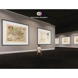
Below are some meta map galleries we have created.
Discover old maps in our MetaMap.gallery. Visit the gallery and feel free to discuss our maps with fellow visitors.
When in our meta gallery you can interact and speak with other visitors (and you can access it through a browser, so no headset required).
Note: You are asked to set up an account so you can create an avatar. When visiting on a mobile phone you are asked to install the spatial.io app. (iPhone and Android).
-256x256.jpg)
MetaMap.gallery 2 - Showing antique maps of Ukraine. The mapping of Ukrainian lands (whose greater part entered the structure of the Polish-Lithuanian Commonwealth) in the 17th century was essentially influenced by the creation of a four-sheet map of the Grand Duchy of
Lithuania by Nikolai-Krzysztof Radzivill in 1613.
See the borders of the Ukraine territory over 400 years.


