TimeLine of Explorers, Mapmakers and Publishers
Below portraits are vailable for sale.
Some Dutch map maker are below
GEMMA FRISIUS (REINER/REGNERUS) 1508-1555
Of German extraction, Gemma Frisius became the foremost
astronomer, mathematician and surveyor of his time. He was an
influential figure, not Only for his teaching of Mercator at his
School of Geography at Louvain but for his scientific contributions
to practical aspects of cartography. He invented an improved form
of cross-staff for astronomical use and in his book A Method of
delineating places he set out the principle of triangulation in
map making. Later, he was the first to suggest the use. of portable
clocks to determine longitude.
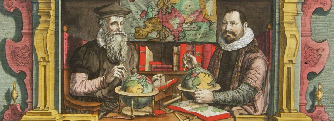
GERARD MERCATOR (KREMER) 1512-1594
For nearly sixty years, during the most important
and exciting period in the story of modern map making, Gerard
Mercator was the supreme cartographer, his name, second only to
Ptolemy, synonymous with the form of map projection still in use
today. Although not the inventor of this type of projection he was
the first to apply it to navigational charts in such a form that
compass bearings could be plotted on charts in straight lines,
thereby providing seamen with a solution to an age-old problem of
navigation at sea. His influence transformed land surveying and his
researches and calculations led him to break away from Ptolemy's
conception of the size and outline of the Continents, drastically
reducing the longitudinal length of Europe and Asia and altering
the shape of the Old World as visualized in the early sixteenth
century.
Mercator was born in Rupelmonde in Flanders and studied in
Louvain under Gemma Frisius, Dutch writer, astronomer and
mathematician. He established himself there as a cartographer and
instrument and globe maker, and when he was twenty-five drew and
engraved his first map (of Palestine) and went on to produce a map
of Flanders (1540) supervising the surveying and completing the
drafting and engraving himself. The excellence of his work brought
him the patronage of Charles V for whom he constructed a globe, but
in spite of his favor with the Emperor he was caught up in the
persecution of Lutheran protestants and charged with heresy,
fortunately without serious consequences. No doubt the fear of
further persecution influenced his move in 1552 to Duisburg, where
he continued the production of maps, globes and instruments
culminating in large-scale maps of Europe (1554), the British Isles
(1564) and the famous World Map on 18 sheets drawn to his new
projection (1569). All these early maps are exceedingly rare, some
being known by only one copy.
In later life he devoted himself to his edition of the maps in
Ptolemy's Geographia, reproduced in his own engraving as
nearly as possible in their original form, and to the preparation
of his 3-volume collection of maps to which, for the first time,
the word 'Atlas' was applied. The word was chosen, he wrote, 'to
honour the Titan, Atlas, King of Mauritania, a learned philosopher,
mathematiciar, and astronomer' . The first two parts of the Atlas
were published in 1585 and 1589 and the third, with the first two
making a complete edition, in 1595 the year after Mercator's
death.
Mercator's sons and grandsons, named above, were all
cartographers and made their contributions in various ways to the
great atlas. Rumold, in particular, was responsible for the
complete edition in 1595. After a second complete edition in 1602,
the map plates were bought in 1604 by Jodocus Hondius who, with his
sons, Jodocus II and Henricus, published enlarged editions which
dominated the map market for the following twenty to thirty
years.
Samples of maps by Mercator for sale.
GERARD DE JODE c. 1509-1591 - CORNELIS DE JODE (son)
1568-1600
Gerard de Jode, born in Nijmegen, was a cartographer, engraver,
printer and publisher in Antwerp, issuing maps from 1555 more or
less in the same period as Ortelius. He was never able to offer
very serious competition to his more businesslike rival although,
ironically, he published Ortelius's famous 8-sheet World Map in
1564. His major atlas, now extremely rare, could not be published
until 1578, eight years after the Theatrum, Ortelius having
obtained a monopoly for that period. The enlarged re-issue by his
son in 1593 is more frequently found. On the death of Cornelis, the
copper plates passed to J. B. Vrients (who bought the Ortelius
plates about the same time) and apparently no further issue of the
atlas was published: however, at least one further issue of the
Polar Map, c.1618, is known.
ABRAHAM ORTELIUS 1528-1598
Abraham Ortel, better known as Ortelius, was born
in Antwerp and after studying Greek, Latin and mathematics set up
business there with his sister, as a book dealer and 'painter of
maps'. Travelling widely, especially to the great book fairs, his
business prospered and he established contacts with the literati in
many lands. On one such visit to England, possibly seeking
temporary refuge from religious persecution, he met William Camden
whom he is said to have encouraged in the production of the
Britannia.
A turning-point in his career was reached in 1564 with the
publication of a World Map in eight sheets of which only one copy
is known: other individual maps followed and then - at the
suggestion of a friend - he gathered together a collection of maps
from contacts among European cartographers and had them engraved in
uniform size and issued in 1570 as the Theatrum Orbis
Terrarum (Atlas of the Whole World). Although Lafreri and
others in Italy had published collections of 'modern' maps in book
form in earlier years, the Theatrum was the first uniformly
sized, systematic collection of maps and hence can be called the
first atlas, although that term itself was not used until twenty
years later by Mercator.
The Theatrum, with most of its maps elegantly engraved by
Frans Hogenberg, was an instant success and appeared in numerous
editions in different languages including addenda issued from time
to time incorporating the latest contemporary knowledge and
discoveries. The final edition appeared in 1612. Unlike many of his
contemporaries Ortelius noted his sources of information and in the
first edition acknowledgement was made to eighty-seven different
cartographers.
Apart from the modern maps in his major atlas, Ortelius himself
compiled a series of historical maps known as the Parergon
Theatri which appeared from 1579 onwards, sometimes as a
separate publication and sometimes incorporated in the
Theatrum.
- 1570 Theatrum Orbis Terrarum 1570-1612 Between these
years the Theatrum was re-issued in 42 editions with 5 supplements
with text in Latin, Dutch, German, French, Spanish, Italian and
English. The English edition was published in 1606 by John Norton,
the maps being printed in Antwerp and the text added in London.
Three years after Ortelius died in 1598, his heirs transferred
publication rights to Jan Baptiste Vrients who produced the later
editions until he died in 1612
- 1577-85 Spiegel der Werelt (8vo) Maps from the
Theatrum, reduced in size, engraved by Philip Galle: text by
Pieter Heyns. 6 editions with Dutch, French and Latin text. 1588-i
603 Epitome theatri orbis terrarum (12mo/8v0) 11 further editions of the smaller maps with an
increasing number of maps with text also in Italian and English
(1603). i6oi-i 2 7 further editions with improved engravings by
Arsenius Brothers: text by Michel Coignet in Latin, French, German,
Italian and English (1603). 1598-1724 Theatro del Mondo
(4t0/12mo/24mo) 8 editions with Italian text; plates engraved in
Italy.
- 1579-1606 Parergon Theatri The number of maps included
in the Parergon increased from 4 in 1579 to 43 in 1606 with
text in Latin, French, Italian, German and English (1606) 1624
Re-issued in Antwerp as a separate publication by Balthasar
Moretus. This edition included a reproduction of the Peutinger
table.
Samples of maps by Ortelius for sale.
LUCAS JANSZOON WAGHENAER 1534-98
By the third quarter of the sixteenth century an ever increasing
volume of the wealth of the New World and the Indies was reaching
Lisbon and the Spanish ports, there to be trans-shipped to Northern
and Western Europe. This trade was almost entirely in the hands of
the Dutch so it was logical that one of their pilots should produce
the first set of effective navigational charts. These were compiled
under the title Spiegel der Zeevaerdt, by Lucas Janszoon
Waghenaer, a native of Enkhuizen on the Zuider Zee, an experienced
seaman and pilot. His magnificently produced charts embodying all
the latest contemporary knowledge of navigation and
position-finding set a standard which was followed by others for
the next century or more -indeed, some of the symbols employed are
still in use today. The charts in the first edition, covering the
coast lines from Holland to Spain and the North Sea and Baltic,
were engraved by the van Doetecum brothers and printed by Plantin:
those in the English edition, which was translated by Sir Anthony
Ashley and issued in 1588 - the year of the Armada - were engraved
by de Bry, Hondius, Rutlinger and Ryther, who also engraved some of
Saxton's maps. The charts are extremely picturesque with elaborate
cartouches, ships in full sail and the sea monsters so commonly
used as decoration in maps of the period. Place names are given on
the coasts but comparatively few are shown inland; cliffs on the
coastline are drawn in elevation; navigational landmarks and
hazards, anchorages, soundings and tidal details are indicated and
the scale is shown in English, Spanish and Dutch leagues.
Altogether some of the most handsome maps ever produced.
The charts became so universally popular that their name,
anglicized to 'Waggoner', came into use in English as a generic
term for sea charts of all kinds.
JODOCUS HONDIUS 1563-1612 - HENRICUS HONDIUS (son)
1587-1638
Jodocus Hondius, one of the most notable engravers
of his time, is known for his work in association with many of the
cartographers and publishers prominent at the end of the sixteenth
and the beginning of the seventeenth century.
A native of Flanders, he grew up in Ghent, apprenticed as an
instrument and globe maker and map engraver. In 1584, to escape the
religious troubles sweeping the Low Countries at that time, he fled
to London where he spent some years before finally settling in
Amsterdam about 1593. In the London period he came into contact
with the leading scientists and geographers of the day and engraved
maps in The Mariner's Mirrour, the English edition of
Waghenaer's Sea Atlas, as well as others with Pieter van den Keere,
his brother-in-law. No doubt his temporary exile in London stood
him in good stead, earning him an international reputation, for it
could have been no accident that Speed chose Hondius to engrave the
plates for the maps in The Theatre of the Empire of Great
Britaine in the years between 1605 and 1610.
In 1604 Hondius bought the plates of Mercator's Atlas which, in
spite of its excellence, had not competed successfully with the
continuing demand for the Ortelius Theatrum Orbis Terrarum.
To meet this competition Hondius added about 40 maps to Mercator's
original number and from 1 6o6 published enlarged editions in many
languages, still under
Mercator's name but with his own name as publisher. These
atlases have become known as the Mercator/Hondius series. The
following year the maps were reengraved in miniature form and
issued as a pocket Atlas Minor. After the death of Jodocus
Hondius the Elder in 1612, work on the two atlases, folio and
miniature, was carried on by his widow and sons, Jodocus II and
Henricus, and eventually in conjunction with Jan Jansson in
Amsterdam. In all, from 1606 onwards, nearly 50 editions with
increasing numbers of maps with texts in the main European
languages were printed. Summaries of these issues are given under
the entry for Gerard Mercator.
Samples of maps by Jodocus Hondius for sale.
PETRUS PLANCIUS 1552-1622
Plancius was a theologian and minister of the Dutch Reformed
Church who fled with many of his compatriots from religious
persecution in Flanders to settle in Amsterdam in 1585. There he
became interested in navigation and cartography and, being
fortunate enough to have access to nautical charts recently brought
from Portugal, he was soon recognized as an expert on the shipping
routes to India. He was interested, too, in the idea of a North
East passage until the failure of Willem Barentsz's third voyage in
1597 seemed to preclude the possibility of such a route. In 1602 he
was appointed cartographer to the new Dutch East India Company.
Although Plancius produced no atlases his individual maps and
charts, over 100 in all, exercised much influence on the work of
other cartographers at the turn of the century. His very large wall
map of the world dated 1592 was of particular significance.
PIETER VAN DEN KEERE (PETRUS KAERIUS) 1571-c. 1646
Pieter van den Keere was one of a number of
refugees who fled from religious persecution in the Low Countries
between the years 1570 and 1 590. He moved to London in 1584 with
his sister who married Jodocus Hondius, also a refugee there, and
through Hondius he undoubtedly learned his skills as an engraver
and cartographer. In the course of a long working life he engraved
a large number of individual maps for prominent cartographers of
the day but he also produced an Atlas of the Netherlands (1617-22)
and county maps of the British Isles which have become known as
Miniature Speeds, a misnomer which calls for some explanation.
In about 1599 he engraved plates for 44 maps of the English and
Welsh counties, the regions of Scotland and the Irish provinces.
The English maps were based on Saxton, the Scottish on Ortelius and
the Irish on the famous map by Boazio. These maps were not
published at once in book form but there is evidence which suggests
a date of issue (in Amsterdam) between 1605 and 1610 although at
least one authority believes they existed only in proof form until
1617 when Willem Blaeu issued them with a Latin edition of Camden's
Britannia. At this stage two maps were added, one of the
British Isles and the other of Yorkshire, the latter derived from
Saxton. To confuse things further the title page of this edition is
signed 'Guilielmus noster Janssonius', which is the Latinized form
of Blaeu's name commonly used up to 1619.
At some time after this the plates came into the possession of
Speed's publishers, George Humble, who in 1627, the year in which
he published a major edition of Speed's Atlas, also issued the
Keere maps as a pocket edition. For these he used the descriptive
texts of the larger Speed maps and thereafter they were known as
Miniature Speeds. In fact, of the 63 maps in the Atlas, 40 were
from the original van den Keere plates, reworked, 16 were reduced
from Speed and 7 were additional. The publication was very popular
and there were further re-issues up to 1676.
Samples of maps by Kaerius for sale.
WILLEM BARENT5Z (BARENTZOON) c. 1560-97
Barentsz was a noted pilot who was convinced by the theorists of
the day that it was possible to reach China and India via a North
East passage through the Arctic. On his first voyage in 1594
accompanied by Jan van Linschoten he reached Novaya Zemlya but was
forced back by ice: he failed again the following year. On his
third voyage in 1596-97 his ship was trapped in pack ice and,
although many of his crew survived in open boats, Barentsz himself
died on the return voyage. He is noted for this chart book of the
Mediterranean, the first of its kind, which was complementary to
Waghenaer's charts of the Atlantic coasts, and which is sometimes
found bound up with the later editions of Waghenaer.
JAN HUYGEN VAN LINSCHOTEN 1563-1610
Van Linschoten, born in Haarlem, is heard of in the service of
the Portuguese Archbishop of Goa where he spent five years between
1583 and 1588. On his return to Holland he produced a History of
his travels, important for the inclusion of maps from Portuguese
sources, at that time rarely available to Dutch - or any other -
cartographers. The maps (including a world map by Petrus Plancius)
engraved by van Langren, are highly decorative with large
cartouches, the arms of Portugal, compass roses, rhumb lines and
sea monsters. Some are illustrated with views of prominent places
or islands.
Samples of maps by Van Linschoten for sale.
JAN BAPTIST VRIENTS 1552-1612
Vrients was the map engraver and publisher in Antwerp who, after
the death of Ortelius in 1598, acquired the publication rights of
the Theatrum. Between 1601 and 1612 he issued a number of
editions which included some of his own maps and he was responsible
for printing the maps for the English edition in 1606. He also
published a number of important individual maps and a small atlas
of the Netherlands.
Samples of maps by Vrients for sale.
CORNELIS WYTFLIET fl. 1597
Little is known of Wytfliet except that he was a native of
Brabant, but there is no doubt about the importance of his only
atlas, which was the first one printed to deal exclusively with
America. Although its title indicated it to be a 'supplement to
Ptolemy', Part 1 covered the history of the discovery of America
and its geography and natural history and Part II consisted
entirely of contemporary maps of America and a world map based on
Mercator.
BARENT LANGENES fl. 1598-1610
Langenes was a publisher in Middelburg about whom little is
known except that he was probably the author of the text and
publisher of the first edition of a very well known miniature
atlas, the Caert Thresoor. After an uneasy start - some maps
were missing from the first edition - the atlas acquired new life
in Amsterdam with a re-written text and eventually with re-engraved
maps which prolonged its use and popularity for about half a
century.
Samples of maps by Langenes for sale.
PETRUS BERTIUS (BERT) 1565-1629
Petrus Bertius grew up in Beveren in Flanders and as a young man
travelled widely in Europe. In company with so many of his
compatriots he moved to Amsterdam as a refugee from religious
persecution and after completing his studies there he was appointed
a professor of mathematics and librarian at Leyden University. As
well as being a prolific writer on mathematical, historical and
theological subjects he is known as a cartographer for his editions
of Ptolemy's Geographia (based on Mercator's edition of
1578) and for the miniature atlases detailed below. In i6i8 he
moved to Paris and became Official Cosmographer to Louis XIII. He
was related by marriage to Jodocus Hondius and Pieter van den
Keere.
Samples of maps by Petrus Bertius for sale.
WILLEM JANSZOON BLAEU 1571-1638 - JOAN BLAEU (son)
1596-1673 - CORNELIS BLAEU (son) d. c. 1642
At the beginning of the seventeenth century Amsterdam was
becoming one of the wealthiest trading cities in Europe, the base
of the Dutch East India Company and a centre of banking and the
diamond trade, its people noted for their intellectual skills and
splendid craftsmanship.
At this propitious time in the history of the Northern
Provinces, Willem Janszoon Blaeu, who was born at Alkmaar in 1571
and trained in astronomy and the sciences by Tycho Brahe, the
celebrated Danish astronomer, founded a business in Amsterdam in
1599 as a globe and instrument maker. It was not long before the
business expanded, publishing maps, topographical works and books
of sea charts as well as constructing globes. His most notable
early work was a map of Holland (1604), a fine World Map (1605-06)
and Het Licht der Zeevaerdt (The Light of Navigation), a
marine atlas, which went through many editions in different
languages and under a variety of titles. At the same time Blaeu was
planning a major atlas intended to include the most up-to-date maps
of the whole of the known world but progress on so vast a project
was slow and not until he bought between 30 and 40 plates of the
Mercator Atlas from Jodocus Hondius II to add to his own collection
was he able to publish, in 1630, a 60-map volume with the title
Atlantis Appendix. It was another five years before the
first two volumes of his planned world atlas, Atlas Novus or
the Theatrum Orbis Terrarum were issued. About this time he
was appointed Hydrographer to the East India Company.
In 1638 Blaeu died and the business passed into the
hands of his sons, Joan and Cornelis, who continued and expanded
their father's ambitious plans. After the death of Cornelis, Joan
directed the work alone and the whole series of 6 volumes was
eventually completed about 1655. As soon as it was finished he
began the preparation of the even larger work, the Atlas
Major, which reached publication in 1662 in II volumes (later
editions in 9-12 volumes) and contained nearly 6oo double-page maps
and 3,000 pages of text. This was, and indeed remains, the most
magnificent work of its kind ever produced; perhaps its
geographical content was not as up-to-date or as accurate as its
author could have wished, but any deficiencies in that direction
were more than compensated for by the fine engraving and colouring,
the elaborate cartouches and pictorial and heraldic detail and
especially the splendid calligraphy.
In 1672 a disastrous fire destroyed Blaeu's printing house in
the Gravenstraat and a year afterwards Joan Blaeu died. The firm's
surviving stocks of plates and maps were gradually dispersed, some
of the plates being bought by F. de Wit and Schenk and Valck,
before final closure in about 1695.
It ought to be mentioned here that there is often confusion
between the elder Blaeu and his rival Jan J ansson (Johannes
Janssonius). Up to about 1619 Blaeu often signed his works
Guilielmus Janssonius or Willems Jans Zoon but after that time he
seems to have decided on Guilielmus or G. Blaeu.
Samples of maps by Willem and Joan Blaeu for sale.
NICOLAAS VAN GEELKERCKEN fl. 1610-35
Engraver, cartographer, publisher active in Leyden, Amhem and
Amsterdam in the early years of the seventeenth century. His maps,
though few in number, were particularly elegant.
HESSEL GERRITSZ 1581-1632
Gerritsz was apprenticed to W. J. Blaeu as an engraver before
starting in business on his own account. He worked closely with
Petrus Plancius and his merit may be judged by the fact that he was
appointed Cartographer to the Dutch East India Company in
preference to Blaeu and subsequently held the same position in a
newly formed West India Company. With the new company he came into
touch with Johannes de
Laet for whom he prepared a number of new maps of America in the
latter's Nieuwe Wereldt published in 1625. His most
important early work was a chart showing Henry Hudson's discoveries
in his voyage of 1610-11: it is the first to give an outline of
Hudson's Bay and indicates Hudson's belief that he had found a way
to the North West Passage.
JAN JANSSONIUS 1588-1664
Johannes Janssonius, more commonly known to us as Jan Jansson,
was born in Arnhem where his father was a bookseller and publisher
(Jan Janszoon the Elder). In 1612 he married the daughter of the
cartographer and publisher Jodocus Hondius, and then set up in
business in Amsterdam as a book publisher. In 1616 he published his
first maps of France and Italy and from then onwards he produced a
very large number of maps, perhaps not quite rivalling those of the
Blaeu family but running a very close second in quantity and
quality. From about 1630 to 1638 he was in partnership with his
brother-in-law, Henricus Hondius, issuing further editions of the
Mercator/Hondius atlases to which his name was added. On the death
of Henricus he took over the business, expanding the atlas still
further, until eventually he published an 11-volume Atlas
Major on a scale similar to Blaeu's Atlas Major.
The first full edition of Jansson's English County Maps was
published in 1646 but some years earlier he issued a number of
British maps in the Mercator/Hondius/Jansson series of atlases
(1636-44); the maps were printed from newly engraved plates and are
different from the later 1646 issue and are now rarely seen (see
Appendix B for further details). In general appearance Jansson's
maps are very similar to those of Blaeu and, in fact, were often
copied from them, but they tend to be more flamboyant and, some
think, more decorative.
After Jansson's death his heirs published a number of maps in an
Atlas Contractus in 1666 and later still many of the plates
of his British maps were acquired by Pieter Schenk and Gerard
Valck, who published them again in 1683 as separate maps.
Samples of maps by Janssonius for sale.
WILLEM CORNELIS SCHOUTEN 1567-1625 JACOB LE MAIRE
d. 1617
The voyage of Schouten/Le Maire in the years 1615-17 was one of
the most important in the seventeenth century; they were the first
to sail round Cape Horn (named after their home town Hoorn in
Holland), disproving the long held theory that Tierra del Fuego r
L'Ardante ou Flamboyante Colomne de Ia was part of a
southern continent.
Subsequent accounts of the voyage, with maps, were L Colom de la
Mer Mediterannee published by Schouten (1618) and Le Maire
(posthumously, 1662)
PIETER VERBIEST c. 1607-74
An engraver and publisher active in Antwerp who
produced a small number of maps including one of the British Isles
based on an earlier map by N. Visscher.
JACOB AERTSZ COLOM 1600-73 - ARNOLD COLOM
(son) c. 1624-68
Jacob Colom was a printer, bookseller, chart and
globe maker who set out to challenge the virtual monopoly held by
W. J. Blaeu, then the only chart maker in Amsterdam. His Pilot
Guide De Vyerighe Colom published in various formats and
languages (with exotic tides) to meet the demands of the time was
highly successful and forced Blaeu to revise and enlarge his
existing chart books. In spite of Blaeu's efforts, Colom's Guide
remained popular with seamen for many years and although the charts
were issued in great quantity, they are now extremely rare.
Samples of maps by Colom for sale.
CLAES JANSZ. VISSCHER 1587-1652 -
NICOLAES VISSCHER 1 (son) 1618-79 NICOLAES VISSCHER II (grandson)
1649-1702
For nearly a century the members of the Visscher
family were important art dealers and map publishers in Amsterdam.
The founder of the business, C. J. Visscher, had premises near to
those of Pieter van den Keere and Jodocus Hondius whose pupil he
may have been. From about 1620 he designed a number of individual
maps, including one of the British Isles, but his first atlas
consisted of maps printed from plates bought from van den Keere and
issued as they stood with some additions of his own, including
historical scenes of battles and sieges for which he had a high
reputation. Some maps bear the latinized form of the family name:
Piscator. After Visscher's death his son and grandson, both of the
same name, issued a considerable number of atlases, constantly
revised and brought up to date but most of them lacking an index
and with varying contents. The widow of Nicholaes Visscher II
carried on the business until it finally passed into the hands of
Pieter Schenk.
Samples of maps by Visscher for sale.
PETRUS MONTANUS (Pieter van den Berg) ft. 1606
A Dutch geographer, active in Amsterdam, who worked in
association with his brother-in-law, J odocus Hondius, for whom he
prepared the text of the Mercator/Hondius Atlas (1606 and later
editions). The map noted below, attributed to Montanus, is the
first separately printed one of Maryland; known as 'Lord
Baltimore's Map' it was published by him to attract settlers to the
colony.
ANTHONIE (THEUNIS) JACOBSZ c. 1606-50 - JACOB
JACOB5Z (LOOTSMAN) (son) d. 1679
Anthonie Jacobsz founded a printing and publishing business in
Amsterdam in which he specialized in the production of pilot books
and sea atlases. As he died at a comparatively early age most of
the numerous editions of his works appeared after his death
published by his sons, Jacob and Caspar, who took the name
'Lootsman' (sea pilot) to distinguish them from another printer of
the name Jacobsz.
Following Blaeu and Colom, Anthonie Jacobsz was the most
important compiler of sea charts in Amsterdam in the first half of
the seventeenth century. In his new ZeeSpiegel issued in
1643 he increased the number of charts normally included in these
books and enlarged them to folio size, which evidently proved
popular. Editions in many forms appeared until 1715 and they were
copied or reprinted by Pieter Goos, Hendrick Doncker and Jan
Jansson, sometimes in competition with each other but usually in
cooperation with the Lootsman brothers.
ABRAHAM GOOS fl. 1614-43 - PIETER GOOS (son)
c. 161 5 -75
Abraham Goos was a noted engraver in Amsterdam who prepared
plates for many maps published in well-known atlases of his time
including Speed's A Prospect ofthe Most Famous Parts of the
World (1627) and the 1632 edition of Speed's Atlas. He was
related to the Hondius family by whom he was also employed as an
engraver. In 1616 he issued a book of maps, the Nieuw
Nederlandtsh Caertboeck (4to) which was re-issued in 1619 and
1625.
His son, Pieter, continued and extended his father's business
and became one of the group of well-known engravers of sea charts
active in Amsterdam in the middle years of the seventeenth century.
In common with Colom, Doncker and Jacobsz he published a pilot
guide, the Zee-Spiegel, basing it on plates obtained from
Jacobsz. This went through many editions in different languages
under the startling titles so popular at the time. In addition to
publishing his Zee-Spiegel in the usual Parts 1 and II
(Europe and Atlantic coasts) and Part III (Mediterranean) he broke
new ground in preparing Parts IV and V, covering charts and sailing
directions for the coasts of the West Indies and West Africa. The
later editions of the Zee Atlas were published by his widow
who eventually sold the publishing rights of the Atlas and of the
Zee-Spiegel to Jacobus Robijn.
Samples of maps by Abraham Goos for sale.
FREDERICK DE WIT 1630-1706
De Wit was one of the most prominent and successful map
engravers and publishers in Amsterdam in the period following the
decline of the Blaeu and Jansson establishments, from which he
acquired many copper plates when they were dispersed at auction.
His output covered most aspects of map making: sea charts, world
atlases, an atlas of the Netherlands, 'town books' covering plans
of towns and cities in the Netherlands and Europe, and wall maps.
His work, notable for the beauty of the engraving and colouring,
was very popular and editions were issued many years after his
death by Pieter Mortier and Covens and Mortier.
Samples of maps by Frederick de Wit for sale.
HENDRICK DONCKER c. 1626-99 - HENDRICK DONCKER II
(son) c. 1664-c. 1739 For about fifty years Hendrick Doncker
ran a flourishing business in Amsterdam as a bookseller and
publisher of sea atlases and textbooks on navigation. In a period
when so many maps and charts were simply copied from other
publishers, Doncker's charts were his own work and were noted for
their accuracy and constant improvement. Apart from this work, he
cooperated for many years with Pieter Goos and Anthonie Jacobsz in
producing a pilot guide De Zeespiegel. Eventually his stock
was sold to Johannes van Keulen.
PIETER VAN ALPHEN c. 1632-91
A bookseller and publisher in Rotterdam, whose charts and maps
were largely based on those of his father-in-law, Jacob Aertsz.
Colom. His Nieuwe Zee-Atlas of 1660 was an important
assembly of sea charts including many of South East Asia and
Australia.
JAN VAN LOON fl. c. 1649-86
Van Loon was a mathematician and engraver who contributed charts
and maps to various pilot books and sea atlases by Jacobsz, Jan
Jansson, Johannes J anssonius van Waesbergen and Robijn. In 1661he
published a sea atlas which was popular until the end of the
century.
JOHANNES JANSSONIUS VAN WAESBERGEN fl. 1661-81 (JAN
JANSSON'S HEIRS)
Van Waesbergen, established as a bookseller in Amsterdam,
acquired by inheritance from his father-in-law Jan Jansson many of
Jansson's plates including those of the Atlas Minor, the
Civitates Orbis Terrarum and the Atlas of the Antique
World. These works were republished by him, or after his death
in 1681 by his son, also named Johannes. For a time he was
associated with Moses Pitt in the abortive attempt in 1680-81 to
publish an English version of the major atlases by Blaeu and
Jansson.
ARNOLD MONTANUS fl. 1671
Published a notable Atlas of America which was used by John
Ogilby as the basis for his An Accurate Description and Complete
History of America. The maps were extremely decorative and
included a view of New Amsterdam as it appeared soon after its
foundation.
HUGH (HUYCH) ALLARD c. 1645-91 CAREL ALLARD (son)
1648-1709
The Allard family ran an active publishing business in Amsterdam
in the latter half of the seventeenth century. Most of their
publications consisted of atlases made up of maps and town plans by
their more famous predecessors, Blaeu, Jansson, de Wit, Visscher
and others, but one of their most attractive and interesting sheet
maps was of New England (Hugo Allard, 1656), based on Jansson,
which included a view of New Amsterdam by C. J. Visscher.
Samples of maps by Hugh Allard for sale.
ARENT ROGGEVEEN fl. 1665-79
Roggeveen was a land surveyor and mathematician by profession,
working in Middelburg where the Dutch East and West India Companies
maintained collections of hydrographic manuscripts and charts,
including Spanish portulans of the West Indies. No doubt through
contacts there Roggeveen became interested in navigation and he
compiled a pilot book of largescale charts of the West Indies and
parts of the American coasts, with a second volume of the coasts of
West Africa. These were the first such charts printed in
Holland.
CORNELIS DANKERTS THE ELDER 1603-56 JUSTUS DANKERTS (son)
1635-1701
The Dankerts family, of whom the above were the most important,
was very large and ramifying having had a lot of members who were
active in engraving on an artistic level. In this short view,
however, we are dealing mainly with those who took part in the
atlas production.
The family’s roots can be traced back to Cornelis Danckerts
(1536-1595), a carpenter in Amsterdam. From his marriage with
Lijsbet Cornelisdr two sons are known: Cornelis Danckerts de Rij
(1561-1634) and Danckert Cornelisz (ca. 1580-1625). Cornelis and
his descendants called themselves Danckerts de Rij. Danckerts
Cornelisz who is at the root of the line we are now interested in
was first a skipper then a stone merchant. He married Lijstbeth
Jansdr, shortly after the turn of the century. Several members of
his branch were well-known engravers-etchers, mapmakers and
printsellers (Keuning, 1955). Danckert Cornelisz had two sons:
Cornelis Danckerts (1603-1656) and Dancker Danckerts (1614-?).
Cornelis the elder brother established himself as an engraver, map-
and artprint producer, printer and publisher in Amsterdam in the
early 1630s. His shop was flourishing under his, the father’s and
his sons’ and grandsons’ direction in the second half of the 17th
century as far as 1717 when the grandson Cornelis died. (Hereafter
for distinguishing Cornelis the firm’s founder and Cornelis, the
grandson, Cornelis (I) and Cornelis (II) will be used,
respectively.) Cornelis (I) was an eminent engraver producing a
number of single-sheet maps and wall maps. Besides his own
publications, he was working for reknown personalities of the time
such as the famous John Speed (1552-1629), historian and mapmaker,
”the father of the English atlases” or for Petrus Bertius
(1565-1629), the illustrious geography professor at Leiden
University (Tooley, 1979).
At Cornelis (I)’ death (1656), the elder son, Dancker (1634-1666)
took the shop over then at his early passing the younger brother
Justus (1635-1701) who had been a stone merchant succeded his
brother in direction of the firm. (As distinguishing marks (I) will
be used at Justus, the father’s name and (II) at the son’s.) The
Danckerts family’s map producing and -publishing office had its
apogee at the time of Justus (I) and of his three sons Theodorus
(I) (1663-1727), Cornelis (II) (1664-1717) and Justus (II)
(?-1692).
Between 1669-1701 their shop was run in the ”Calverstraet in the
Danckbaerheyt” (Danckbaerheyt=Thankfulness). Cornelis (II) married
Geertrui Magnus, the daughter of a famous contemporary Amsterdam
bookbinder, Albert Magnus and moved into the house of Magnus’ widow
on the ”Nieuwendijk in de Atlas”. (Albert Magnus had died some
years before.) Thus after 1696 two print shops of the Danckerts
were being run in Amsterdam and from that time onwards on different
publications, also on maps and on atlas’ title- and index-pages,
Cornelis (II) used this new address.
The Danckerts’s firm’s closing down was gradually taking place. The
first harder breaking could be caused by the general depression in
1713 when Justus (I)’ heirs decided to sell a part of the map and
atlas stock with lots of copperplates. The final, full stopping
occured at the time of the last surviving brother, Theodorus (I) in
1727 when the remaining estate was also sold. The copperplates of
the maps were bought by Reiner and Josua Ottens, first-rate
Amsterdam map- and atlas publishers in the first part of the 18th
century. Following the general custom of the time, the Ottens
erased the Danckerts names and addresses replacing them with their
own
Samples of maps by Danckerts for sale.
JOHANNES VAN KEULEN 1654-1711 - GERARD VAN KEULEN 1678-c.
1727
As we have noted in other biographies in this chapter, the Dutch
produced a remarkable number of enterprising and prolific map and
chart makers but not even the Blaeu and Jansson establishments
could rival the vigour of the van Keulen family whose business was
founded in 1680 and continued under their name until 1823 and in
other names until 1885 when it was finally wound up and the stock
dispersed at auction. Throughout the history of the family, the
widows of several of the van Keulens played a major part, after
their husbands' deaths, in maintaining the continuity of the
business.
The firm was founded by Johannes van Keulen who was registered
as a bookseller in Amsterdam in 1678. In 1680 he published the
first part of his Zee Atlas which, over the years, was
expanded to 5 volumes and continued in one form or another until
1734. More ambitious and with a far longer and more complicated
life was his book of sea charts, the Zee-Fakkel, published
in 1681-82 which was still being printed round the year 1800. A
major influence in the development of the firm was the acquisition
in 1693 of the stock of a rival map publisher, Hendrik Doncker.
Although the firm was founded by Johannes van Keulen, he was
primarily a publisher; it was his son, Gerard, a talented engraver,
mathematician, Hydrographer to the East India Company, who became
the mainspring of the business which not only published charts but
also books on every aspect of geography, navigation and nautical
matters.
Gerard Hulst van Keulen was a member of the distinguished van
Keulen family, which was amongst the most prolific and highly
respected families of Dutch cartographers active between about 1680
and 1822. While the family was renowned for its sea-charts and
associated material, Gerard's arrival in the family business in
1757, along with his brother Cornelis Buys, heralded a change in
direction. More books appeared and there was greater
diversification in the cartographic side of the business.
CLAES JANSZ. VOOGHT fl. 1680-96
Not much is known of Vooght's personal life beyond his own
description of himself as a 'surveyor and teacher of mathematics
and the art of navigation' on which he was a prolific writer. He is
noted as the author of charts in Johannes van Keulen's
Zee-Fakkel; indeed, on some editions only his name appears
and in consequence the Zee-Fakkel is often catalogued under
his name.
Samples of maps by Van Keulen for sale.
JACOBUS ROBIJN 1649-c. 1707
About 1675, shortly before the van Keulen publishing business
was set up in Amsterdam, Robijn practised there as a map
'illuminator' and chart seller. After a short association with
Johannes van Keulen he acquired publishing rights covering the
Zee-Spiegel and Zee Atlas from the widow of Pieter
Goos and used the plates to produce his own pilot book and sea
atlas. Apart from a small number of plates prepared to his own
order, most of Robijn's work cannot be said to be original: he
issued Goos's charts and those of Roggeveen with a variety of texts
by J. and C. Jacobsz (Lootsman), Arent Roggeveen and even John
Seller with the result that analysis of the various issues cannot
easily be simplified. Robijn's stock was eventually taken over by
Johannes Loots. The brief details given below should be read in
conjunction with our notes on Pieter Goos and Arent Roggeveen.
PIETER SCHENK 1660-c. 1718
Pieter Schenk was born in Germany but settled in Amsterdam where
he became a pupil of Gerard Valck, the engraver. In 1687 he married
Valck's sister and thereafter the Schenk and Valck families were
active over a long period with a wide range of interests as print
sellers, publishers of books, maps, topographical and architectural
drawings and globe makers. Although the Schenk family produced some
original maps, most of their atlases consisted of printings from
revised and re-worked plates originally by Jansson, the Visschers,
the Sansons and others.
Samples of maps by Petrus Schenk for sale.
GERARD VALCK c. 1651-1726 - LEONARD VALCK (son)
1675-c. 1755
Gerard Valck and his son were printers, engravers and globe
makers in Amsterdam, closely linked by marriage with the Schenk
family with whom they also had a long business association in map
engraving and publishing. For further detail see entry under Pieter
Schenk.
Samples of maps by Gerard Valck for sale.
PIERRE MORTIER 1661-1711
Pieter and David Mortier were brothers of French extraction
whose publishing interests covered a wide field embracing French
and English works as well as Dutch. Pieter was probably trained in
the bookselling business in Paris and David spent many years in
England; in fact, he acquired British nationality and died there in
about 1728. After Pieter's death, his widow continued the business
until their son, Cornelis, was able to take over; then, in 1721,
Cornelis entered into partnership with his brother-in-law, Johannes
Covens, to form the famous name Covens and Mortier, a firm which
continued in being with slight change of name until the middle of
the nineteenth century. For details of their publications see under
Covens and Mortier.
Samples of maps by Covens and Mortier for sale.
ROMAIN DE HOOGHE c. 1646-1708
A famous Dutch artist and engraver who produced a number of
magnificent maps published in various atlases: some of the charts
in Pieter Mortier's Atlas Maritime (part of Le Neptune
Francois, 1693) were particularly splendid. For a time de
Hooghe was in the service of King William III in England.
FRANCOIS HALMA 1653-1722
A book publisher who started business in Utrecht and later moved
to Amsterdam and finally settled in Leeuwarden.
JOHANNES LOOTS c. 1665-1726
A mathematical and nautical instrument maker, Loots also
published manuals on navigation. For a time he was in partnership
with an engraver, A de Winter, and an author of text books on
charts, Claes de Vries, who had ambitions to publish a very large
sea atlas of some 200 charts but this was never completed on the
scale contemplated. Some of their charts were sold to Gerard van
Keulen and others were used in a sea atlas published in 1697.
Charts by Loots also appear in a number of other pilot books and
sea atlases of the time.
PIETER VAN DER AA 1659-1733
Records show that van der Aa, born in Leyden in 1659, made an
early start in life by being apprenticed to a bookseller at the age
of nine and starting on his own in business as a book publisher by
the time he was twenty-three. During the following fifty years he
published an enormous amount of material including atlases and
illustrated works in every shape and size, two of them consisting
of no less than 27 and 28 volumes containing over 3,000 maps and
plates. Most of his maps were not of the first quality and were
certainly not original but they are often very decorative and are
collected on that account.
EUGENE HENRI FRICX fl. 1706-c. 1740
Bookseller and printer in Brussels whose major work was a very
large-scale map of Belgium and Luxembourg, much copied by other
publishers.
JOACHIM OTTENS 1663-1719 - REINER OTTENS (son) 1698-1750
- JOSHUA OTTENS (son) 1704-65
The family business of print and map selling was founded by
Joachim Ottens but the active period of map publishing was
concentrated in the years between 1720 and 1750 when the brothers,
Reiner and Joshua, produced enormous collections of maps, some as
large as 15 volumes. These, including copies of practically all
maps available at the time, were made up to order and were
magnificently coloured. Besides these specially prepared
collections they also issued single-volume atlases with varying
contents as well as pocket atlases.
Samples of maps by Ottens for sale.
JOHANNES COVENS 1697-1774 - CORNELIS MORTIER
1699-1783
Under the heading Pieter Mortier we give some details of the
extensive publishing business which he built up in Amsterdam and
which, after his death, was subsequently taken over by his son, the
above-named Cornelis. In 1721 Cornelis married the sister of
Johannes Covens and in the same year he and Johannes entered into
partnership as publishers under the name Covens and Mortier which,
with its successors, became one of the most important firms in the
Dutch map publishing business.
Their prolific Output over the years included reissues of
general atlases by Sanson, Jaillot, Delisle, Visscher, de Wit
(whose stock they acquired) and others (often with re-engraved
maps), atlases of particular countries including Germany, England
and Scotland and others in Europe, pocket atlases, town plans and,
from about 1730 onwards, a series under the title Nieuwe
Atlas, some consisting of as many as 900 maps by various
cartographers and publishers. As there is no conformity about these
volumes they were presumably made up to special order and only
general details of publication can be quoted in a work of this
size.
JOHANNES RATELBAND 1715 c. 1791
1735 Kleyne en Beknopte Atlas (8vo) Maps and town plans
of various European Countries based on the work of the La Feuille
family.
ISAAC TIRION c. 1705-65
A successful publisher in Amsterdam who produced extensive
volumes of Dutch town plans as well as a number of atlases with
maps usually based on those of G. Delisle.
Samples of maps by tirion for sale.
HENDRIK DE LETH c. 1703-66 - HENDRIK DE LETH (THE
YOUNGER) ft. 1788
Engraver, publisher and painter, active in Amsterdam, worked for
the Visscher family and eventually took over the business. De Leth
is better known as an artist and engraver than as a cartographer
although his historical atlas of the Netherlands was a very popular
work. His son, Hendrik de Leth (the Younger), published a World
Atlas in 1788.
JAN BAREND ELWE fl. 1785-09
A bookseller and publisher who reproduced a small number of maps
copied from his predecessors.
PHILIPPE M. G. VANDERMAELEN 1795-1869
A Belgian publisher who produced one of the first atlases
printed by lithography.
Go to Top
|