Subscribe to be notified if similar examples become available.
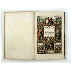
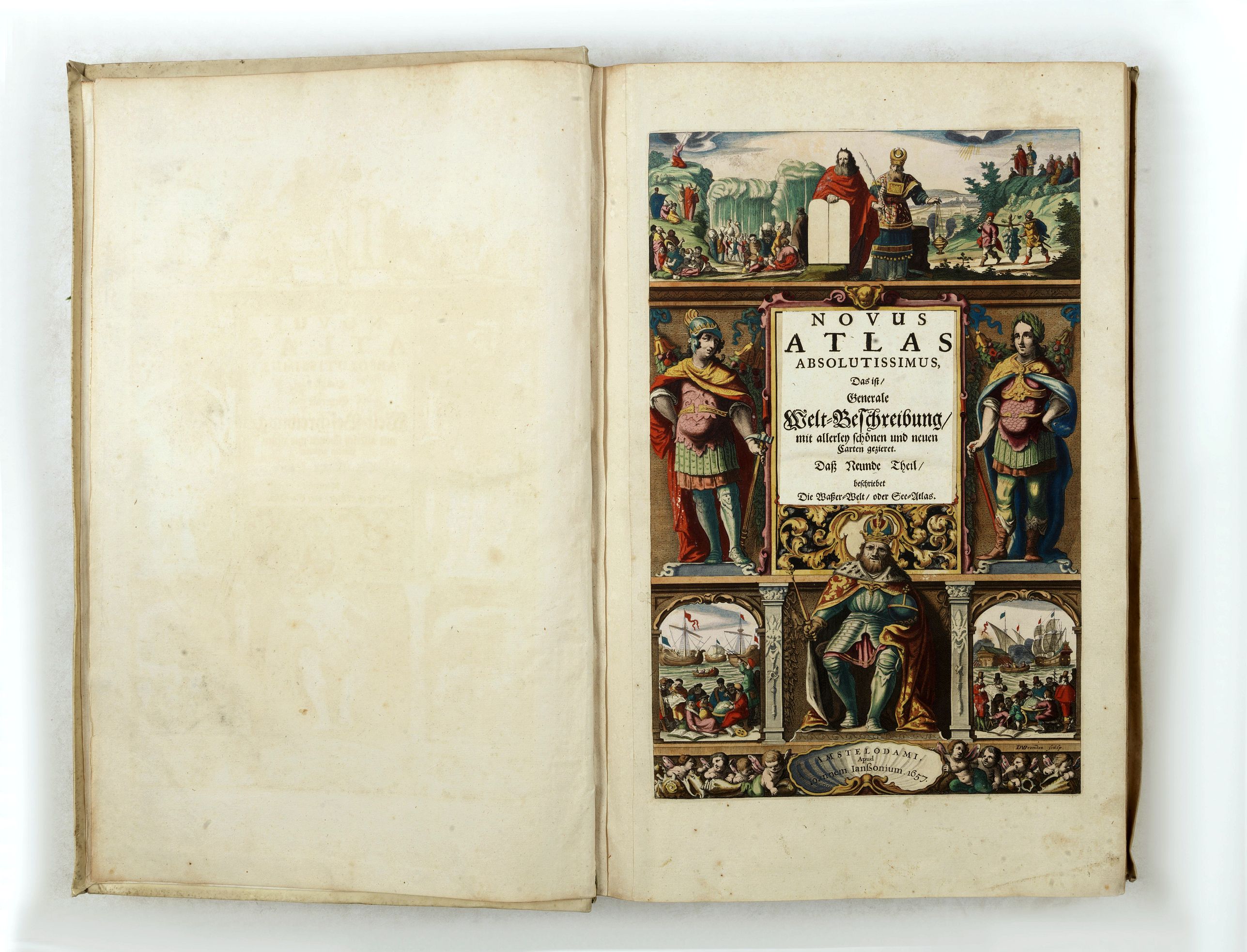
Novus Atlas Absolutissimus... Die Wasser-Welt, oder See-Atlas. |
||||||||||||||||||||
|
||||||||||||||||||||
|
|
||||||||||||||||||||
|
|
Collection - Save and collect this or any of your favorite items in one place.
If you want to save the items permanently, please sign in or create account first. |
|||||||||||||||||||
Description
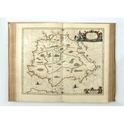
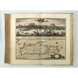
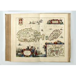
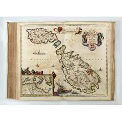
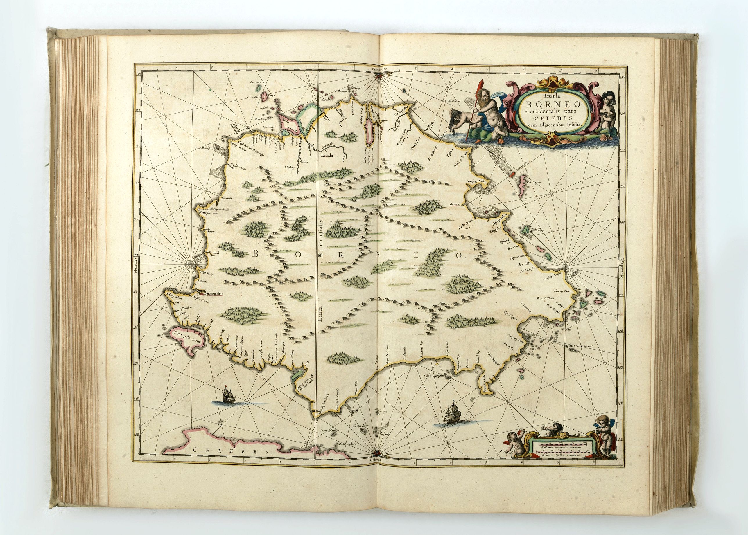
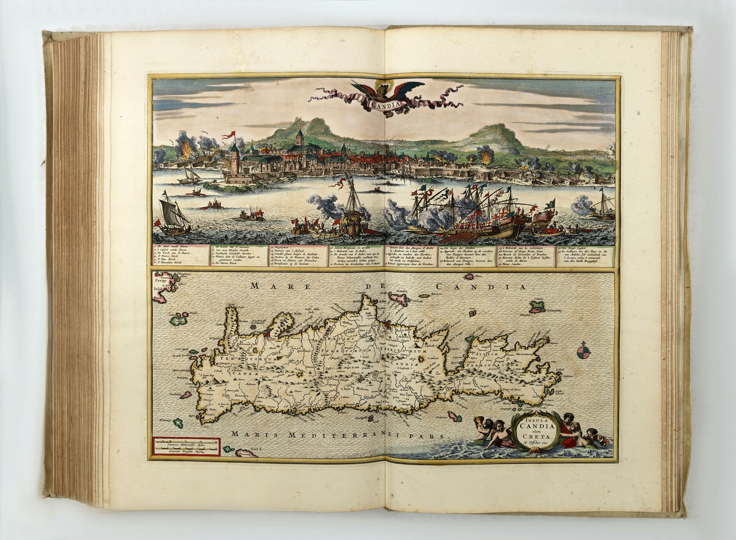
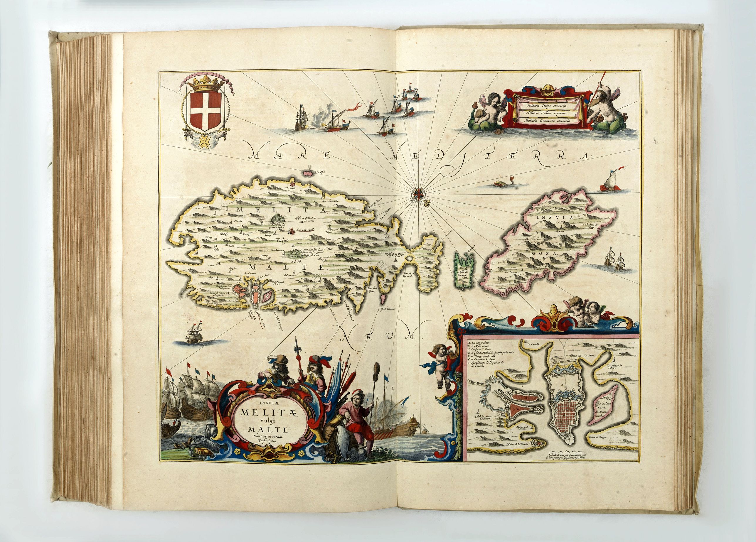
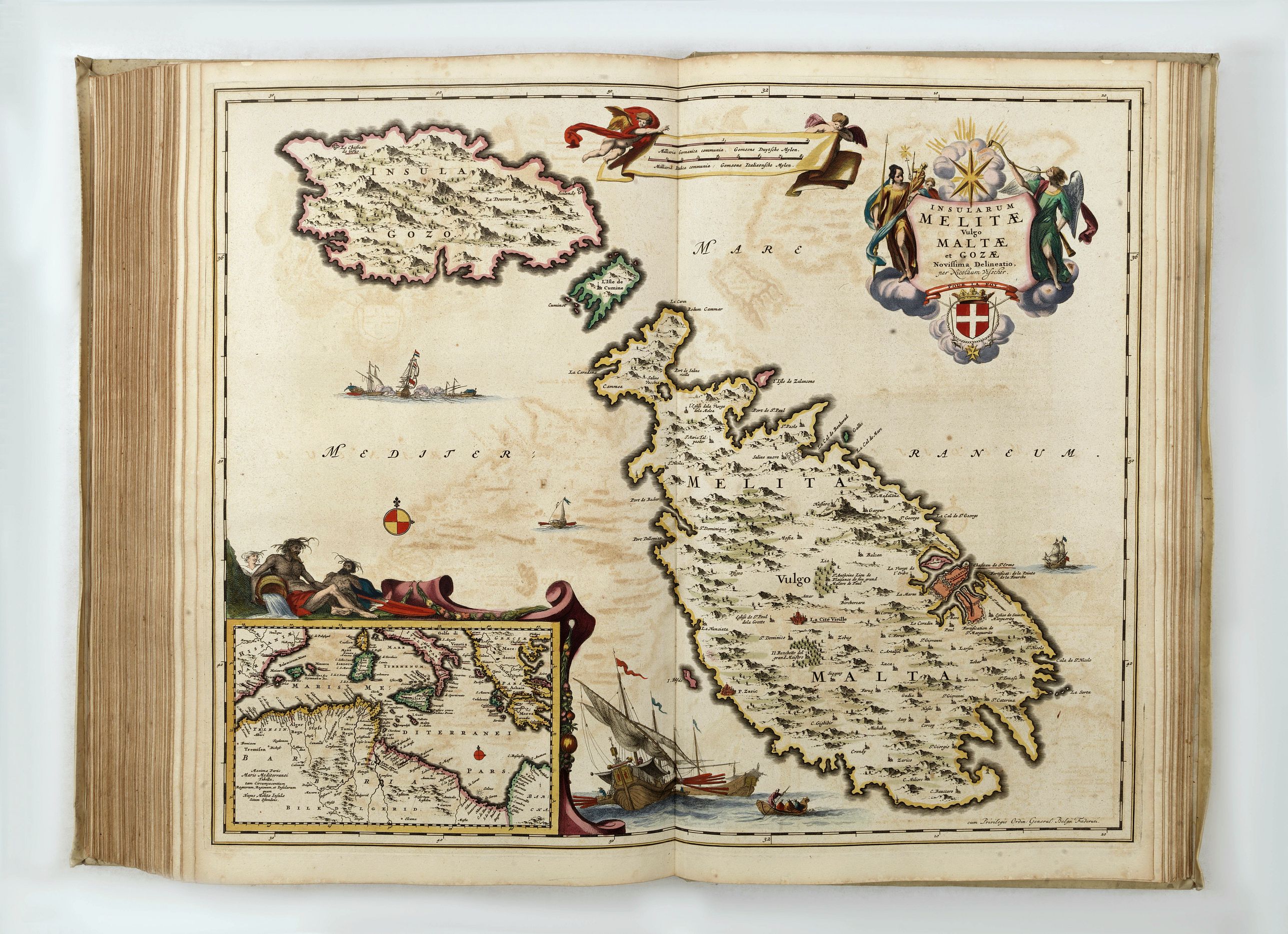
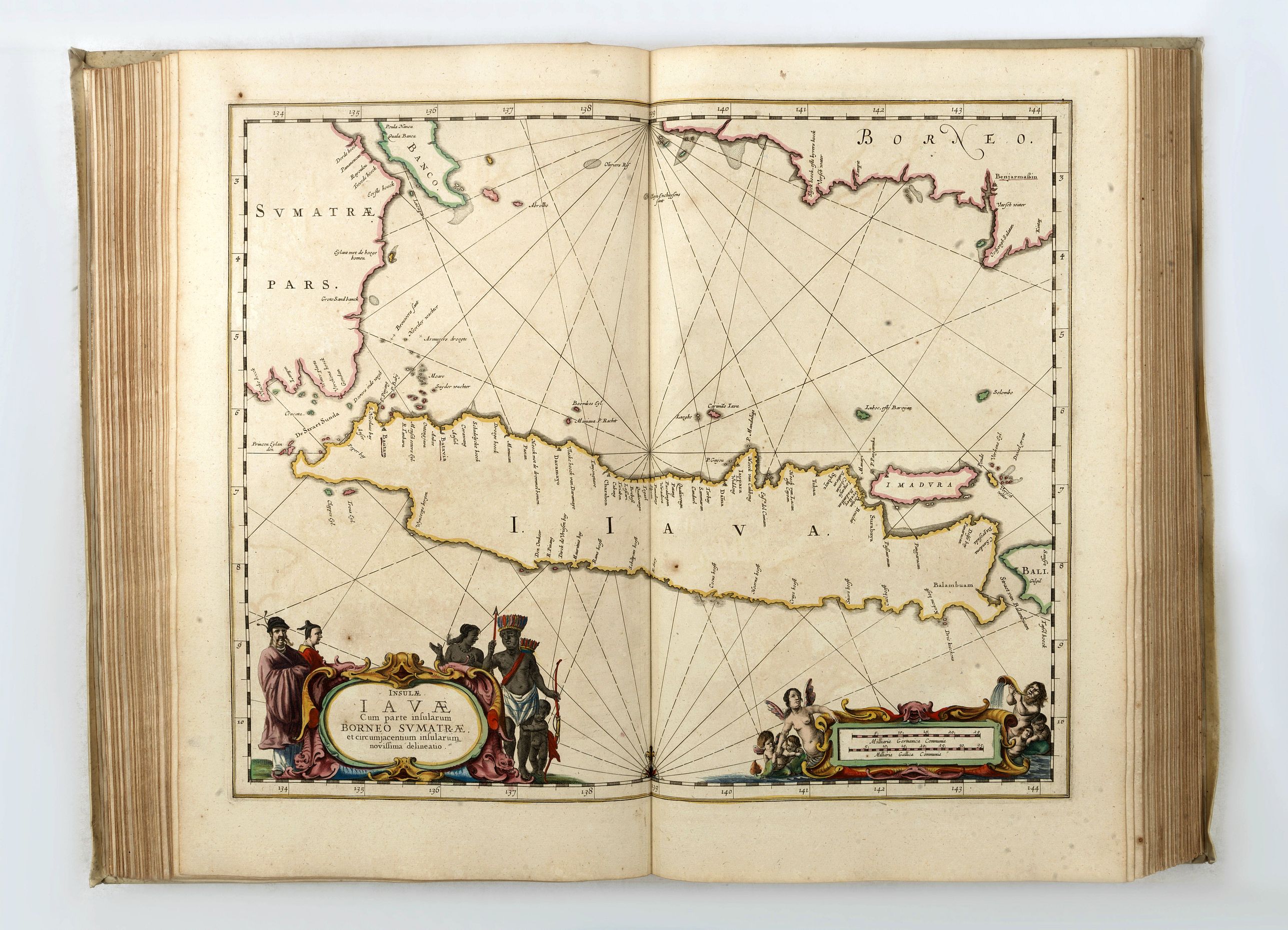
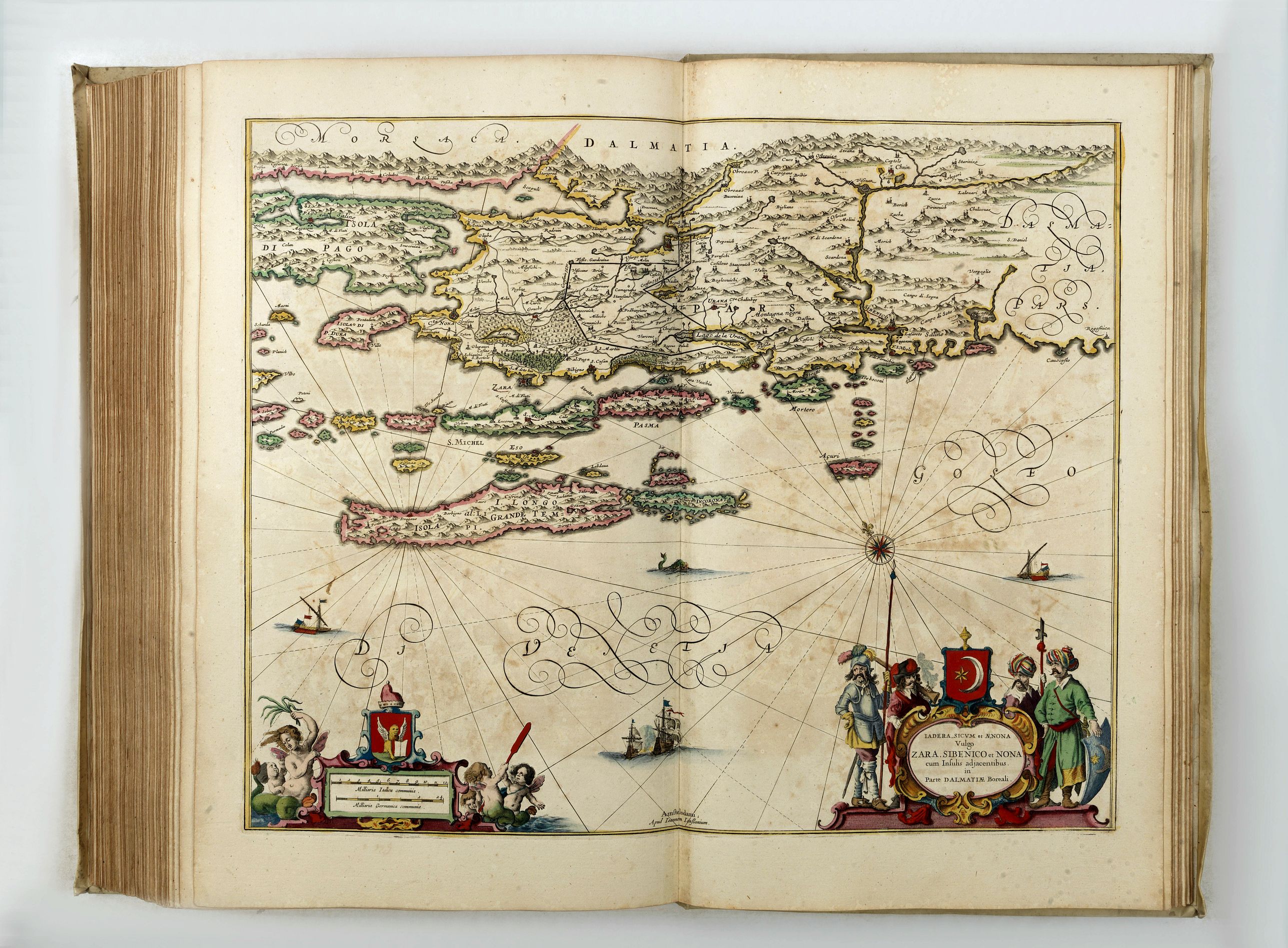
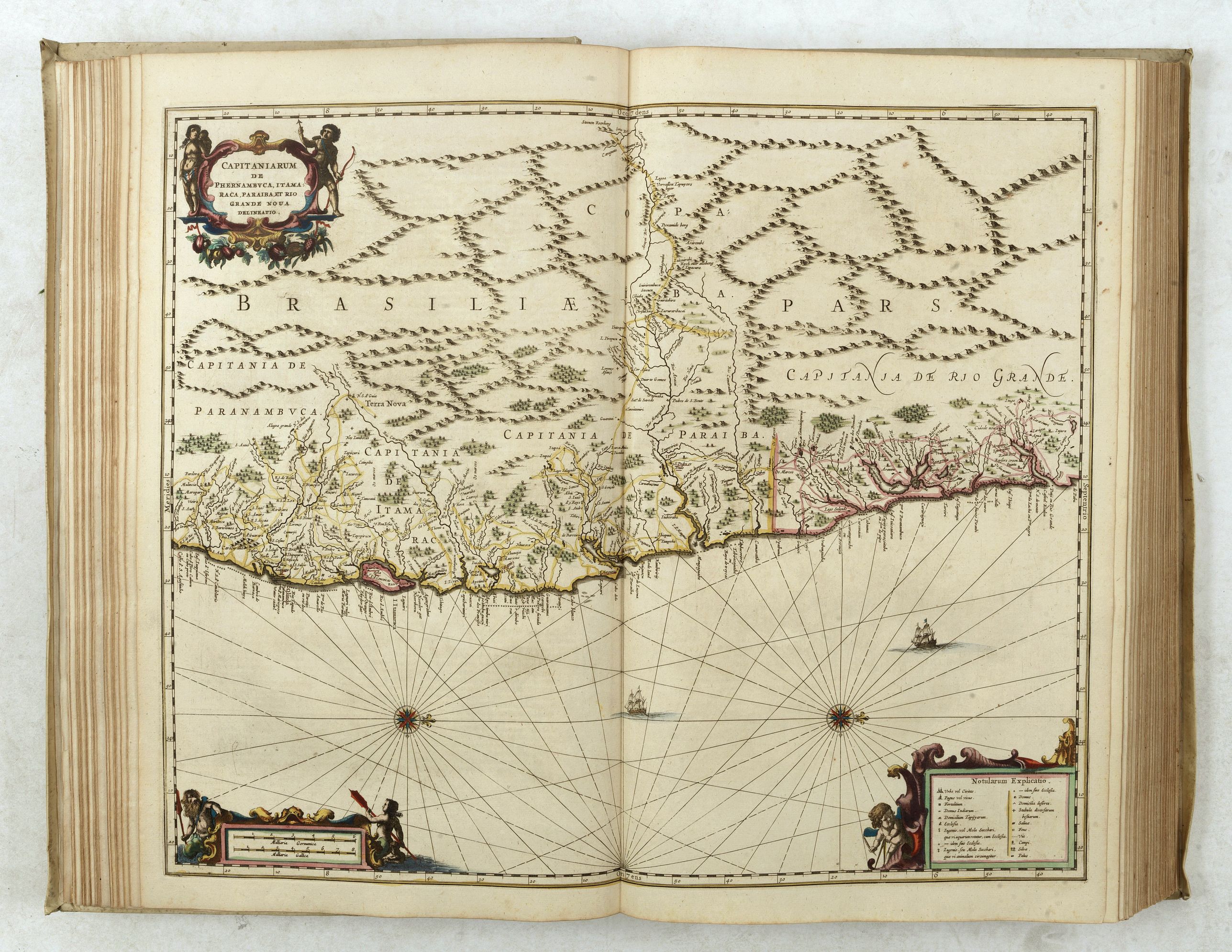
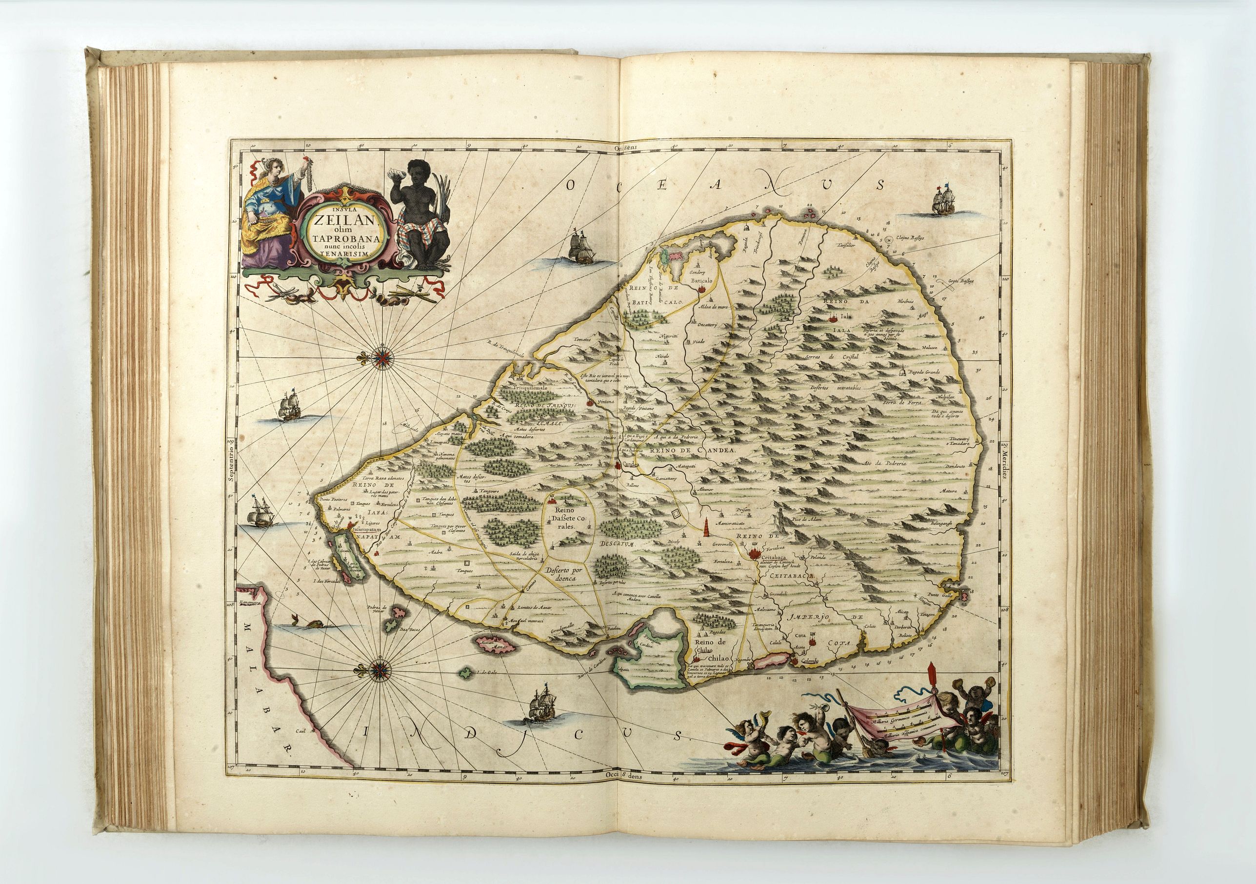
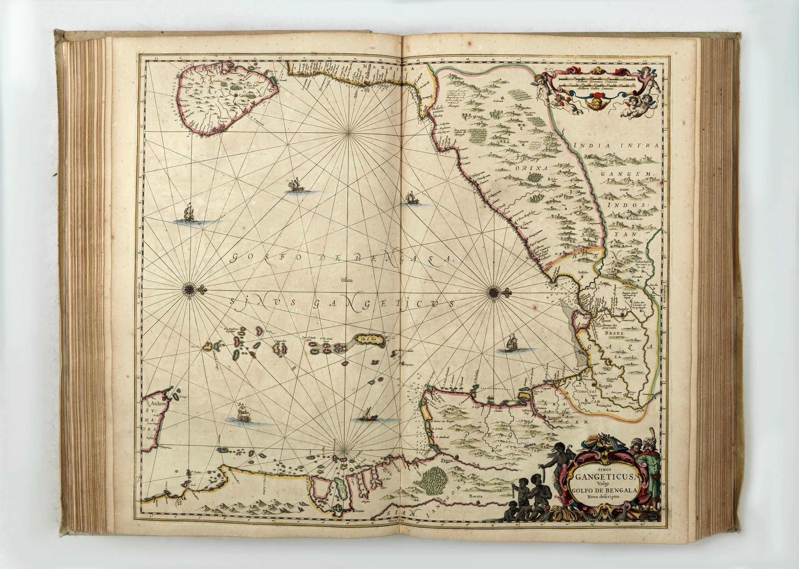
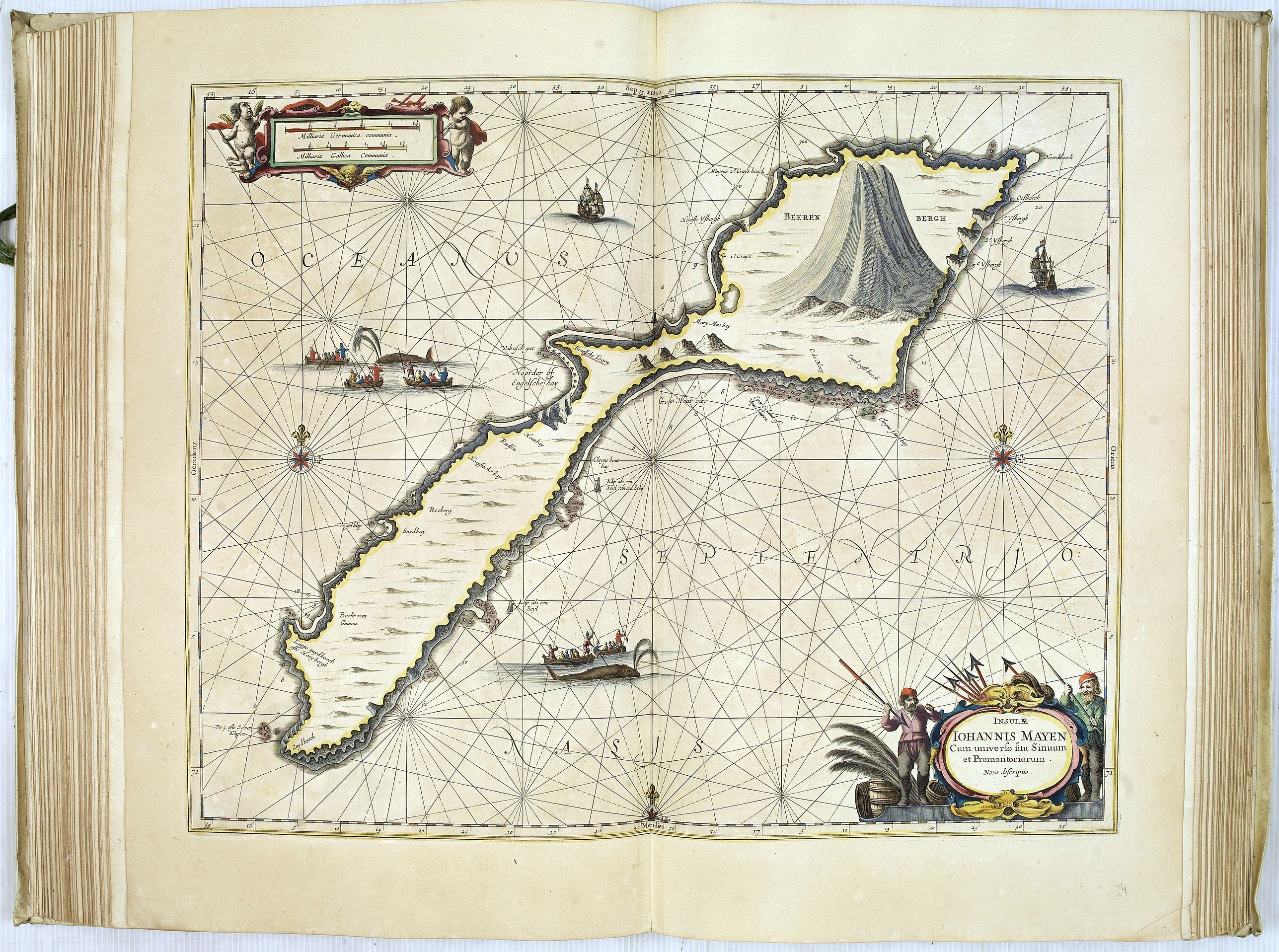
Volume IX (Sea-Atlas) of the "Novus Atlas Absolutissimus". German text, letterpress title on slip within hand-colored engraved architectural border, heightened in gilt, 39 maps are finely colored by a contemporary hand. With six additional maps by Visscher listed in the index : ("Insulae Americanae", "Insula Matanino", "Novi Belgii", "Indiae orientalis", "Insularum Melitae" et "Insula Candia").
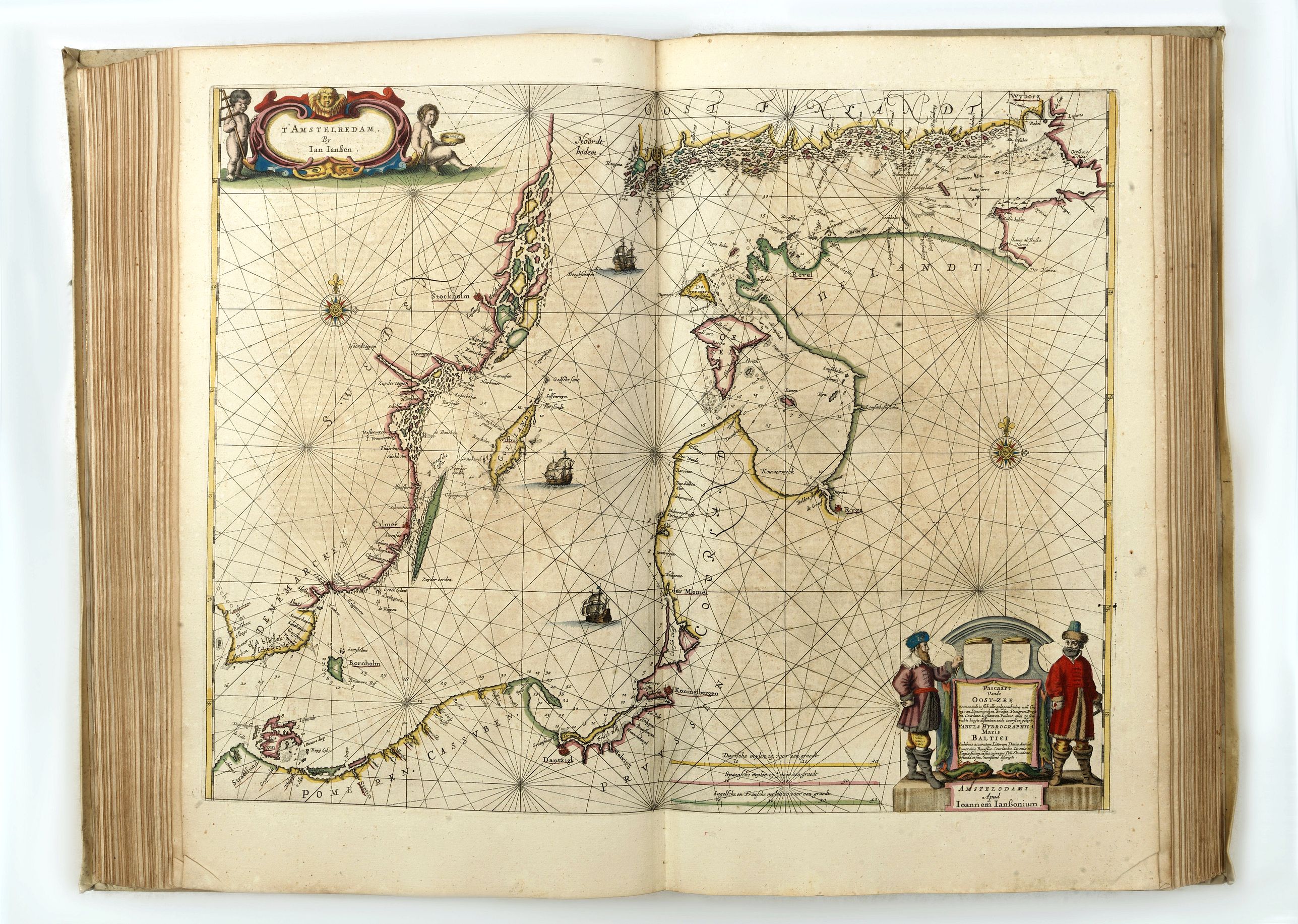
The ‘Water wereld’ was, Koeman states, the “first sea-atlas (in the real sense of the word) printed in the Netherlands”. It was first published in 1650, containing 23 charts and ten historical maps, and formed the fifth volume of Janssonius’ five-volume ‘Atlas Novus’.
In 1657, Janssonius issued a new, six-volume edition of the ‘Atlas Novus’. For this edition, he added nine new charts to the ‘Waterwereld’, removed the historical maps, and reset the text. As well as being issued within the ‘Atlas Novus’, the ‘Waterwereld’ was also issued separately.
Even if one accepts Koeman’s comments that “not all [of the maps] should be seen as charts”, and that “the elaborate printed text … is not pertaining to maritime affairs”, the 1657 incarnation of the ‘Waterwereld’, with its large double-page engraved charts, elaborate title, and high production values, should be seen as the progenitor of the Dutch sea atlases produced from the 1660s onwards. In this edition, he ads a number of newly-engraved maps and maps published by Nic. Visscher.
The atlases were probably made in a very small number of copies and later obviously only made to order. This can explain the variation in letterpress titles and title pages. When letterpress titles were out of print, the later made-to-order copies have letterpress titles composed by cutting and pasting of words, sometimes even syllables or letters.
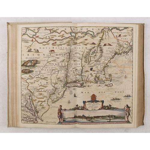
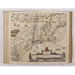
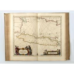
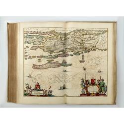
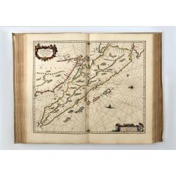
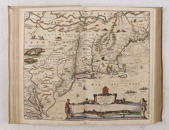
All Visscher maps added to the atlas are extremely decorative, but one of the most important was Visscher's famous map of the New Netherlands, "Novi Belgii Novaeque Angliae Nec Non Partis Virginiae Tabula", included present-day New England as well as New Jersey, New York, and Maryland and combined both Dutch and Indian place names. Scattered throughout the map are depictions of native flora and fauna: herons, beavers, wild turkeys, deer, rabbits, bears, muskrats, foxes, and wolves. Stockaded settlements and dugout canoes represent the Indian presence.
At the bottom of the map is a striking inset view of New Amsterdam, showing period houses, ships in the harbor, a windmill, and even a gallows! To either side of the inset are two female Indian figures, allegorical representations of America. (Burden, America, 318, state 4.)
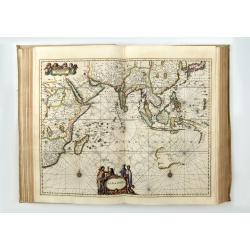
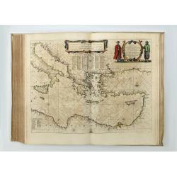
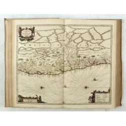
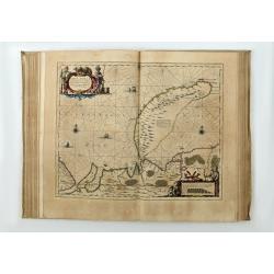
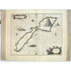
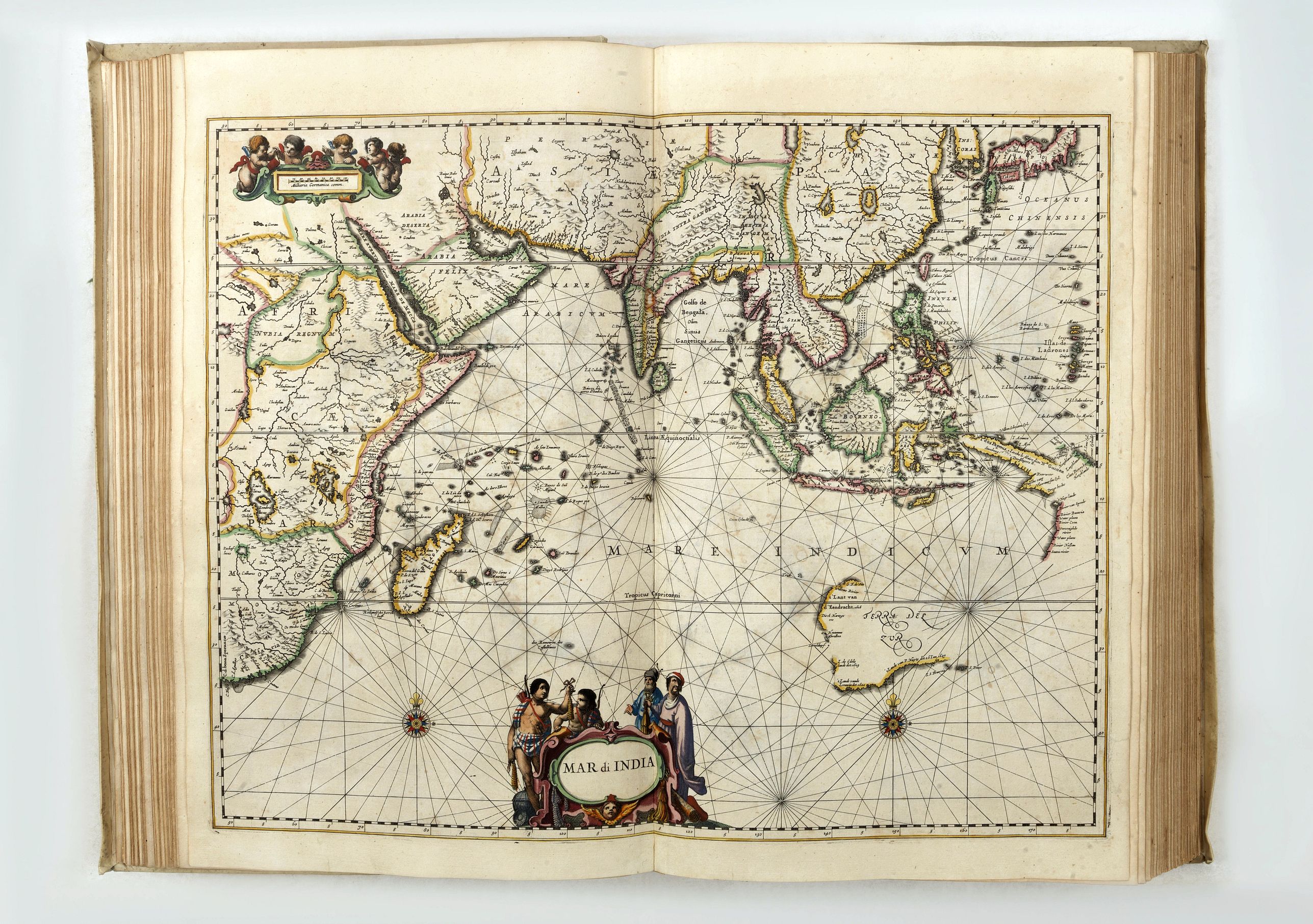
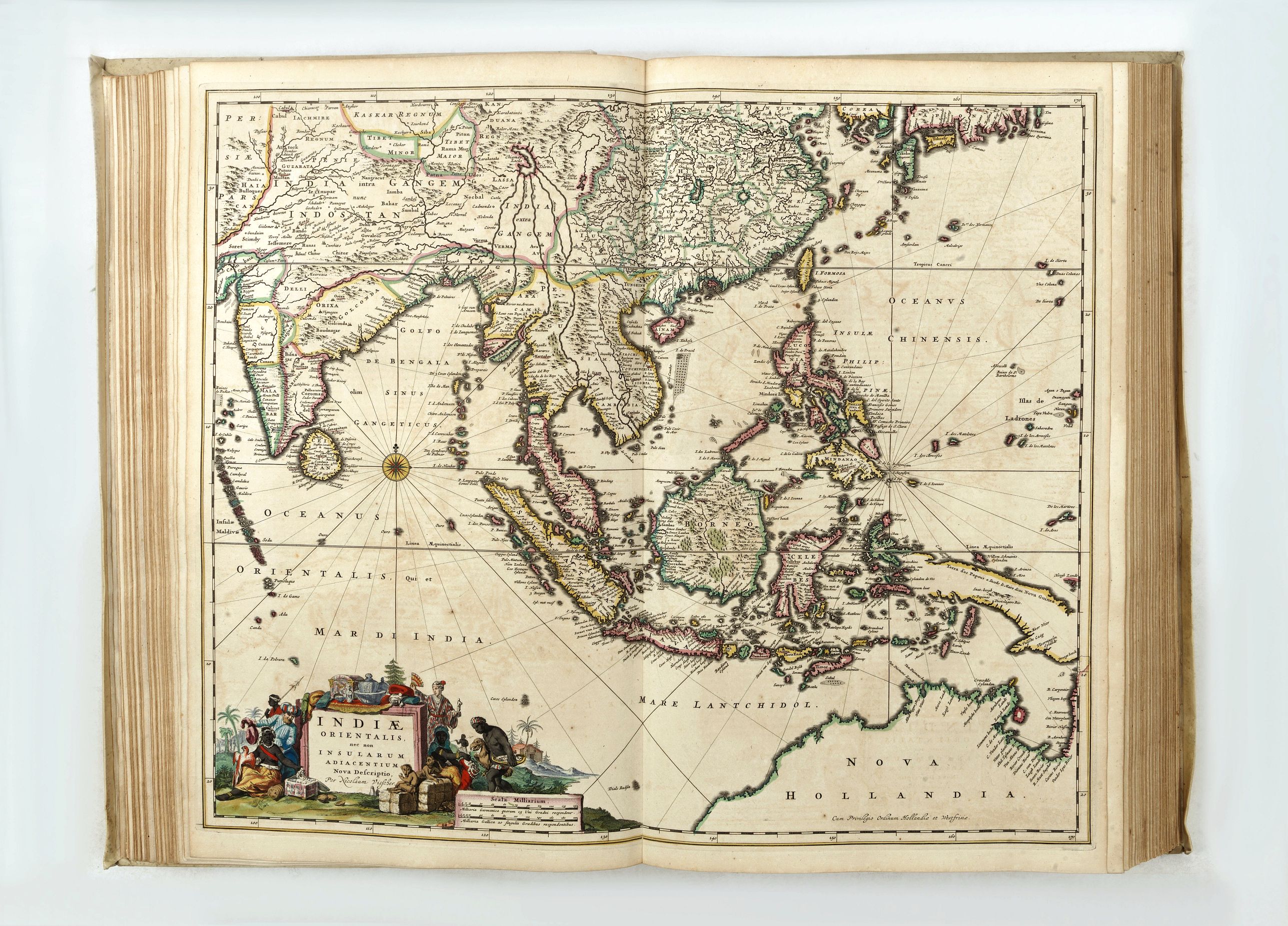
"Mar di India", covers the area between the Cape of Good Hope and Korea (INS: CORAI) and Japan. It owes its importance to the rendering of the coastline of Australia, which bears the name 'TERRA DEL ZUR'. Of the results of the Carstensz expedition in 1623, only those of the ship Pera on the West Coast of Cape York Peninsula are shown. The results of the voyage of the Arnhem are omitted. The discoveries of the Vianen in 1628 are rendered.
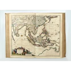
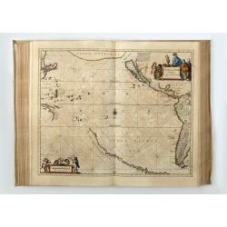
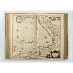
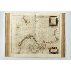
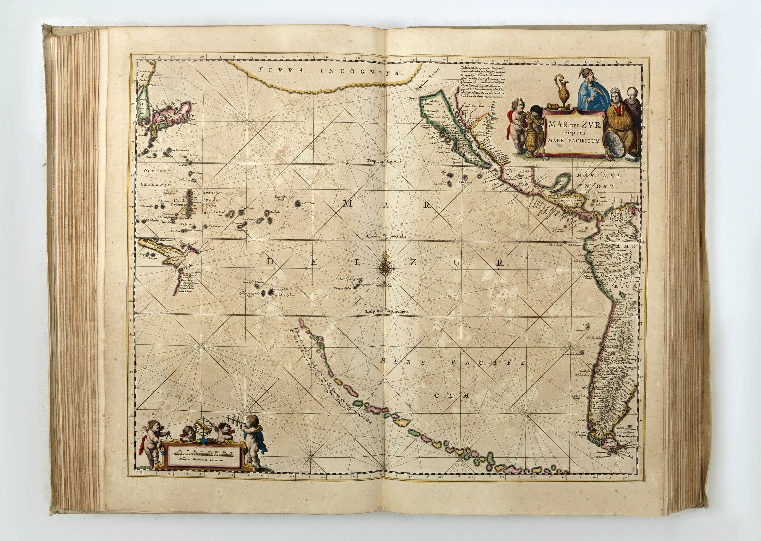
Mar del Zur Hispanis Mare Pacificum: the first map of the Pacific to show California as an Island and the earliest map of the Pacific to appear in a Dutch Atlas. From the string of fictitious islands in the South Pacific to the recently discovered coastlines of Australia and New Guinea, to "Japon" and "Corai" and Terra Incognita in the north. Ref.: McLaughlin 11; Tooley pl 30; Burden 292; Potter p.129; Wagner 359; Leighly pl VI.
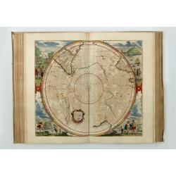
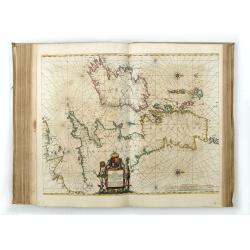
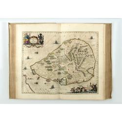
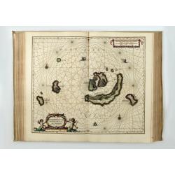
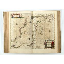
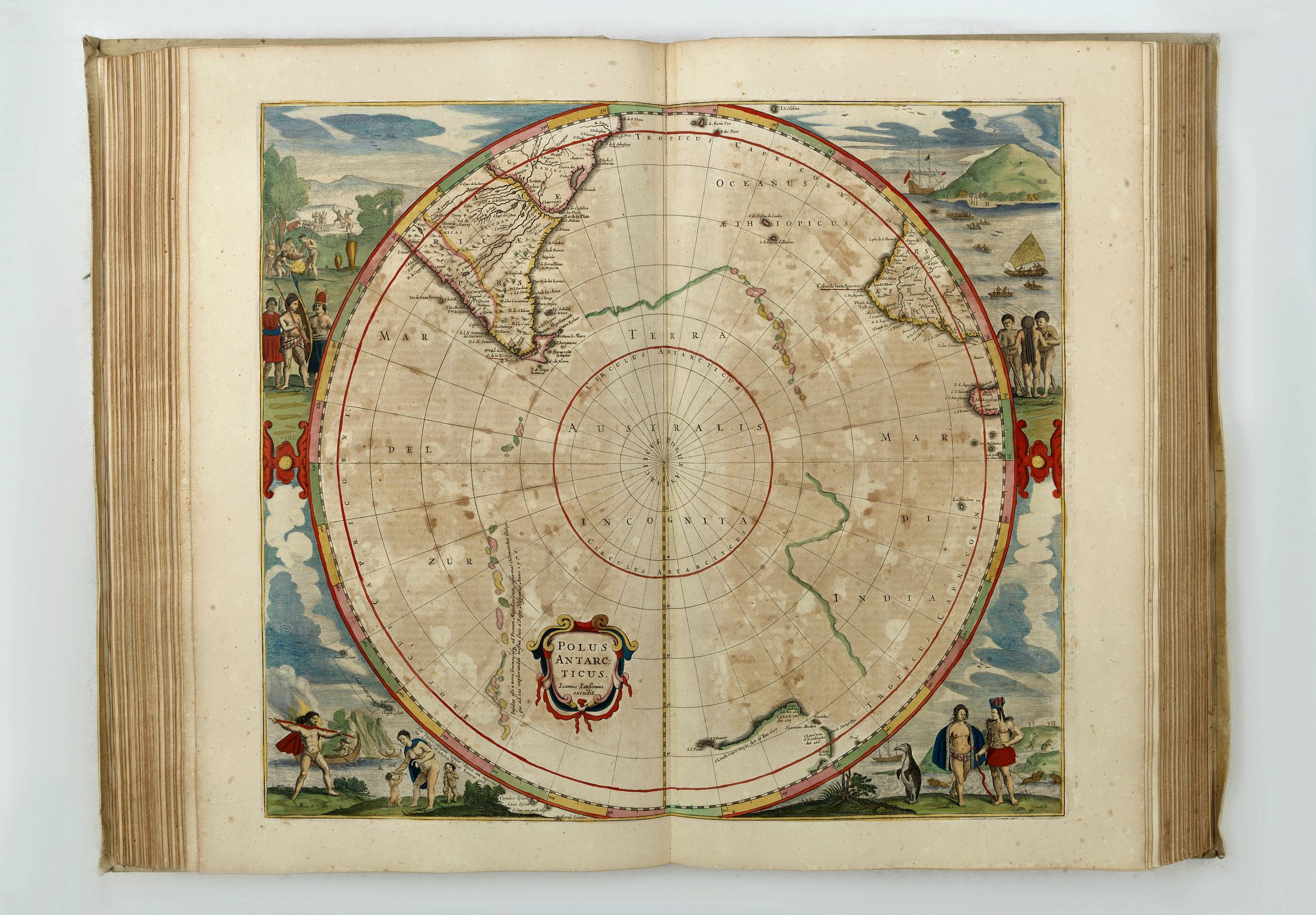
Much attention is paid to the Northern region, a waterway considered for a long time for reaching the East. The Pole maps, both in circular form, rank among the highlights of Dutch map-making and are decorated with whaling and maritime scenes. The chart of the South pole, "Polus Antarcticus", predates the first appearance of New Zealand and Van Dieman's Land
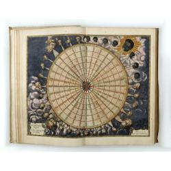
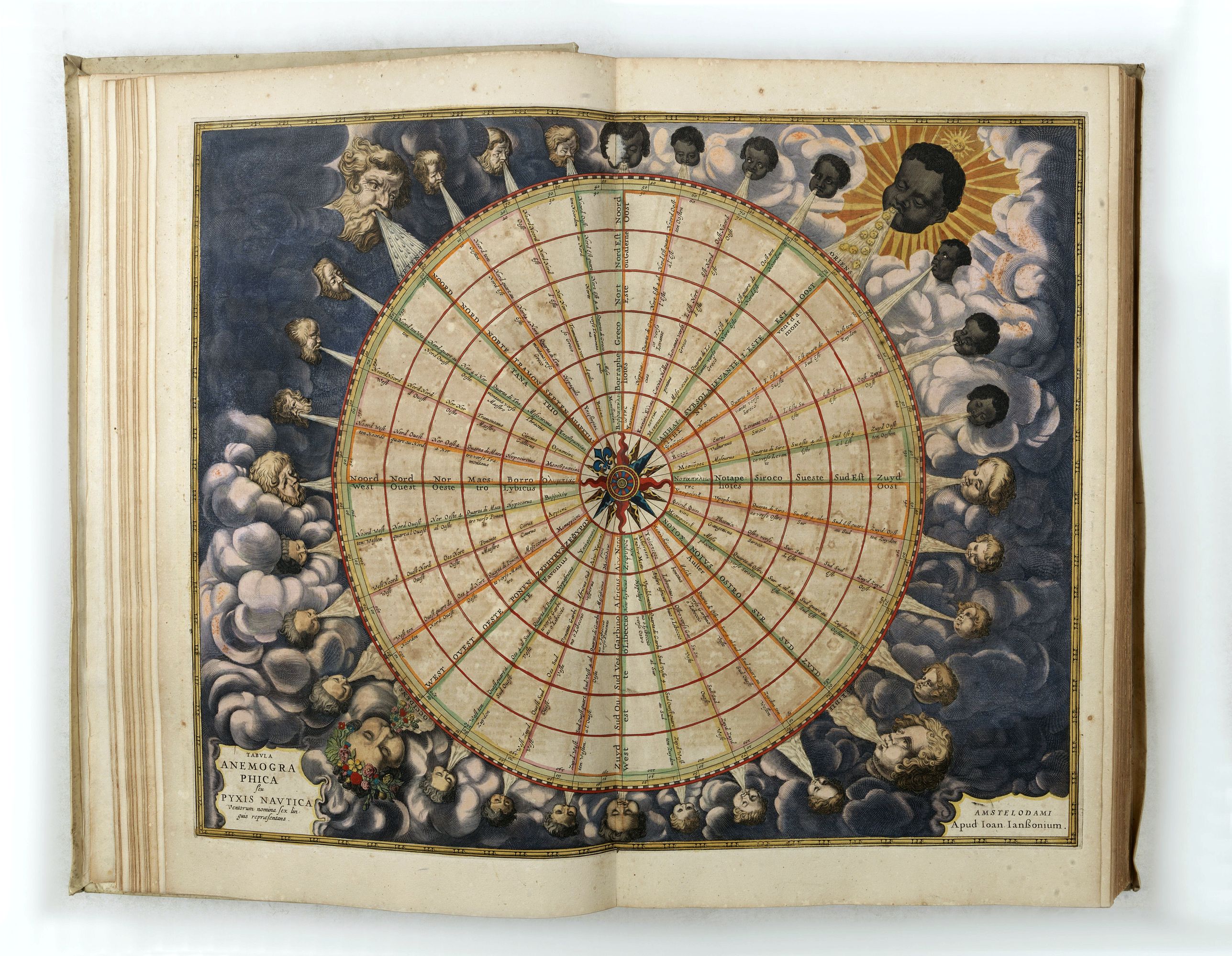
Tabula Anemographica Seu Pyxis Nautica. . . oder des See-Compasses. . .
Over the centuries, an increased diversity of names for the winds and ambiguity about the direction they came from produced a multitude of different wind systems. To create order out of the tangled confusion of names and directions, cartographers produced wind roses such as this by Joannes Janssonius in 1650. Thirty-two points (directions) are shown and labeled with various directional names for the winds. But to sailors plying the waters of the open oceans, a wind blowing from Thrace (Thracias) lost all relevance in defining direction. Eventually, the wind rose, overburdened by a multiplicity of names and obtuse symbolism, and gave way to the directional system of north, east, south, and west, with their intermediate compounds, as used today.
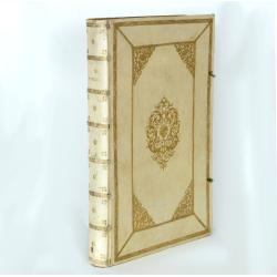
The atlas is bound in a very rich contemporary Dutch publisher's paneled vellum, each cover elaborately decorated in gilt in two panels with fillets of broad floral roll tools, large floral inner corner pieces and central floral cartouche surrounding an armillary globe.
Reference: Koeman/Van der Krogt, 1:428.9.
The ‘Water wereld’ was, Koeman states, the “first sea-atlas (in the real sense of the word) printed in the Netherlands”. It was first published in 1650, containing 23 charts and ten historical maps, and formed the fifth volume of Janssonius’ five-volume ‘Atlas Novus’.
In 1657, Janssonius issued a new, six-volume edition of the ‘Atlas Novus’. For this edition, he added nine new charts to the ‘Waterwereld’, removed the historical maps, and reset the text. As well as being issued within the ‘Atlas Novus’, the ‘Waterwereld’ was also issued separately.
Even if one accepts Koeman’s comments that “not all [of the maps] should be seen as charts”, and that “the elaborate printed text … is not pertaining to maritime affairs”, the 1657 incarnation of the ‘Waterwereld’, with its large double-page engraved charts, elaborate title, and high production values, should be seen as the progenitor of the Dutch sea atlases produced from the 1660s onwards. In this edition, he ads a number of newly-engraved maps and maps published by Nic. Visscher.
The atlases were probably made in a very small number of copies and later obviously only made to order. This can explain the variation in letterpress titles and title pages. When letterpress titles were out of print, the later made-to-order copies have letterpress titles composed by cutting and pasting of words, sometimes even syllables or letters.
All Visscher maps added to the atlas are extremely decorative, but one of the most important was Visscher's famous map of the New Netherlands, "Novi Belgii Novaeque Angliae Nec Non Partis Virginiae Tabula", included present-day New England as well as New Jersey, New York, and Maryland and combined both Dutch and Indian place names. Scattered throughout the map are depictions of native flora and fauna: herons, beavers, wild turkeys, deer, rabbits, bears, muskrats, foxes, and wolves. Stockaded settlements and dugout canoes represent the Indian presence.
At the bottom of the map is a striking inset view of New Amsterdam, showing period houses, ships in the harbor, a windmill, and even a gallows! To either side of the inset are two female Indian figures, allegorical representations of America. (Burden, America, 318, state 4.)
"Mar di India", covers the area between the Cape of Good Hope and Korea (INS: CORAI) and Japan. It owes its importance to the rendering of the coastline of Australia, which bears the name 'TERRA DEL ZUR'. Of the results of the Carstensz expedition in 1623, only those of the ship Pera on the West Coast of Cape York Peninsula are shown. The results of the voyage of the Arnhem are omitted. The discoveries of the Vianen in 1628 are rendered.
Mar del Zur Hispanis Mare Pacificum: the first map of the Pacific to show California as an Island and the earliest map of the Pacific to appear in a Dutch Atlas. From the string of fictitious islands in the South Pacific to the recently discovered coastlines of Australia and New Guinea, to "Japon" and "Corai" and Terra Incognita in the north. Ref.: McLaughlin 11; Tooley pl 30; Burden 292; Potter p.129; Wagner 359; Leighly pl VI.
Much attention is paid to the Northern region, a waterway considered for a long time for reaching the East. The Pole maps, both in circular form, rank among the highlights of Dutch map-making and are decorated with whaling and maritime scenes. The chart of the South pole, "Polus Antarcticus", predates the first appearance of New Zealand and Van Dieman's Land
Tabula Anemographica Seu Pyxis Nautica. . . oder des See-Compasses. . .
Reference: Koeman/Van der Krogt, 1:428.9.
FAQ - Guarantee - Shipping
Buying in the BuyNow Gallery
This item is available for immediate purchase when a "Add to Cart" or "Inquire Now" button is shown.
Items are sold in the EU margin scheme
Payments are accepted in Euros or US Dollars.
Authenticity Guarantee
 We provide professional descriptions, condition report (based on 45 years experience in the map business)
Paulus Swaen warrants the authenticity of our items and a certificate of authenticity is provided for each acquired lot.
Condition and Coloring
We indicate the condition of each item and use our unnique HiBCoR grading system in which four key items determine a map's value: Historical Importance, Beauty, Condition/Coloring and Rarity.
Color Key
We offer many maps in their original black and white condition. We do not systematically color-up maps to make them more sellable to the general public or buyer.
Copper engraved or wood block maps are always hand colored. Maps were initially colored for aesthetic reasons and to improve readability. Nowadays, it is becoming a challenge to find maps in their original colors and are therefor more valuable.
We use the following color keys in our catalog:
Original colors; mean that the colors have been applied around the time the map was issued.
Original o/l colors; means the map has only the borders colored at the time of publication.
Colored; If the colors are applied recently or at the end of the 20th century.
Read more about coloring of maps [+]
Shipping fee
A flat shipping fee of $ 30 is added to each shipment by DHL within Europe and North America. This covers : International Priority shipping, Packing and Insurance (up to the invoice amount).
Shipments to Asia are $ 40 and rest of the world $50
We charge only one shipping fee when you have been successful on multiple items or when you want to combine gallery and auction purchases.
Read more about invoicing and shipping
FAQ
Please have a look for more information about buying in the BuyNow gallery
Many answers are likely to find in the general help section.
Collection
![]()
With Collection you can collect all your favorite items in one place. It is free, and anyone can create his or her Virtual map collection.
Unless you are logged in, the item is only saved for this session. You have to be registed and logged-in if you want to save this item permanently to your Virtual Collection.
Read More[+]
Register here, it is free and you do not need a credit card.
Add this item to
Virtual Collection
or click the following link to see my Collection.
| Digital Image Download | |
|
Paulus Swaen maintains an archive of most of our high-resolution rare maps, prints, posters and medieval manuscript scans. We make them freely available for download and study. Read more about free image download |
Click the image for a free small image download. |

In accordance with the EU Consumer Rights Directive and habitually reside in the European Union you have the right to cancel the contract for the purchase of a lot, without giving any reason.
The cancellation period will expire 14 calendar days from the day after the date on which you or a third party (other than the carrier and indicated by you) acquires, physical possession of the lot. To exercise the right to cancel you must inform Paulus Swaen Inc, of your decision to cancel this contract by a clear statement (e.g. a letter sent by post, or e-mail (amsterdam@swaen.com).
To meet the cancellation deadline, it is sufficient for you to send your communication concerning your exercise of the right to cancel before the cancellation period has expired.
