
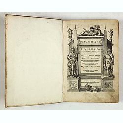
Descrittione di M. Lodovico Guicciardini patritio Fiorentino, di tutti i Paesi Bassi,... |
||||||||||||||||||||
|
||||||||||||||||||||
|
|
||||||||||||||||||||
$10000 / ≈ €8788This item is available for immediate sale! Questions before Buying ?
We are happy to answer your questions. |
My Collection +
Add this or any of your favorite items in one place. If you want to save the items permanently, you have to sign in or create an account first. |
|||||||||||||||||||
Description
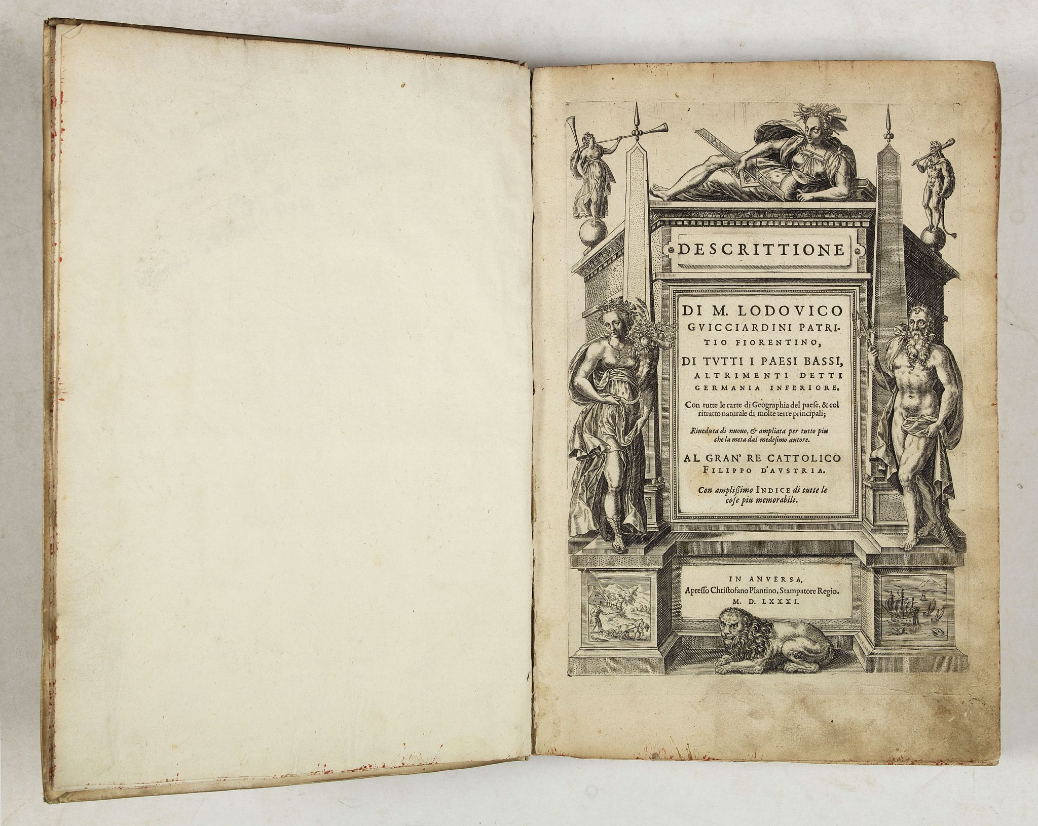
Second Italian edition (variant B) and first Plantin edition (1st Silvius 1567) and the most sought-after edition of the famous description of the Low Countries, updated by the author with the recent drastic changes in the region's history.
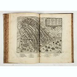
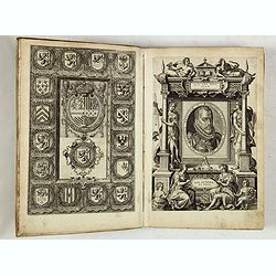
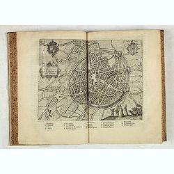
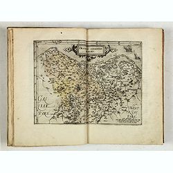
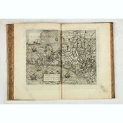
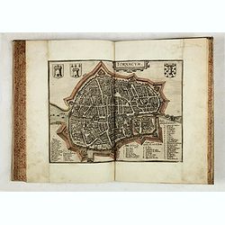
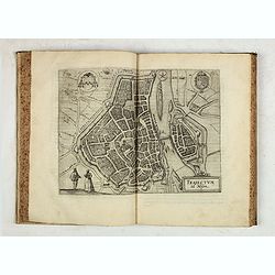
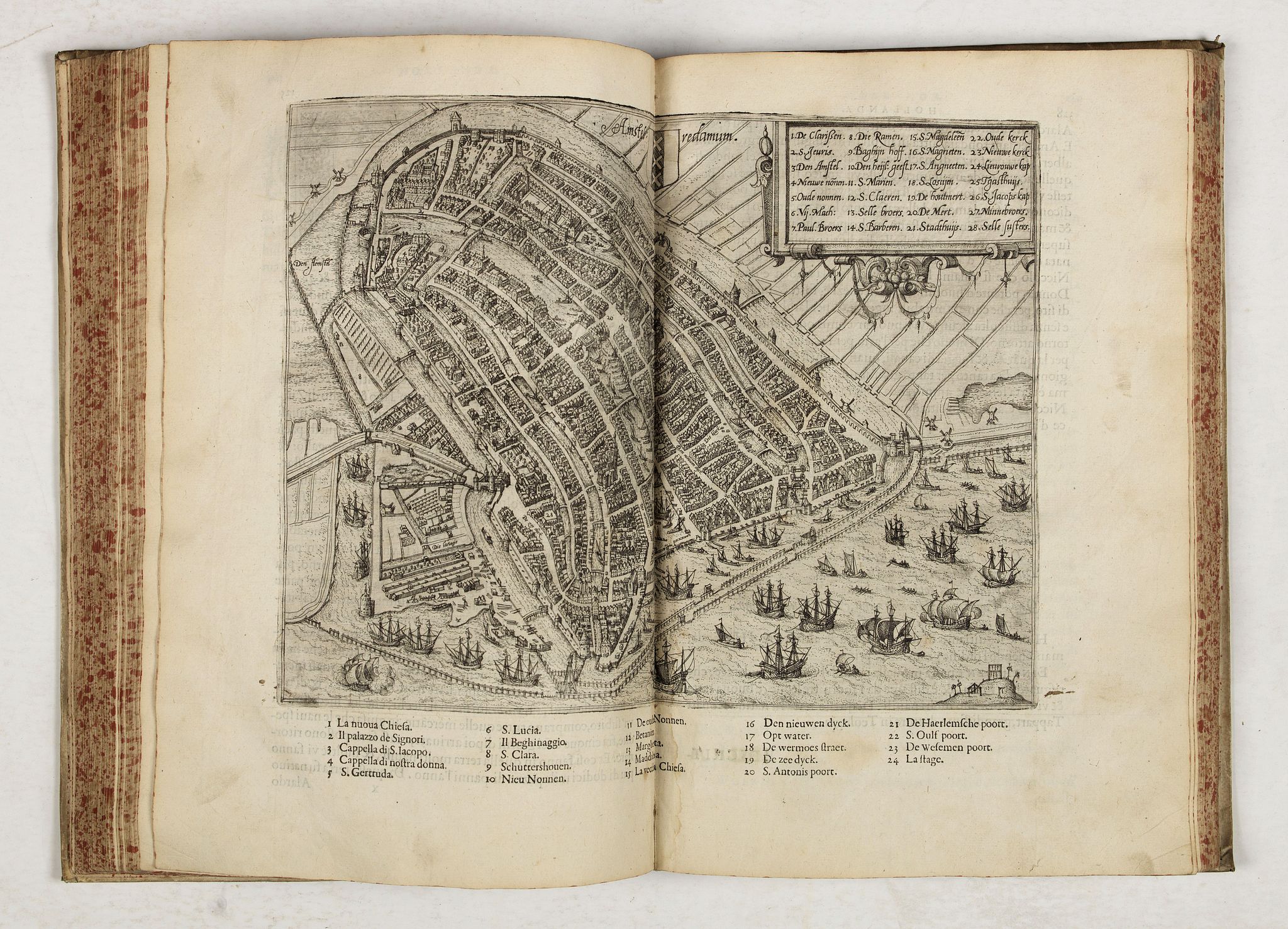
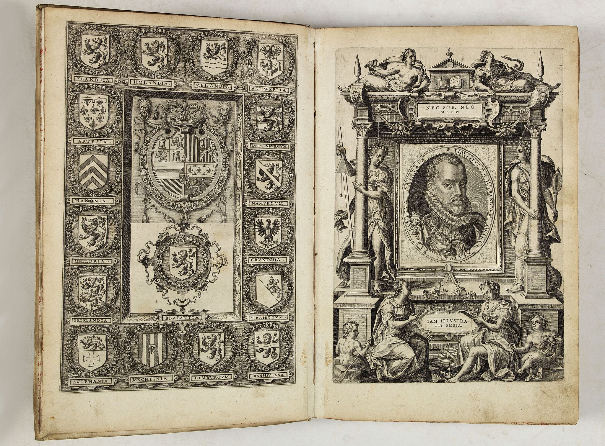
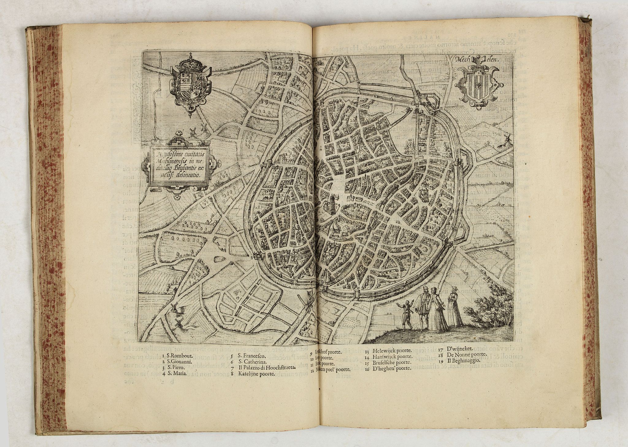
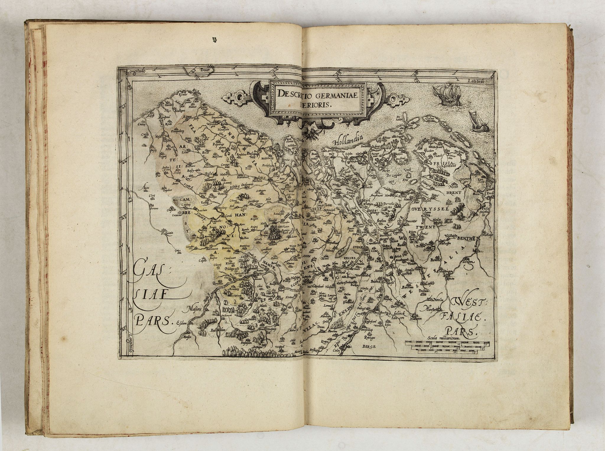
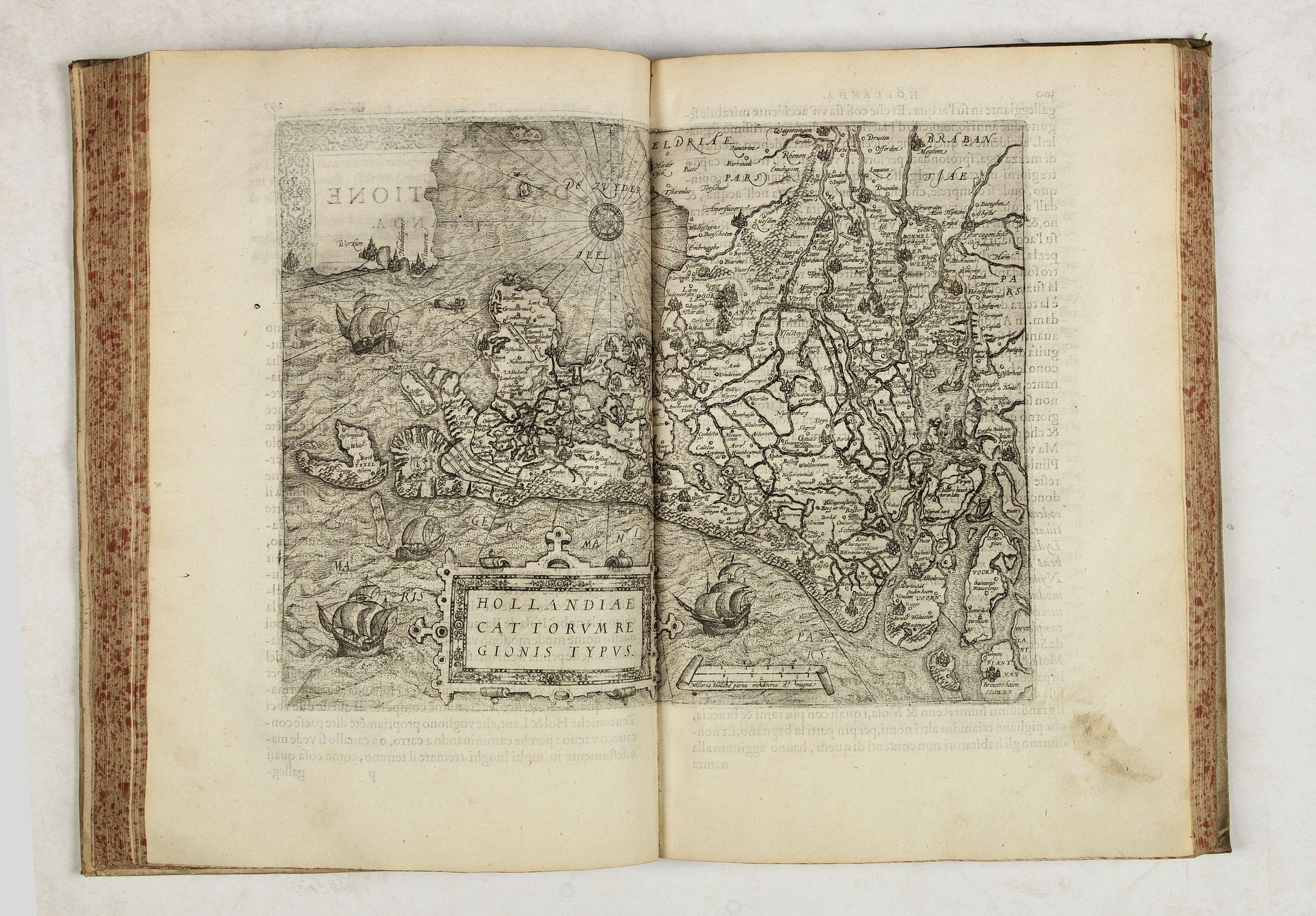
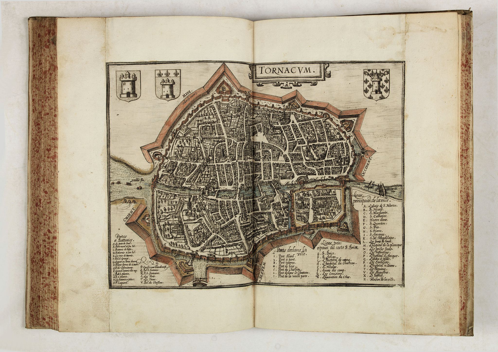
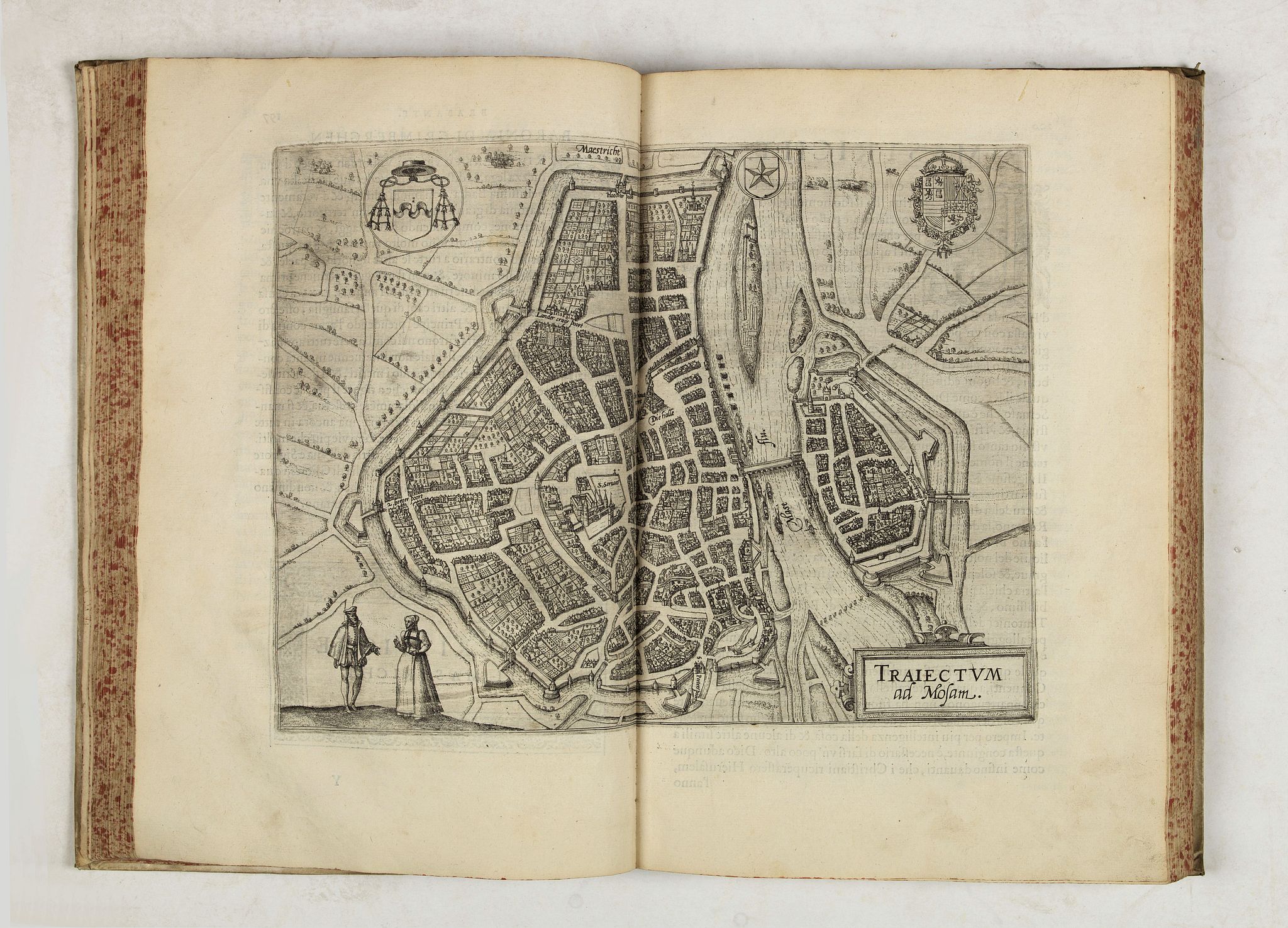
Illustrated with engraved plates : title, coats-of-arms of the 17 Provinces with coat-of-arms of Philip II pasted on in the middle, portrait of Philip II pasted on in the middle of a baroque architectural setting with between the allegorical presentation of Arts and Sciences, the compass of Plantin, on verso the coat-of-arms and device of Guicciardini, elaborate frontispiece (allegorical representation of the Netherlands with the 3 rivers), 57 plates including 1 general map of the Netherlands and 56 plates representing maps of each province and city plans and views of the towns.
Probably Ortelius' copy of Lodovico Guicciardini's ''Descittione di tutti Paesi Bassi''.
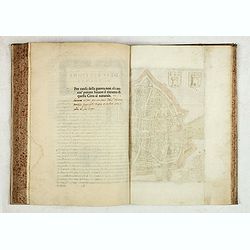
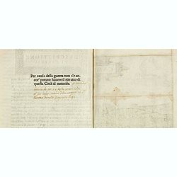
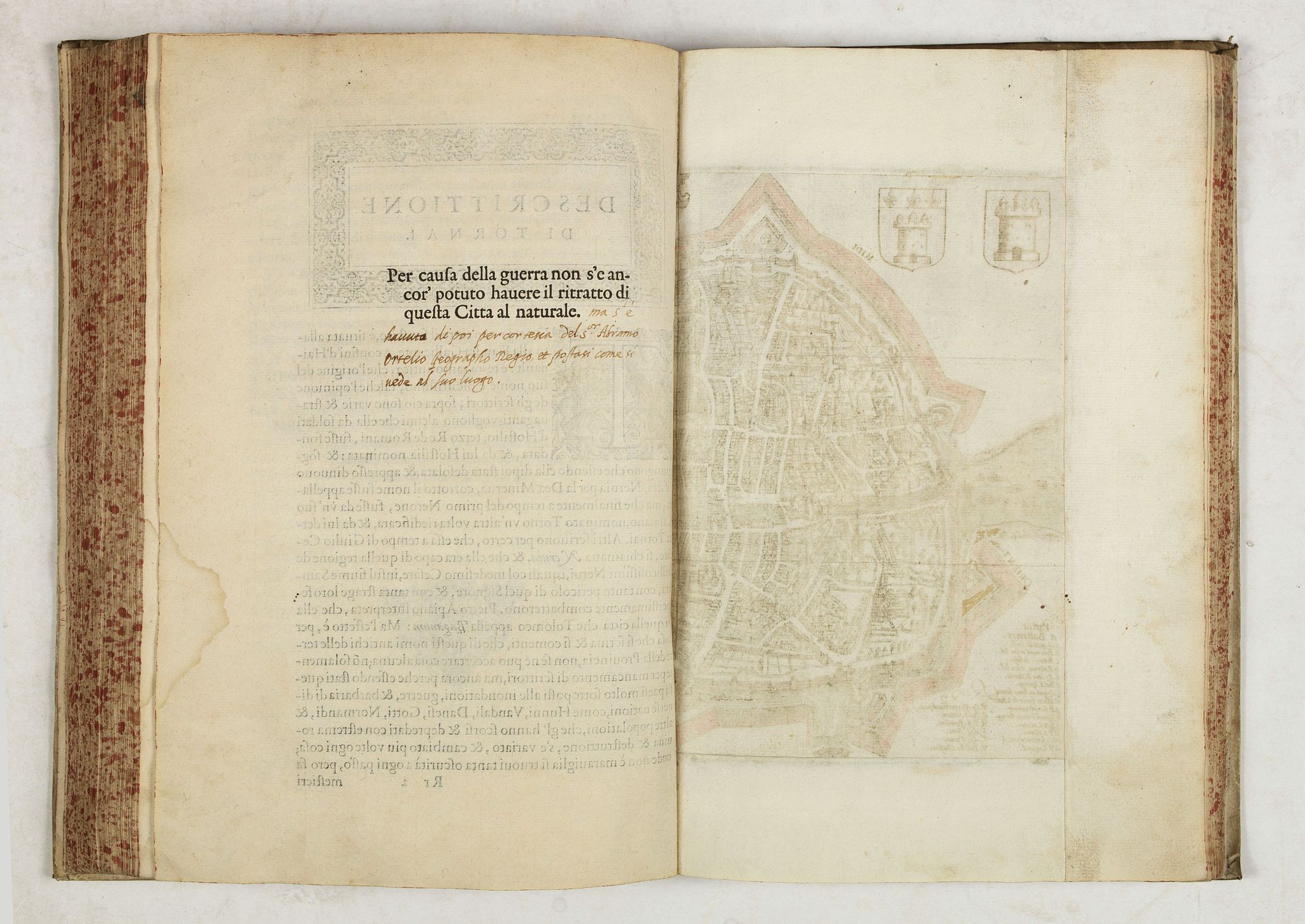
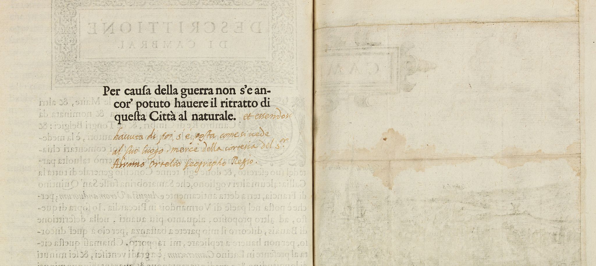
The two plates (Tournai and Cambrai), who are usually not yet included, are present in this example. The verso of the plates have a printed text "per causa della guerra non s'e ancor' potuto habere il ritratto di questa Citta al naturale", and in a manuscript in a conteporary hand ''ma s'e havuta di poi per cortesia del S.or Abramo Ortelio geographo regio et postasi come si vede al suo luogo." [
but it was later obtained through the courtesy of the S.or Abramo Ortelio geographo regio and was placed as seen in its place]
With further annotations in Italian handwriting on pp. 440 and 470.
It seems to be an acknowledgment by L. Guicciardini himself to Abraham Ortelius, the royal geographer, for having him provide the missing plates of Tournai and Cambrai.
Ludovico Guicciardini was a nobleman from Florence who lived and worked in the Low Countries and died at Antwerp in 1589. His present work was translated into French, Dutch, Latin, -and even German and English throughout the sixteenth and part of the 17th century, and all editions were in folio. The illustrations in the numerous editions vary greatly and were often renewed or replaced.
Plantin ordered entirely new plates, specially engraved for his editions, in 1581, mostly by the brothers Hogenberg, the famous engravers of Ortelius's atlas. Many new and updated city plans are included. Braun and Hogenberg used the illustrations of this most important work in their 'Civitates Orbis Terrarum'.
The book is divided into sections, each devoted to a particular, with emphasis on the topography of the various regions and the region. It really is a sophisticated traveler's guide, with emphasis on the topography of the various regions and the major cities, and beautifully illustrated by plans and views.
Including a fine print of the Antwerp Exchange. But the book comprehensively covers all aspects of contemporary life in each area as well, including an extensive treatment of the fine arts, trade and the commercial concerns of each region.
"It is well known that during his lifetime, Ortelius gradually filled his house with substantial collections of various art forms.
He also accumulated a large library of printed books, books with maps, loose maps, portolan charts, manuscript maps and manuscript texts.
Unusually for the time, Ortelius recorded his cartographical sources and the books and authors he consulted for his maps and writings in a Catalogus auctorum, but much can also be discovered from the texts on the verso of the maps in the Theatrum orbis terrarum, and from the Synonymia and Thesauri, his correspondence and the ledgers in the Plantin Moretus Museum, in which Ortelius’s transactions with Christophe Plantin were recorded. Some of Ortelius’s library books, identified by his signature, have survived.
From all these sources it is estimated that Ortelius owned about 5,965 maps and 3,514 books written by about 2,892 authors, making his library one of the largest, if not the largest, private collections of books and maps in sixteenth-century Europe…. We know, for instance, that he owned Lodovico Guicciardini's Descittione di tutti Paesi Bassi…" (Imago Mundi, 66).

Reference: Guicciardini Illustratus, 5 B
FAQ - Guarantee - Shipping
Buying in the BuyNow Gallery
This item is available for immediate purchase when a "Add to Cart" or "Inquire Now" button is shown.
Items are sold in the EU margin scheme
Payments are accepted in Euros or US Dollars.
Authenticity Guarantee
 We provide professional descriptions, condition report (based on 45 years experience in the map business)
Paulus Swaen warrants the authenticity of our items and a certificate of authenticity is provided for each acquired lot.
Condition and Coloring
We indicate the condition of each item and use our unnique HiBCoR grading system in which four key items determine a map's value: Historical Importance, Beauty, Condition/Coloring and Rarity.
Color Key
We offer many maps in their original black and white condition. We do not systematically color-up maps to make them more sellable to the general public or buyer.
Copper engraved or wood block maps are always hand colored. Maps were initially colored for aesthetic reasons and to improve readability. Nowadays, it is becoming a challenge to find maps in their original colors and are therefor more valuable.
We use the following color keys in our catalog:
Original colors; mean that the colors have been applied around the time the map was issued.
Original o/l colors; means the map has only the borders colored at the time of publication.
Colored; If the colors are applied recently or at the end of the 20th century.
Read more about coloring of maps [+]
Shipping fee
A flat shipping fee of $ 30 is added to each shipment by DHL within Europe and North America. This covers : International Priority shipping, Packing and Insurance (up to the invoice amount).
Shipments to Asia are $ 40 and rest of the world $50
We charge only one shipping fee when you have been successful on multiple items or when you want to combine gallery and auction purchases.
Read more about invoicing and shipping
FAQ
Please have a look for more information about buying in the BuyNow gallery
Many answers are likely to find in the general help section.
My Collection+
![]()
With My Collection+ you can collect all your favorite items in one place. It is free, and anyone can create his or her virtual collection.
Unless you are logged in, the item is only saved for this session. You have to be registed and logged-in if you want to save this item permanently to My Collection+.
Read More[+]
Register here, it is free and you do not need a credit card.
Add this item to
My Collection+
or click the following link to see My Collection+.
| Digital Image Download | |
|
Paulus Swaen maintains an archive of most of our high-resolution rare maps, prints, posters and medieval manuscript scans. We make them freely available for download and study. Read more about free image download |
Click the image for a free small image download. |

In accordance with the EU Consumer Rights Directive and habitually reside in the European Union you have the right to cancel the contract for the purchase of a lot, without giving any reason.
The cancellation period will expire 14 calendar days from the day after the date on which you or a third party (other than the carrier and indicated by you) acquires, physical possession of the lot. To exercise the right to cancel you must inform Paulus Swaen Inc, of your decision to cancel this contract by a clear statement (e.g. a letter sent by post, or e-mail.
To meet the cancellation deadline, it is sufficient for you to send your communication concerning your exercise of the right to cancel before the cancellation period has expired.
