Subscribe to be notified if similar examples become available.
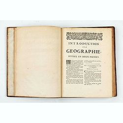
Introduction à la géographie en plusieurs cartes avec leur explication. Par les Srs Sanson Géographes Ordinaires du Roy. Dédiée à Monseigneur Jean Paul Bignon. |
||||||||||||||||||||
|
||||||||||||||||||||
|
|
||||||||||||||||||||
Estimated value: $7000 - $7500 |
||||||||||||||||||||
Description
First part illustrated with 21 plates of spheres and hemispheres, second part illustrated with 8 maps, 5 for the continents, 2 for the climates and one for the Colonial demarcation lines between Castille/Spain and Portugal, all with original outline colors. The atlas is dedicated to Jean-Paul Bignon, Abbott of Saint-Quentin, an influential member of the French Academy and the nephew of the then secretary of state Pontchartrain.
Nicolas Sanson (1600-67) was succeeded by his sons Guillaume and Adrien. Their nephew Pierre Moullart-Sanson bought the map business from the former in 1694 and in 1704, after Guillaume's death, received a royal privilege to continue to publish the family maps.
List of plates :
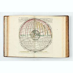
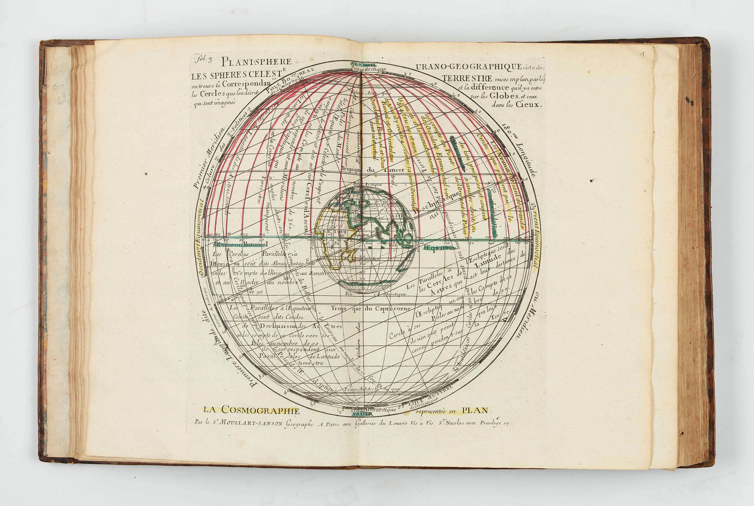
- Moullart-Sanson. Planisphère urano-géographique c'est-à-dire les sphères céleste et terrestre mises en plan… dans les Cieux. 1700.
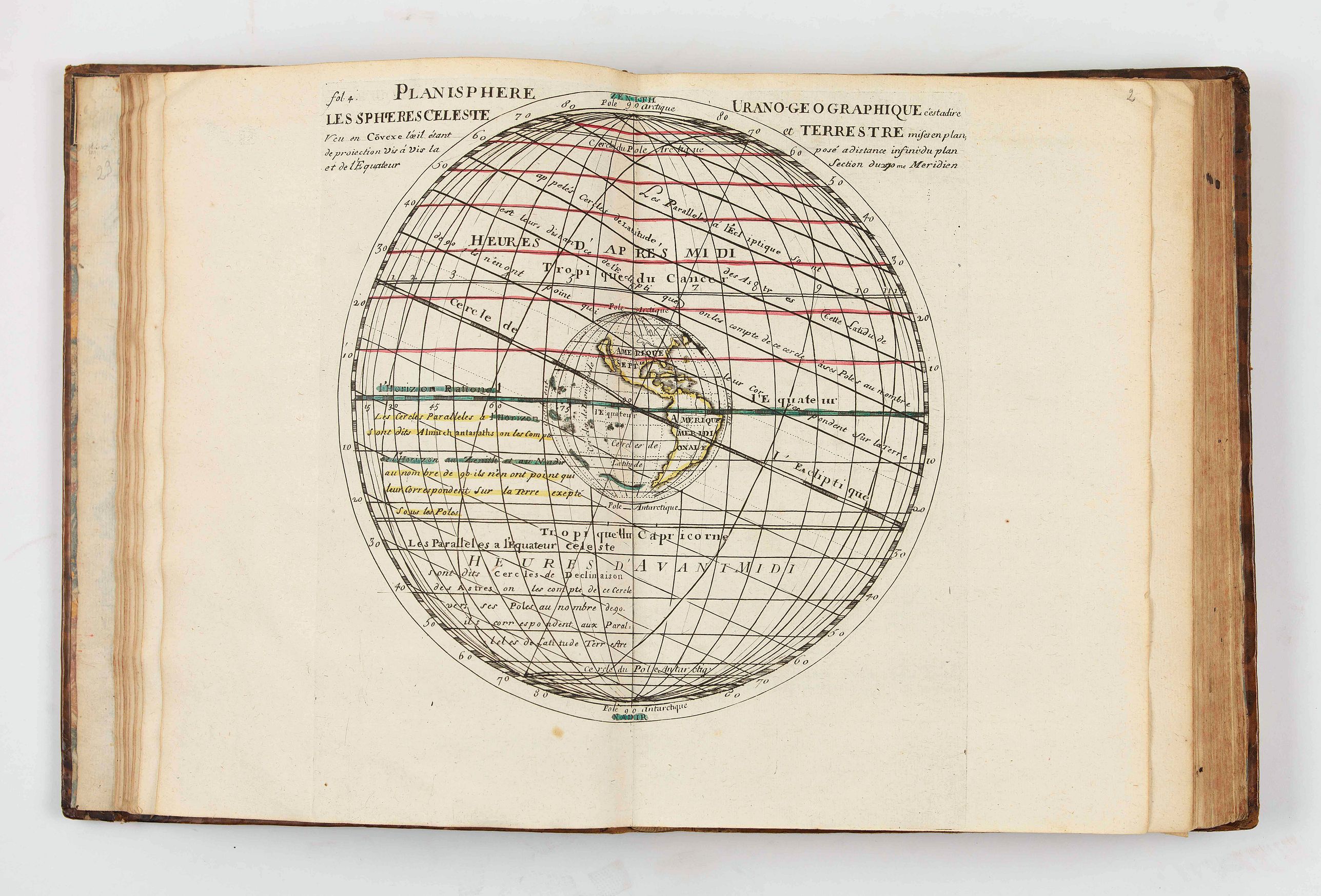
- Planisphère urano-géographique c'est-à-dire les sphères céleste et terrestre mises en plan… section du 270me Meridien occidenta. McLaughin, [118].
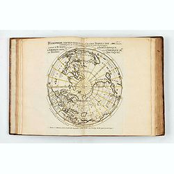
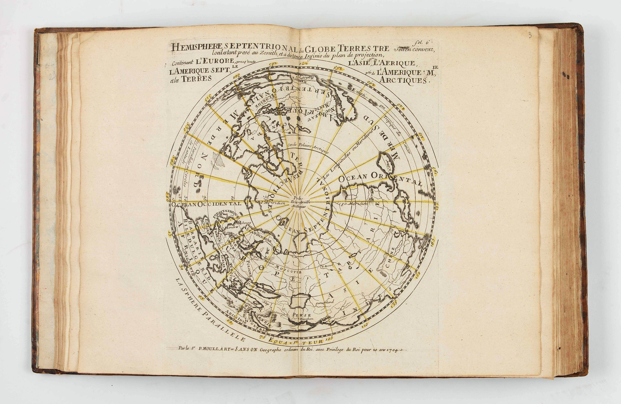
- Moullart-Sanson. Hemisphere septentrional du Globe Terrestre veu en convexe, … et les Terres Arctiques. 1704.
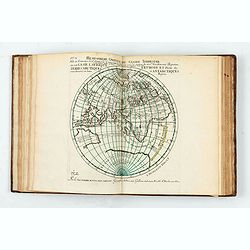
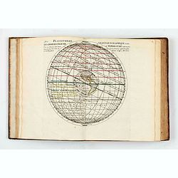
- Moullart-Sanson. Hemisphere meridional du Globe Terrestre… et les Terres Antarctiques.- Moullart-Sanson. Hemisphere septentrional du Globe Terrestre veu en concave… et les Terres Arctiques. 1704. (Partie de texte imprimée en miroir).
- Hemisphere Meridional, Austral, et Antarctique…, dites Magellaniques.
- Moullart-Sanson. Hemisphere septentrional du Globe Terrestre veu en plan, … et les Terres Arctiques.
- Moullart-Sanson. Hemisphere Austral ou Merid.l …
- Moullart-Sanson. Hemisphere Superieur du Globe Terrestre. 1704.
- Moullart-Sanson. Hemisphere Inferieur du Globe Terrestre pour l’Horizon de l’Antipode de Paris, veu en convexe… McLaughin, [117]- Moullart-Sanson. Hemisphere Inferieur du Globe Terrestre pour l’Horizon de l’Antipode de Paris, veü en concave.
- Contr’épreuve de l’Hemisphere Superieur du Globe Terrestre veu en creux pour l’Horizon de Paris.
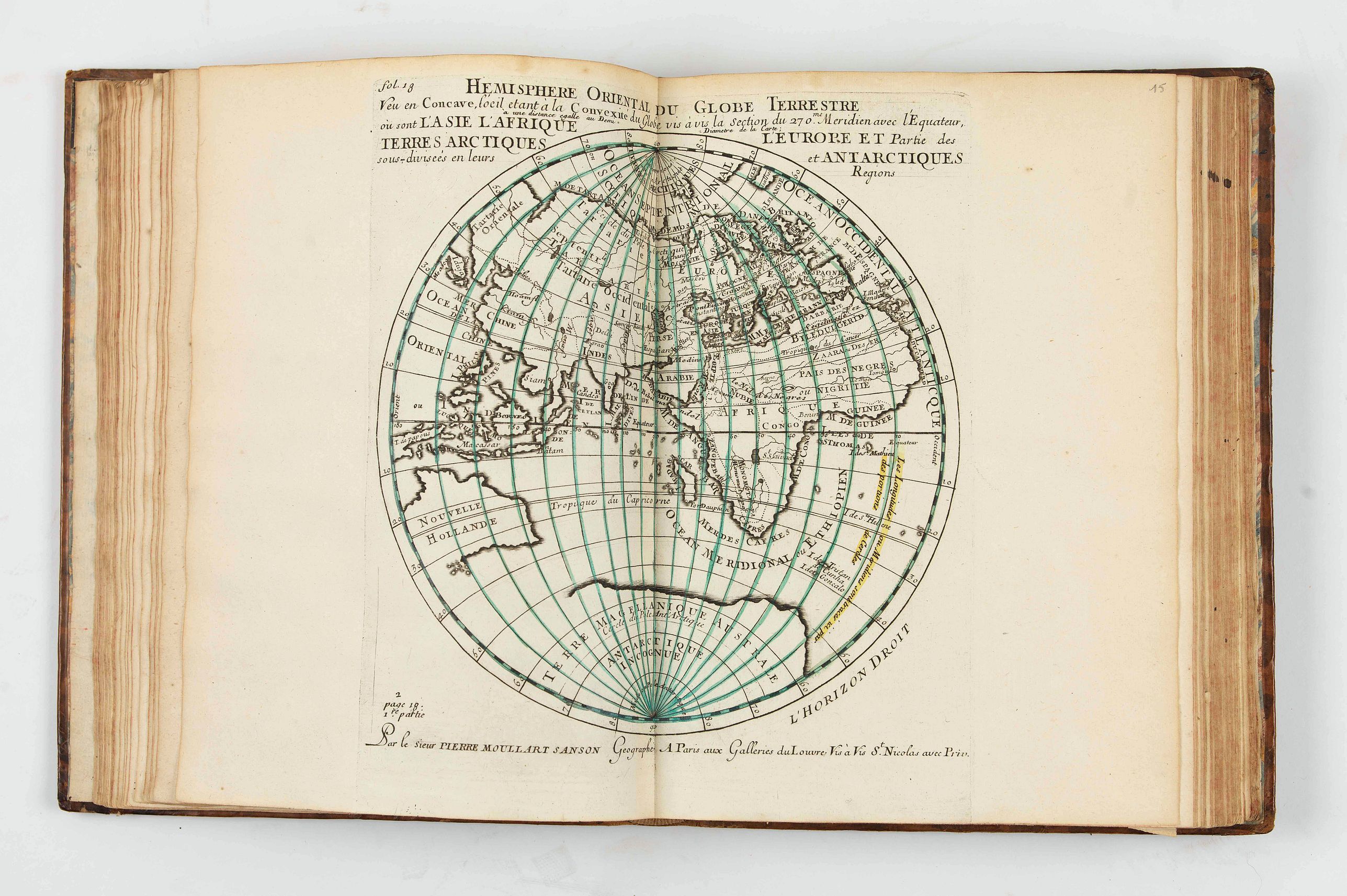
- Moullart-Sanson. Hemisphere Oriental du Globe Terrestre veu en Convexe…
- Hemisphere Occidental du Globe Terrestre veu en Convexe… 1705.
- Moullart-Sanson. Hemisphere Oriental du Globe Terrestre veu en Concave.
- Hemisphere Occidental du Globe Terrestre veu en Concave.
- Hemisphere Oriental du Globe Terrestre contenant l’Asie, l’Afrique, l’Europe et Partie des... 1705.
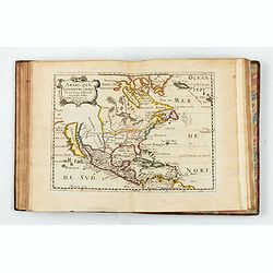
- Moullart-Sanson. Hemisphere Occidental du Globe Terrestre contenant l’Amerique Septent.le et l’Amerique M.le…
- Moullart-Sanson. Sphere Armillaire représentée en plan…
- Moullart-Sanson. Les trois positions de la sphere…
- Sous-division du Jour c.l des Juifs
Introduction a la Geographie. Seconde partie- Hemisphere Oriental du Globe Terrestre, formé par le Meridien de la Demarcation, ou ligne de Mers entre les Castillans et les Portugais.
- Moullart-Sanson. Division du Globe par les Ombres, selon que les peuples sont Perisciens... 1704.- (Les 24 Climats)
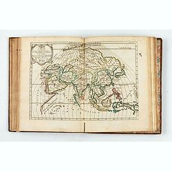
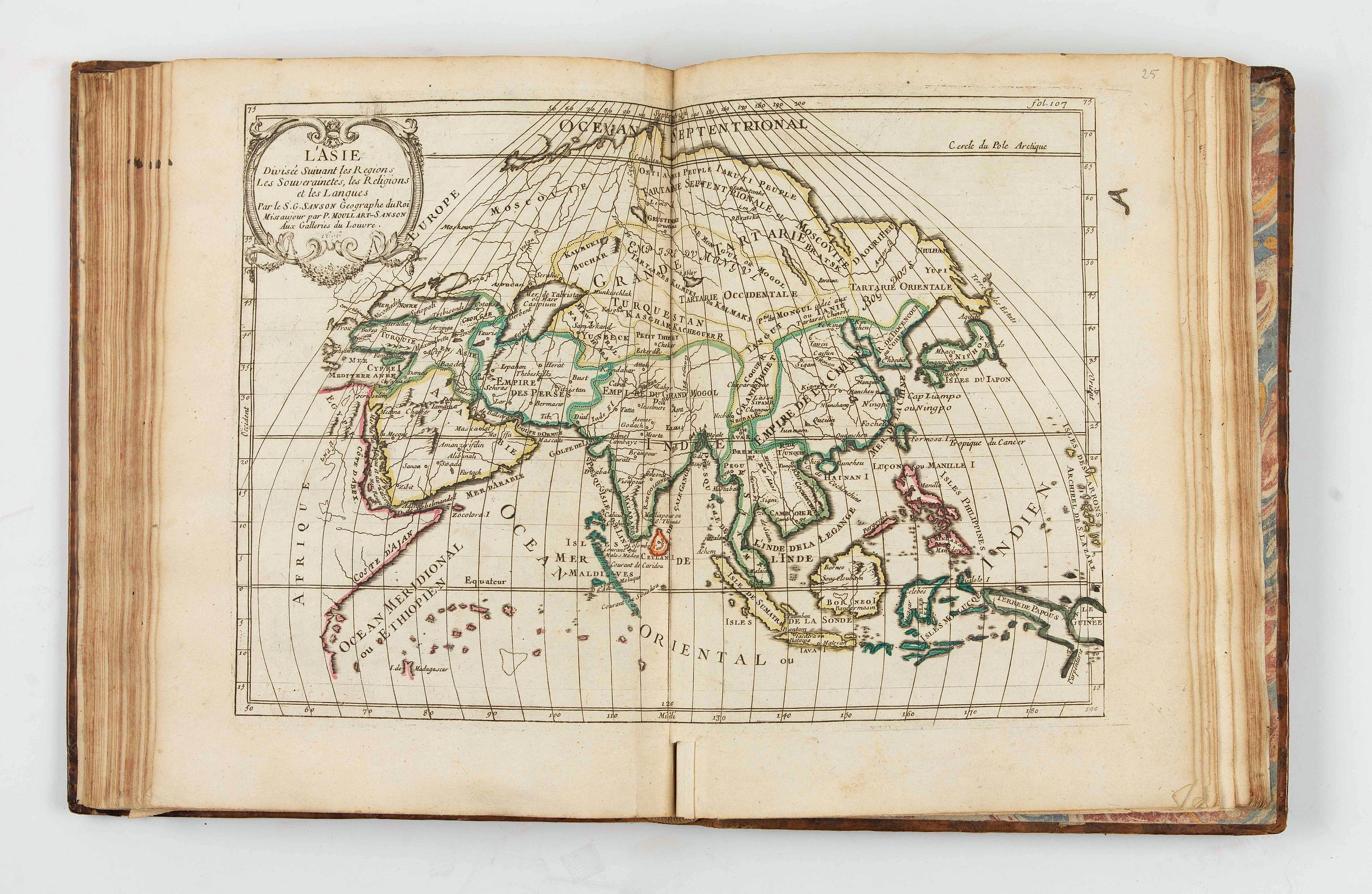
- Sanson, G. L’Asie. 1696.
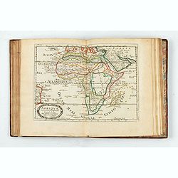
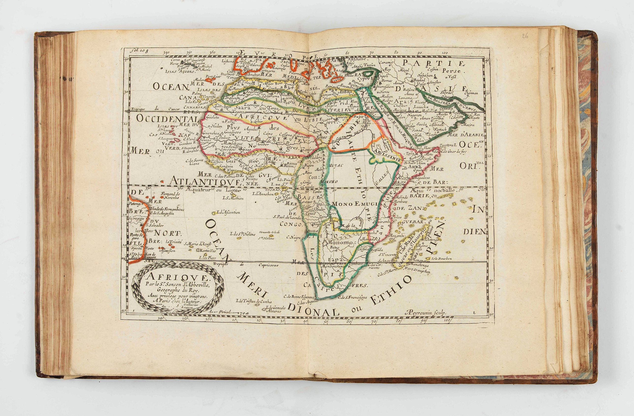
- Sanson. Afrique. 1704.
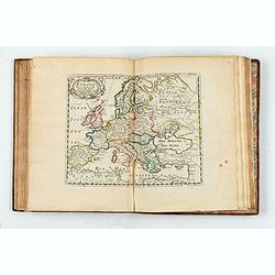
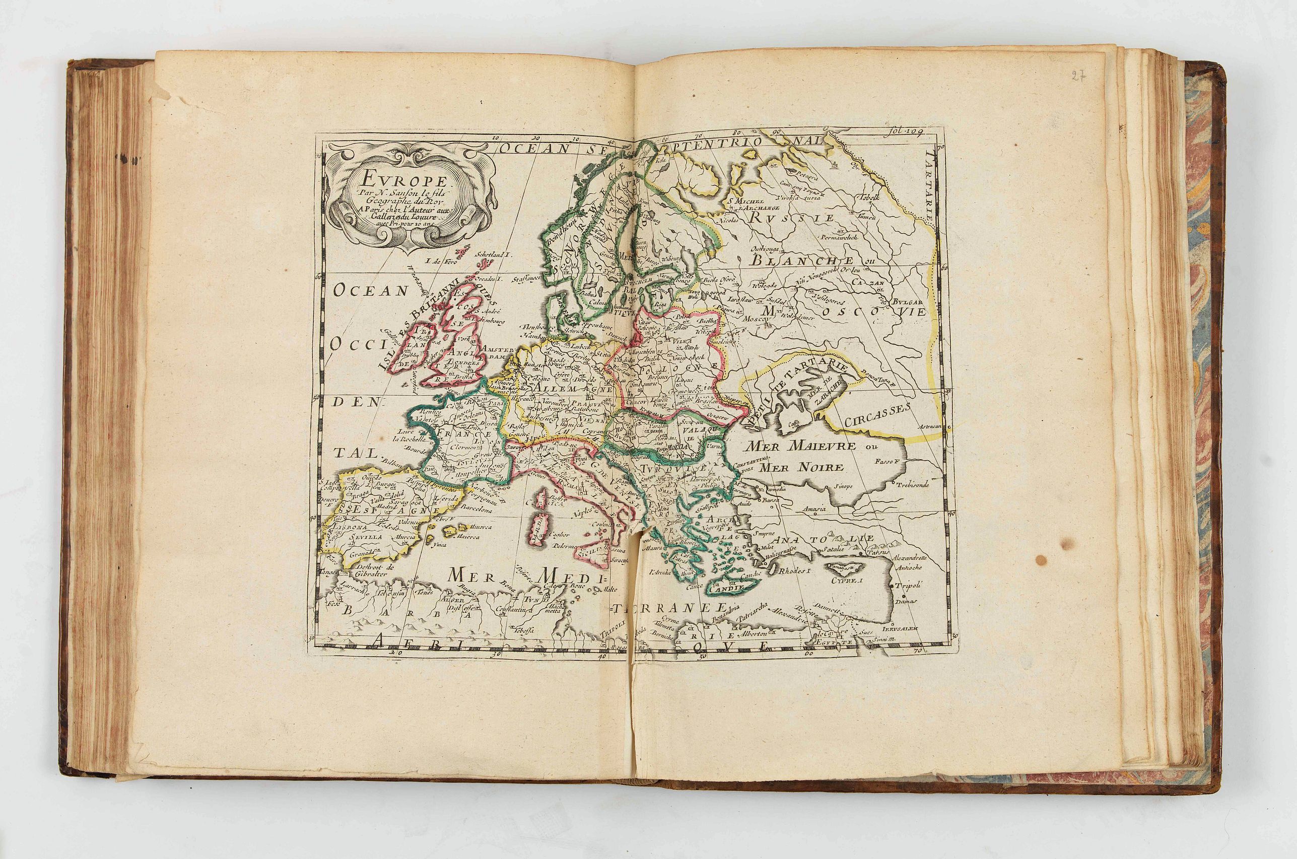
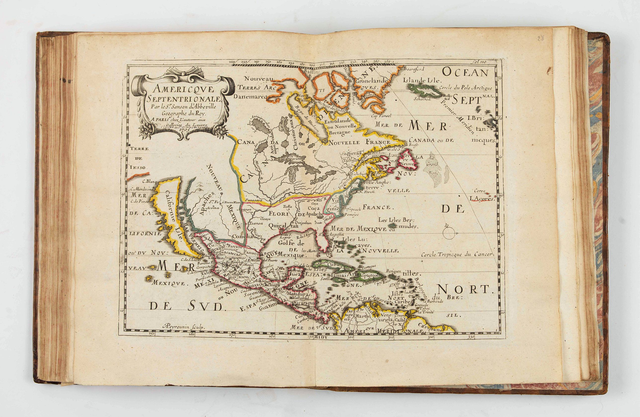
- Nicolas Sanson le fils. Europe. - Chez l’Auteur Aux Galleries du Louvre. Americque Septetrionale. 1705. Burden, 324, State 5.
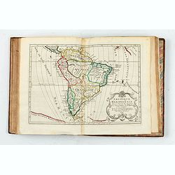
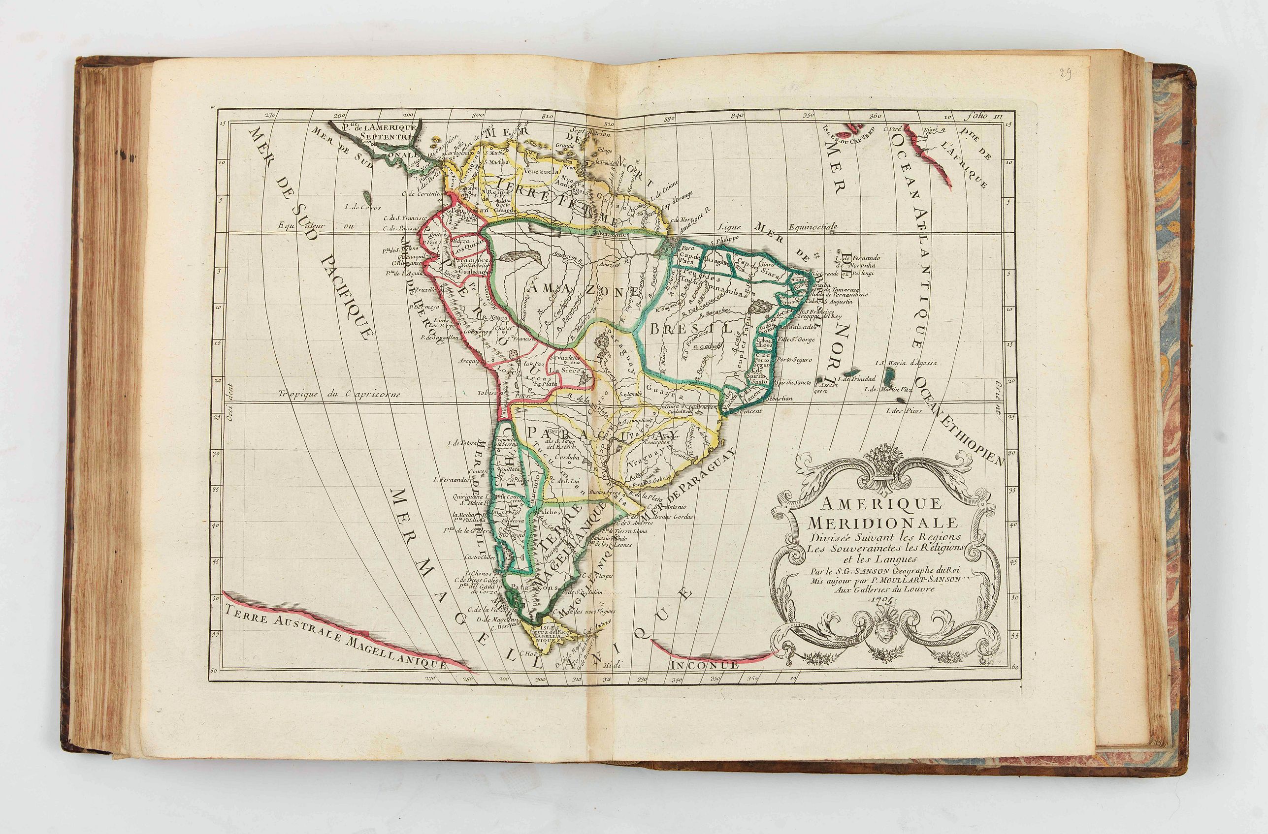
- Moullart-Sanson Aux Galleries du Louvre. Amerique Meridionale. 1705.
Reference: McLaughin, The mapping of California as an Island.
FAQ - Guarantee - Shipping
Buying in the BuyNow Gallery
This item is available for immediate purchase when a "Add to Cart" or "Inquire Now" button is shown.
Items are sold in the EU margin scheme
Payments are accepted in Euros or US Dollars.
Authenticity Guarantee
 We provide professional descriptions, condition report and HiBCoR rating (based on 45 years experience in the map business)
We fully guarantee the authenticity of items we sell. We provide a certificate of authenticity for each purchased item.
Condition / Coloring
We indicate the condition of each item and use our unnique HiBCoR grading system in which four key items determine a map's value: Historical Importance, Beauty, Condition/Coloring and Rarity.
We offer many maps in their original black and white condition. We do not systematically color-up maps to make them more sellable to the general public or buyer.
Copper engraved or wood block maps are always hand colored. Maps were initially colored for aesthetic reasons and to improve readability. Nowadays, it is becoming a challenge to find maps in their original colors and are therefor more valuable.
We use the following color keys in our catalog:
Original colors; mean that the colors have been applied around the time the map was issued.
Colored; If the colors are applied recently or at the end of the 20th century, then "colored", or "attractive colors" will be used.
Original o/l colors; means the map has only the borders colored at the time of publication.
Read more about coloring of maps [+]
FAQ
Please have a look for more information about buying in the BuyNow gallery.
Many answers are likely to find in the general help section.
Virtual Collection
![]()
With Virtual Collection you can collect all your favorite items in one place. It is free, and anyone can create his or her Virtual map collection.
Unless you are logged in, the item is only saved for this session. You have to be registed and logged-in if you want to save this item permanently to your Virtual Collection.
Read More [+]
Registering Here, it is and you do not need a credit card.
Add this item to
Virtual Collection
or click the following link to see my Virtual Collection.
Invoice
The invoice and certificates of authenticity are available in the client center >Invoices
| High-Resolution Digital Image Download | |
|
Paulus Swaen maintains an archive of most of our high-resolution rare maps, prints, posters and medieval manuscript scans. We make them freely available for download and study. Read more about free image download |
Click this image for a free HR-image download. |
In accordance with the EU Consumer Rights Directive and habitually reside in the European Union you have the right to cancel the contract for the purchase of a lot, without giving any reason.
The cancellation period will expire 14 calendar days from the day after the date on which you or a third party (other than the carrier and indicated by you) acquires, physical possession of the lot. To exercise the right to cancel you must inform Paulus Swaen Europe bv, which is offering to sell the lot either as an agent for the seller or as the owner of the lot, of your decision to cancel this contract by a clear statement (e.g. a letter sent by post, or e-mail (amsterdam@swaen.com).
To meet the cancellation deadline, it is sufficient for you to send your communication concerning your exercise of the right to cancel before the cancellation period has expired.