Carta geographica generalatus carlostatuensiscum adgacentibus confinis turcicis et venetis martinimis dolmatio istrensibus.
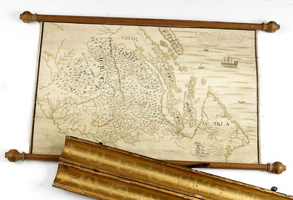
Rare manuscript map of Croatia and the Dalmatian coast from the early eighteenth century. Oriented to the south the map details the Venetian, Austrian and Turkish possessions. The border of the Ottoman Empire (‘Turcica’) depicted on the map shows its geographical extent after the Treaty of Karlowitz. (Venice, c. 1700) . Size: 470 x 770 mm / 18.5 x 30.3 inches.
Kept in a fine contemporary cylindrical case with decorated engraved gilt interior.
Price US$ 12.000
The treaty followed the heavy defeat of the Ottomans by the Austrians at the Battle of Zenta, September 11, 1697. As a result the Ottomans lost all of Hungary (including Transylvania but not the Banat of Temesvar), Croatia, and Slavonia, which were acquired by Austria. Podolia passed to Poland, and the Peloponnesus and most of Dalmatia passed to Venice.
The Treaty of Karlowitz was the first international diplomatic agreement followed by the demarcation and mapping of a borderline that legally, physically, and cartographically separated the territories of the Habsburg and Ottoman powers and also transformed the sociocultural conditions in the Balkans.
