Amstelodamum, Celebre Emporium Forma Plana
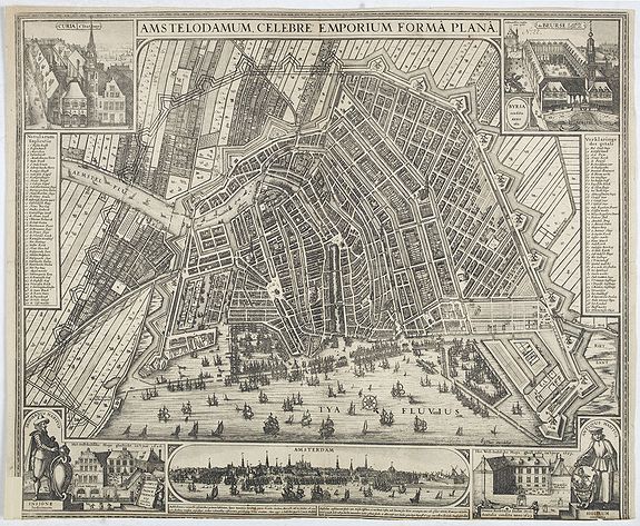
Second state of this rare and decorative plan of Amsterdam with Visscher's imprint. With a panoramic view seen from the IJ and further insets of Council House, The Exchange, House of the Dutch East India Company and House of the West India Company.
Price $ 5000
This state figures the fourth extension with the projected growth of the city added to the left half of the sheet; on the west side, the "Realeneiland" has been extended, above the image of the west India House, the imprint of Visscher has been added, and, on the bastion right next to the St. Anthonispoort, a windmill has appeared.
This map appeared at the height of the Golden Age of the Dutch Empire, which was built on its dominance in international finance and the spice trade. Accordingly, the institutions highlighted in the corners of the map are not churches or monasteries but economic institutions such as the stock market, the headquarters of the Dutch West and East India Companies, and the old statehouse.
