Le Neptune Oriental ou routier general des Cotes des Indes orientales et de la Chine..
THE RARE FIRST EDITION of this important French Sea Atlas of the Red Sea, India, the East Indies, Indochina and Formosa.
2° (640 x 490 mm).
 Title printed in red and black with woodcut vignette, engraved
head-piece on first text leaf, With 25 large engraved charts of which 13 are double-page and 18 full-page.
Title printed in red and black with woodcut vignette, engraved
head-piece on first text leaf, With 25 large engraved charts of which 13 are double-page and 18 full-page.
Title printed in red and black with woodcut vignette, engraved
head-piece on first text leaf, With 25 large engraved charts of which 13 are double-page and 18 full-page.“A
vast, superb volume” (Lust). A very important atlas was compiled for the French East India Company. “The French Admiralty considering that the Neptune Oriental was too dangerous for ... navigation, ordered the remaining copies to be destroyed” (Manonmani Filliozat, Indian Journal of History of Science, 292, 1994, p. 341).
He later studied geometry and astronomy under Joseph Nicholas Delisle, the mathematician and geographer, and at the age of nineteen sailed to the Caribean.
This item has been sold
D' Après de Mannevillette (1707-1780) was a famous French sailor and hydrograph. He was born in Le Havre to a sea-faring family. “He first sailed to India in 1719 in the Solide, captained by his father.He later studied geometry and astronomy under Joseph Nicholas Delisle, the mathematician and geographer, and at the age of nineteen sailed to the Caribean.
During a voyage to China in 1728 he succeeded in correcting the
latitudes of many places using new instruments. Back in France, he devised a plan to correct and publish all the existing maps of the route to China: the Red Sea, the coasts of India, Malaya, the northern parts of Indonesia, Indochina and China.
During many subsequent voyages Apres assembled a collection of material for [this]… hydrographic atlas…” (Howgego A-107); Lust 162. Polak 127n. Phillips Atlases 3163 and 3168.
Contents :
Contents :
Printed title,
10pp preface.
Carte réduite de l'Océan Oriental Septentrional (La Mer Rouge - Ceylan). Entrée de la Mer Rouge.
Plan Particulier du Golfe de Perse.. Jusqu'à Bassora.
Gusurat, Concan, Decan.
[Coste de Canara, de Malabar].
Carte Plate qui comprend l'Isle de Ceylan et une partie des costes de Malabar et de Coromandel.
[Coste de Coromandel]
[Gergelin Orixa Bengal].
Carte Réduite de l'Archipel des Indes Orientales..
Carte Plate du Golfe du Bengal.. Jusqu' à l'Embouchure du Gange.
Plan de l'Archipel de Mergui.. Jusqu'aux Isles Ste Susane.
Plan de l'Isle de Junkseilon.
Plan Particulier de la Rade d'Achem.
Plan Particulier du Détroit de Malaca..
Carte Plate de la cote occidentale de l'Isle Sumatra.
Carte de la cote occidentale de l'Isle Sumatra jusq'au Détroit de la Sonde.
[Isle de Java].
Carte qui comprend le Détroit de la Sonde Jusqu' à Batavia.
Carte Plate Qui comprend une partie des Isles Java & Sumatra..
Nouveau Plan du Détroit de Banca…
Carte des Mers Comprises entre le Détroit de Banca et P.° Timon.
Carte Plate qui comprend le Golfe de Siam..
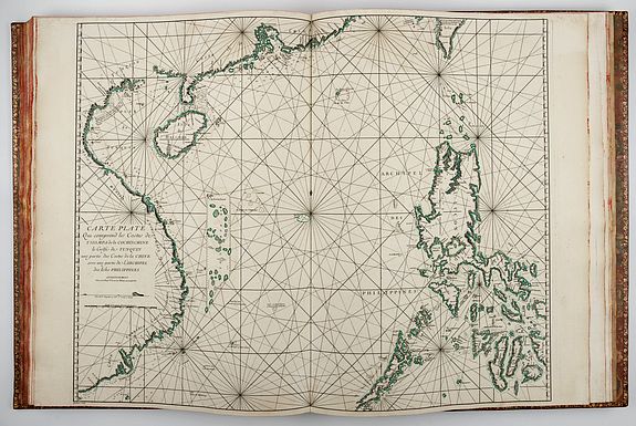
Carte Plate qui comprend les Costes de Tsiompa de la Cochinchine.. Avec une partie de l'Archipel des Isles Philippines.
Plan de la Baye de Manille.
Carte de la Coste Orientale de la Chine.. Avec une partie de l'Isle de Formose.
