Map collectors and passion
Below are some Florida map collectors who all shared their love and interest in early maps. They all eventually wanted to share their love for antique maps either by making them public or by publishing a book.
We are so thankful to have known them, worked with them and still see them on a regular base.
They came in contact with antique maps during a vacation trip, accidentally or visiting the Miami Map fair over the last 30 years.
Jay I. Kislak (June 6, 1922 – October 3, 2018)
was a businessman, philanthropist, bibliophile, and aviator. He moved to South Florida in 1953, and his collection began with books, particularly those that charted the history of his new home state.
I remember the day that Jay Kislak asked me if I knew about any existing example of the Maritime version of the Waldseemuller world map! The week after it was announced that Jay bought the only existing example of Martin Waldseemüller’s ‘Carta marina’ of 1516, which he in 2004 would donate with nearly 4,000 other items from his collection to the Library of Congress.
J. Thomas "Tom" Touchton In 1982, by chance, Tampa businessman Tom Touchton and his wife bought an old map while vacationing in England. That unexpected purchase soon evolved into a passion for collecting rare historical maps of Florida, which expanded into a campaign to build the $50 million Tampa Bay History Center. Tom's maps are now publicly displayed at the Tampa Bay History Center. A must-see when in the Tampa Bay area.
Neil Asbury
When Neil was at the start of his career, he traveled to Asia and got fascinated by the history of each country he visited. Once he returned to the USA and settled in Florida he got fascinated with American history and its maps.
The walls in his house and offices are filled with maps.
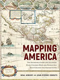
Neil likes to talk about them, and he recently published a book: Mapping America. It is not a carto-bibliographic book but it uses maps to tell the story of the exploration and birth of America in a unique prism of maps and engravings of the period.
According to Neal Asbury and National Geographic doctoral professor at Fielding Graduate University Jean-Pierre Isbouts they aim to offer a new and immersive look at the ambition, the struggle, and the glory that attended and defined the exploration and making of America.
Most of the maps in this informative and lushly illustrated volume are from Neil's collection.
Before photography and television, printed maps brought home the thrill of undiscovered lands and exploration possibilities while guiding armies on all sides through the Indian Wars and the clashes of the American Revolution. Only by looking through the prism of these maps, can we truly understand how and why America developed the way it did.
Buy this book on Amazon
